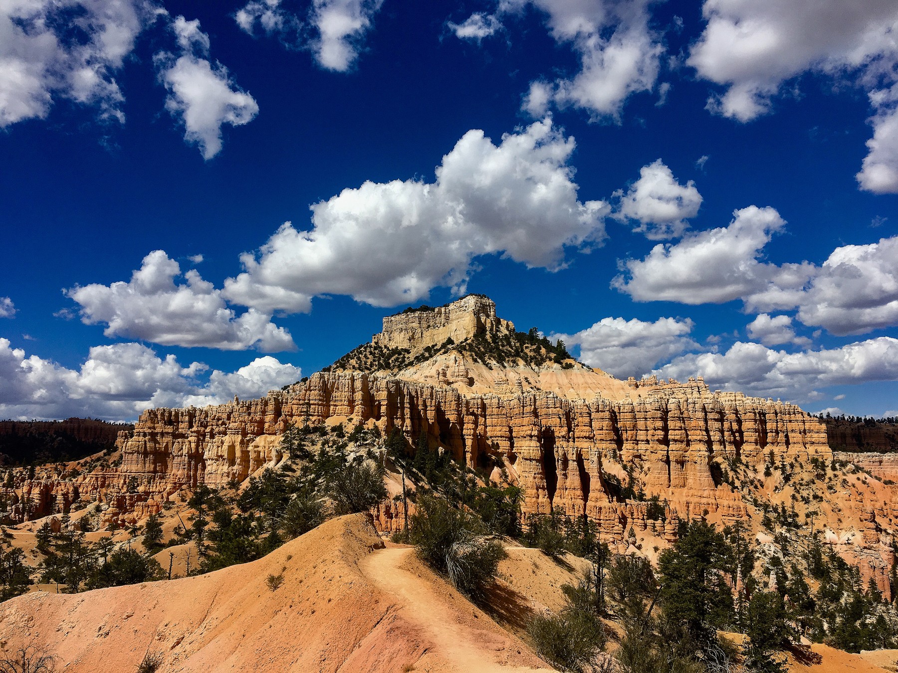
Boat Mesa (above).
Bryce Canyon National Park
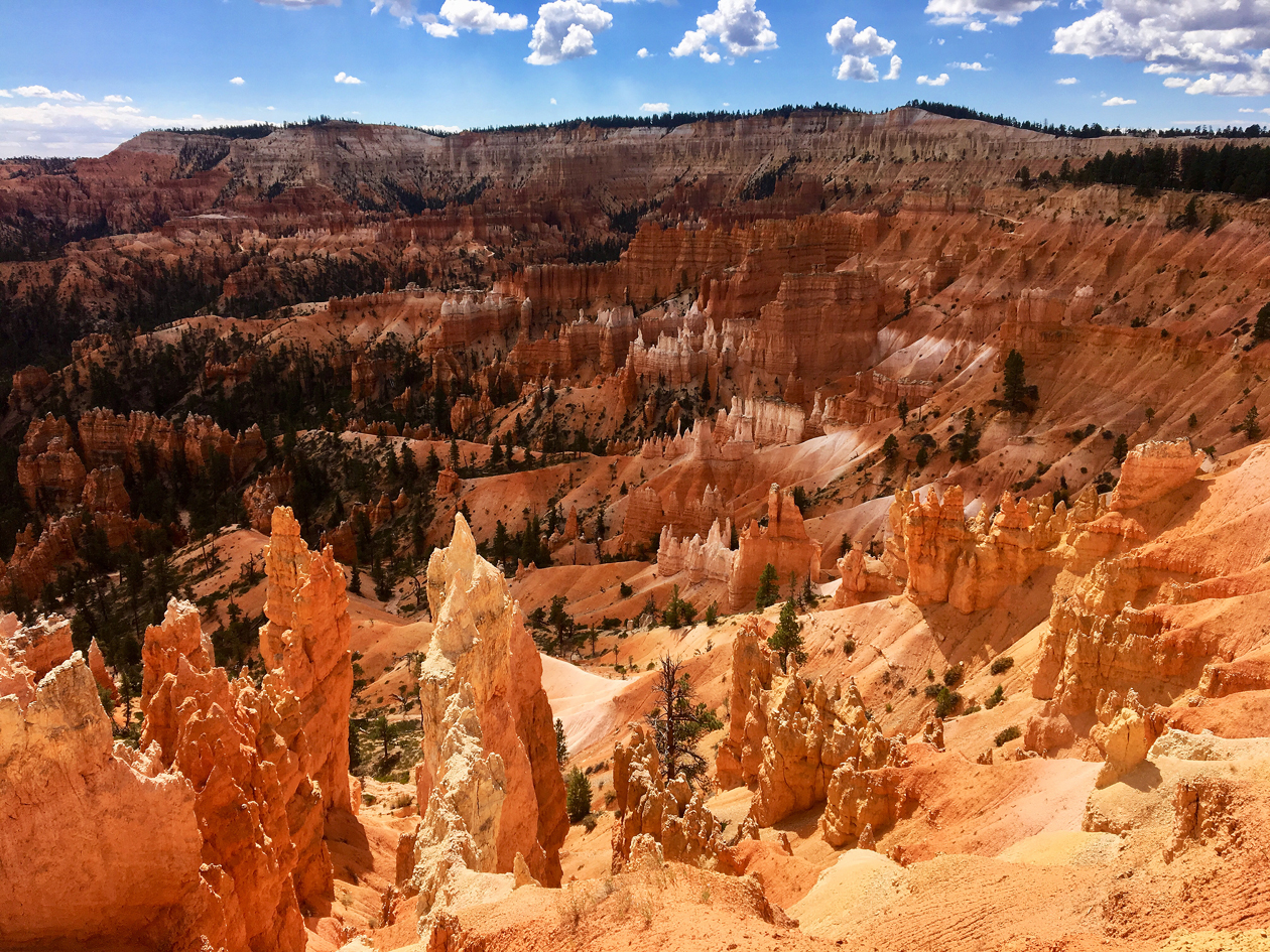
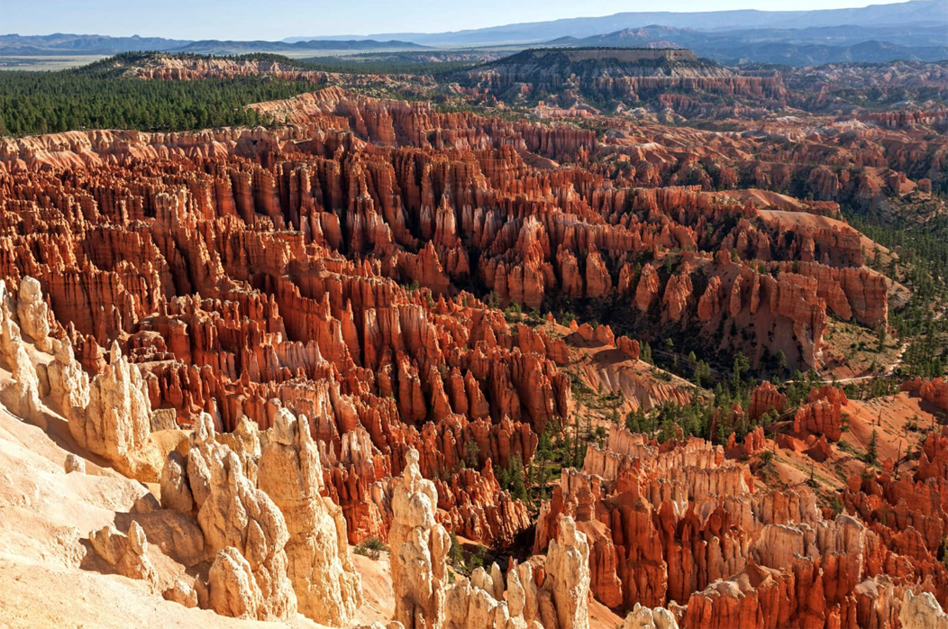
In September 2018, we visited Bryce Canyon National Park in Southwestern Utah, which was designated a national park in 1928. The park covers 35,835 acres and showcases the stunning geology of southern Utah, a red-rock wonderland created by wind, water, and snow.
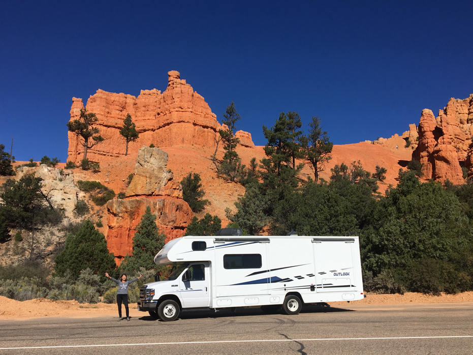
We flew into Las Vegas, picked up an RV and headed off to Bryce Canyon.
Before our visit, I discovered that Bryce isn’t actually a canyon. It’s a natural amphitheater carved into the eastern flank of the Paunsaugunt Plateau by millions of years of wind and water erosion.
The Paunsaugunt Plateau was created by a geologic uplift on the Colorado Plateau roughly 10 to 20 million years ago. The dissected plateau is drained by two northward flowing rivers – the East Fork Sevier River and the Escalante and Paria Rivers on its eastern rim. Erosive forces have compounded the uplift activity, resulting in the spectacular red rock hoodoos that highlight Bryce Canyon National Park. Two hundred days per year, on average, of freeze-thaw cycles ensure that erosion will continue to alter this distinct topography.
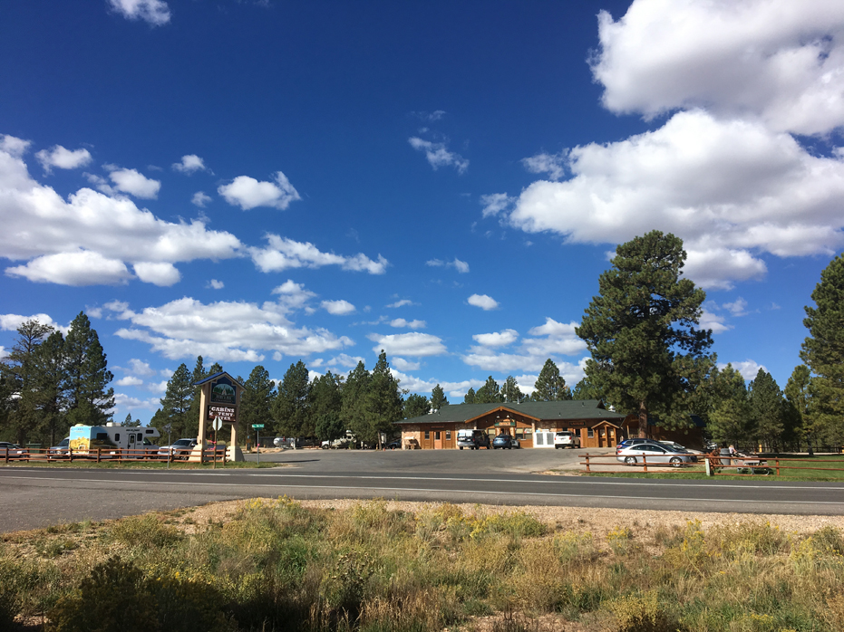
Rubys Inn and RV Park
First stop was Ruby’s Inn & RV Park
We arrived at Ruby’s Inn just after sunset and set about trying to back the 27 foot RV into a site for the first time ever. We had reserved a 24 foot RV but when we arrived they had none, so they upgraded us.
It didn’t take long for our neighbours to realize we were novices and come out to lend a hand and before we knew it, we had ourselves in place and level. After a bit of a chat, it turned out that those neighbours were from Guelph, Ontario, a 2 hour drive south of us in Collingwood.
In the morning, we noticed several RV’s pulling out and managed to snag a more level location and got ourselves settled again, this time all on our own, had some breakfast and headed off to catch the Bryce Shuttle to the Fairyland Loop Trail, which conveniently starts at Rubys Inn.
The Bryce Amphitheater Shuttle runs regularly on 15 minute intervals from 8 a.m. to 6 p.m. with extended hours to 8 p.m. in summer, and brings visitors to areas of interest, viewpoints, and trailheads within the Bryce Amphitheater area of the park. The shuttle is free with park admission.
The Fairyland Loop trail is actually as far out of the national park you can go while still being a part of the national park. It’s basically between the national park and the city of Bryce. Thankfully this means it will probably be a lot less crowded than inside the park if you decide to hike this trail. Most of the visitors to the park are not really hikers, they are more day tourists, at least from my perspective, so having to walk a full mile in from the road, after the shuttle drops you off, to the start of this trail is much more than most of the visitors we saw were prepared to do.
That works to the advantage of anyone who seriously loves hiking, like us.
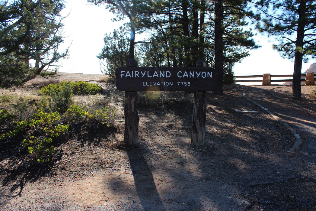
A quiet and unassuming arrival sign.
Fairyland Loop
Fairyland Loop is is a 7.8 mile loop, with about 1,545 ft of elevation gain. That may not seem like a lot to you but remember that the up part on this trail comes at the end of that 5 – 6 hours, not at the beginning, no matter which way you hike this trail.
It took us almost 6 hours to complete this portion of the hike because we were constantly stopping to take photos, and admire the moments. We also stopped for a nice lunch in the shade along the way. Because of that, we broke the hike into two days and on the second day, added the Navajo Loop Trail and the Wall Street Trail after finishing up the Rim Trail to Sunrise Point.
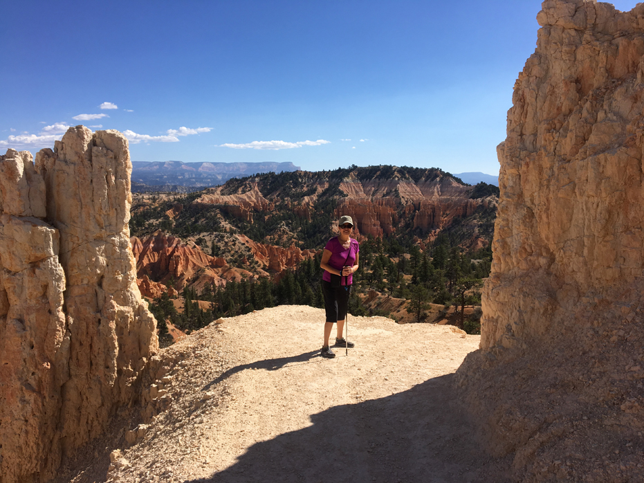
Yim as we begin our descent.
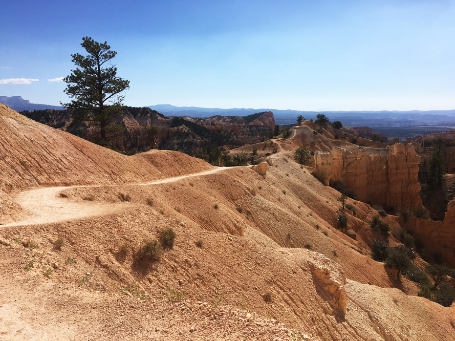
Fairyland Point
There are two different places you can start the trail: Fairyland Point or close to Sunrise Point. We started at Fairyland Point, which is the official trailhead of the hike. The shuttle dropped us off on the main road, as I pointed out above, we walked the 1 mile in.
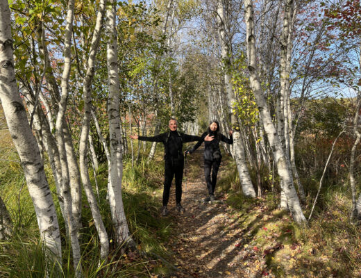
I was really excited to walk up the the rail above the trailhead here but when we both looked over the ridge and saw the hoodoos for the first time, we both kind of caught our breath collectively.
While planning our hike online, I had noticed there was a lot of debate about whether or not we should do the hike clockwise or counter-clockwise. We chose to go clockwise. That way, we entered the trail and descended right down into the hoodoos, which was wonderful. We ended our first days hike at Sunrise Point, used the facilities and caught the shuttle back to Rubys.
What we found most remarkable is that as one of the most beautiful hiking trails in one of the most famous national parks in Utah, there was barely anyone on it. All I can think of is that due to the free shuttle, it seems the vast majority of visitors go directly to Sunrise and Sunset point, rather than walking the one mile in from the road, making this a beautiful hike without the selfie stick crowds. I recall seeing less than a dozen people on our 6+ hour hike.
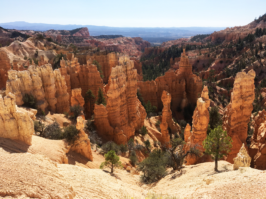
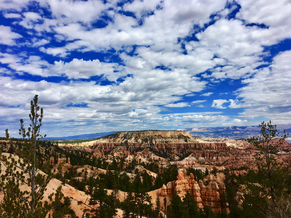
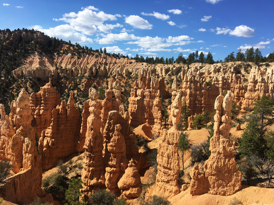
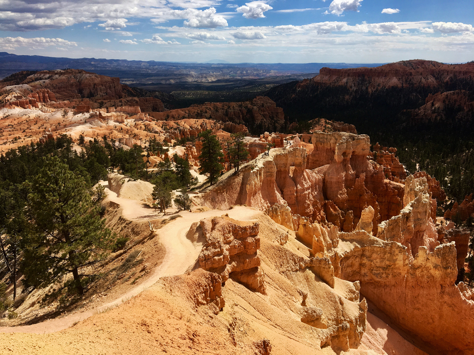
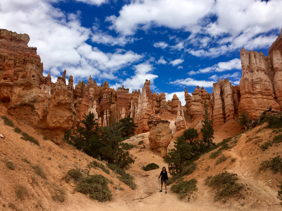
So, about the hike. From above, you might think that the hoodoos look big but once you actually get down into the valley and stand next to one they really show their size. You really feel like a little ant walking in between these massive hoodoos.
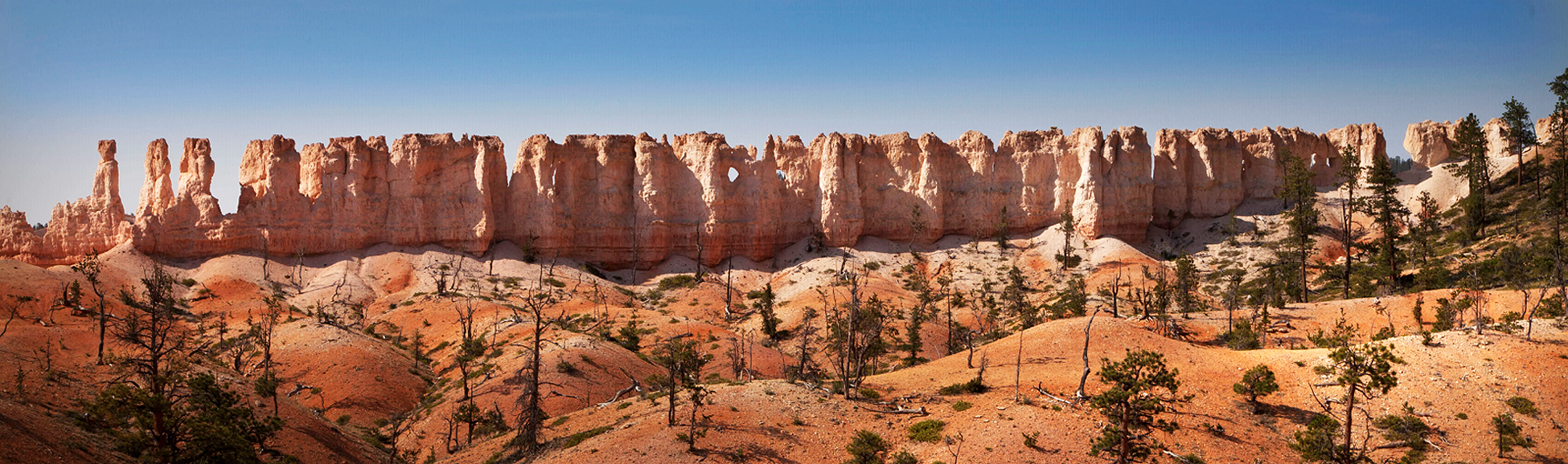
“Fairyland” earns its name from the surrounding hoodoos, which have a whimsical or even supernatural-like feel to them. In fact, hoodoos are often-referred to as “fairy chimneys” so ultimately, it’s called the Fairyland Loop, because, well, it feels like you’re walking through a fairyland.
The first section of the trail is entirely downhill so hiking poles will come in handy. This was my favourite part of the hike, and I think that is because the hike was so unique to us and there were simply so many formations to marvel at. We had seen hoodoos before in Drumheller, Alberta and again in Banff Springs but nothing like the display here.
Plus, for the first hour, we could look back up at the rim, which gave us a new appreciation for the landscape and the scale of the hoodoos.
The Paiute Indians, who inhabited the area for hundreds of years before the arrival of European Americans, claimed the colourful hoodoos were ancient “Legend People” who were turned to stone as punishment for bad deeds. While these hoodoos can cast their spell on all who visit, I preferred to think of them as quiet goodwill sentinels standing guard over their realm here and around each corner, there was a new grouping.
The trail itself is very well maintained and from that standpoint, makes this a very easy hike.
As you get closer to the bottom, you’ll notice that it gets greener and greener with all the shrubs and trees. Then the contrast against the orange rocks becomes even more stunning. The trail winds through the canyon and you get to walk right beside these spectacular hoodoos. We loved seeing the different colours, ranging from vibrant orange to pastel peach and pink.
We like to think we’ve done a lot of hiking but you really cannot prepare yourself for this hike.
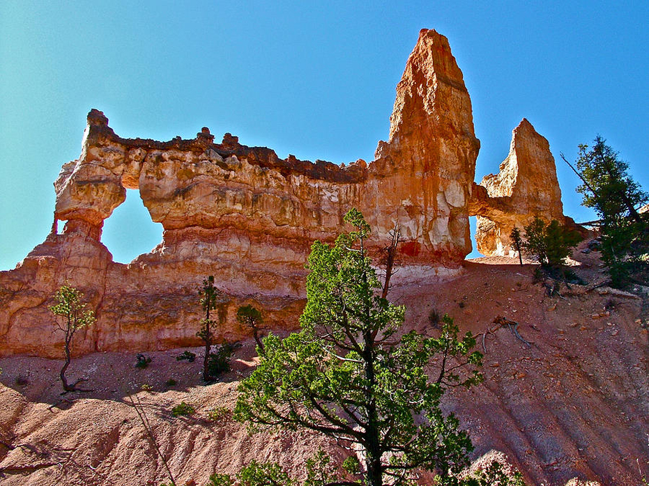
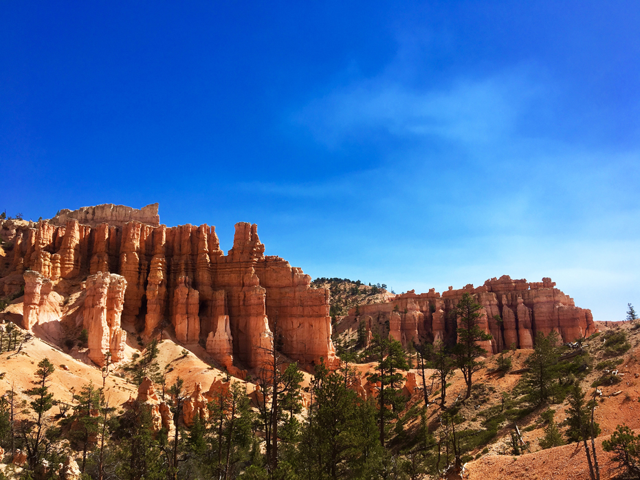
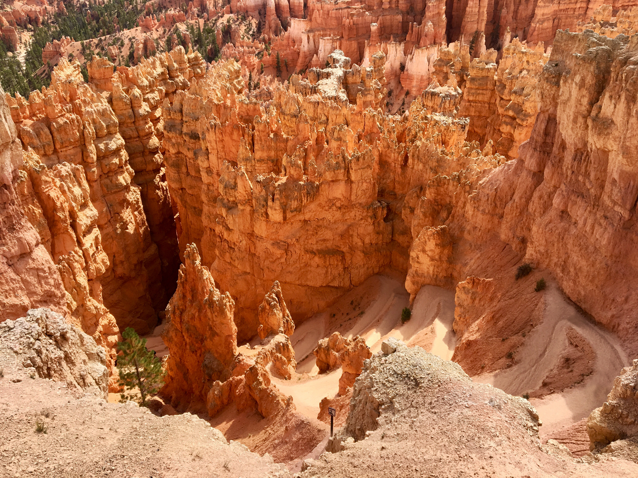
About halfway into our hike, the sight that caught my attention was Boat Mesa, which is my feature photo above for this post. I hadn’t noticed it until we turned upwards and started across a ridge and at that point, it dominated the landscape for the remainder of the hike. Walking towards it is spectacular – the path seems to narrow and fall away on both sides and it seems like you are walking along a ridge specifically made to showcase the Mesa until, of course, the trail veers off down into the side canyon below Fairyland Point, reaching the wash along the vegetated canyon floor.
Boat Mesa separates Fairyland Canyon from the rest of Bryce Canyon.
At this point, the trail drops to cross the wash of a tributary canyon. This is the low point of the hike at 7,150 feet. From this point, it is all back uphill.
Beyond the crossing, the path climbs over a low ridge and crosses the wash of another tributary canyon and then ascends on moderate grades up to the ridge, which separates Fairyland and Campbell Canyons. At this point, you have entered the Campbell Canyon section of the hike.
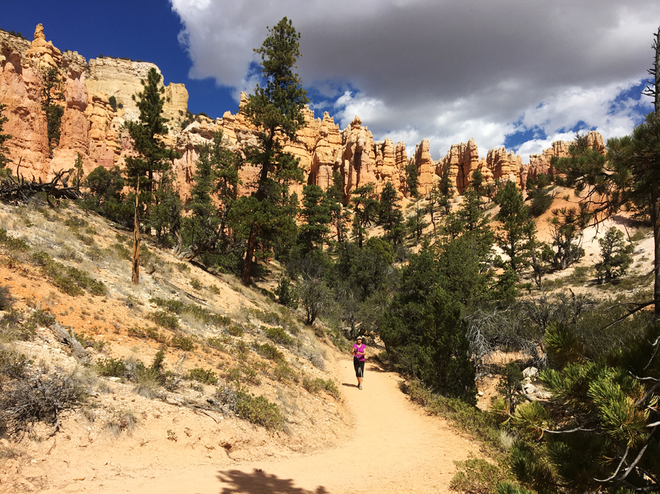
The final part of the hike involves some steady uphill hiking to Sunrise Point. It’s not too steep but it can be tough, especially in the heat, so make sure you take plenty of breaks and stay hydrated. Some of the trail goes through a more forested area so depending on what time of day you’re hiking, you may get some shade.
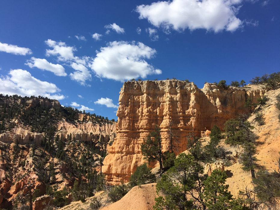
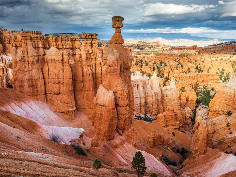
Another highlight along the trail is Tower Bridge (in group of photos above). There is a short spur trail off the main trail which will take you to the base of this formation, which features two natural arches and two high “towers” that apparently bear a striking resemblance to the defining landmark of London.
Walking past the formation really gave you a sense of scale. You can see that in the photo above, the last of the grouping of four photos, which shows the trail walking wasp the formation.
We reached this part around 3 pm and by then, we were feeling a little tired.
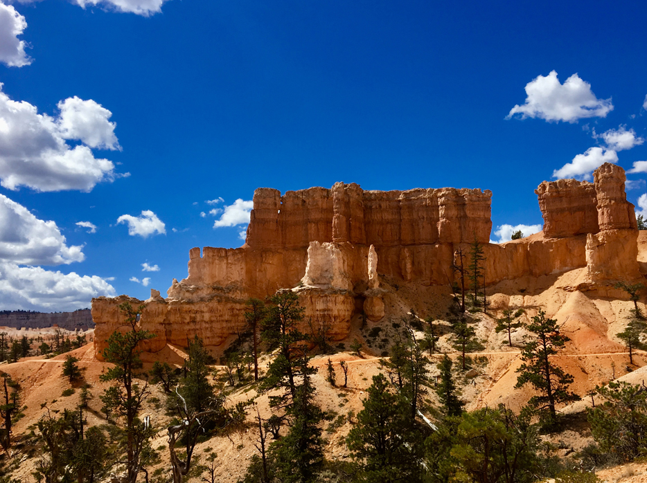
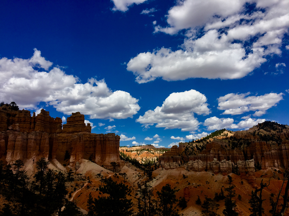
Now our ascent has started and we could feel the burn in our legs. In the distance we could see the Chinese Wall and even from there, you could see how the years of frost-wedging and runoff has enlarged cracks in the formations to create windows. At some points along the wall these windows have collapsed, leaving columns of rock that will continue to erode and be sculpted into hoodoos, like you can see at one end. Pretty cool.
At this point, we simply started upwards and we were very happy to get to the top. The end of the trails features multiple switchbacks and some carved out rest stops to sit and take a break if you feel the need. There’s no shame in that – we certainly took advantage of the option.
We were delighted at the facilities available after the hike then sat down and waited for the shuttle to take us back to Rubys.
NOTE: Before you decide to hike the Fairyland Loop, make sure you’re comfortable hiking this distance and prepared for the elevation changes. Yim and I were pooped by the end of the day had to hike upwards for the last hour and a half. Plus, the trail is exposed for the most part so you’ll need to bring sun protection (sunscreen, hat, sunglasses, cover up etc.) There are no places along the way to fill up on water so make sure you pack plenty to get you through the hike.
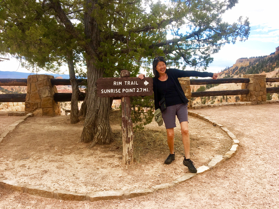
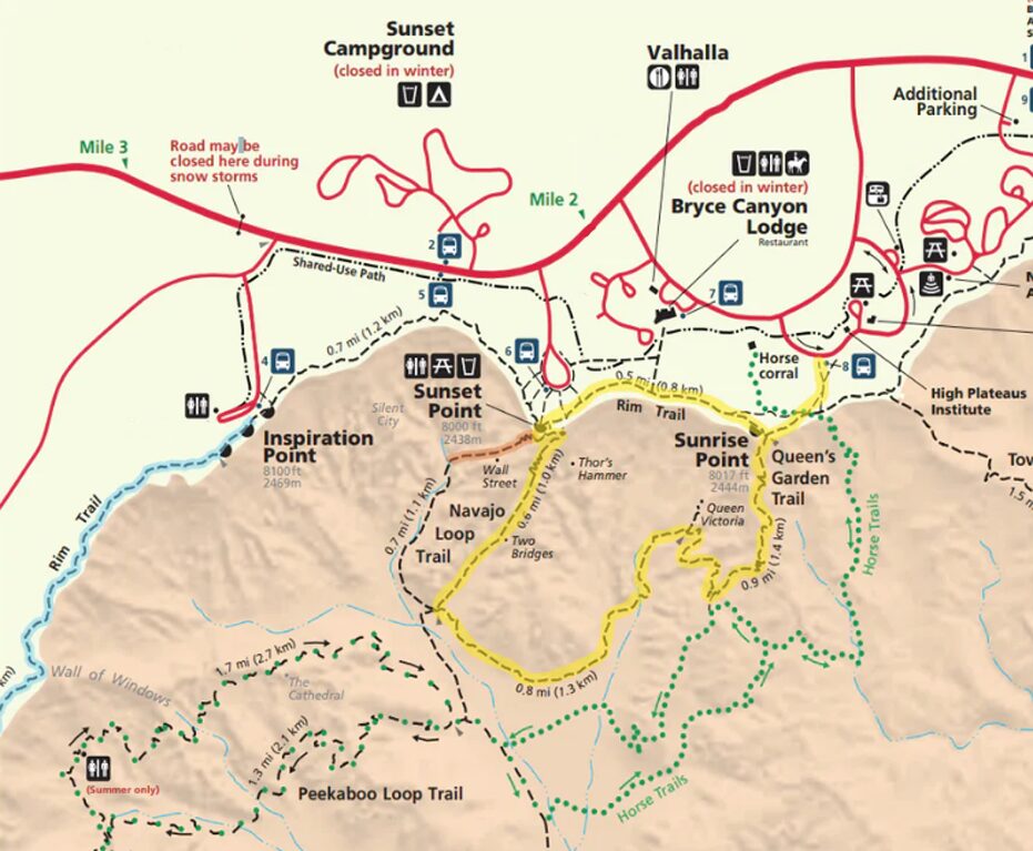
Day Two – The Rim Trail to Sunrise Point
This very popular path runs along the rim of Fairyland Canyon and Bryce Canyon, connecting and passing all the scenic overlooks in between.
Since we wanted to break up our hike into two days, we started the Rim Trail on our second day at Bryce Canyon.
Many park visitors hike the Rim Trail since it is easily accessible from the park road at various lookout points and provides spectacular views of the spires and canyons below. Travellers can choose to hike the entire trail by starting from Fairyland Point or Bryce Point or break the hike up into smaller segments. Most of the pathway between Sunrise and Sunset points is either paved or so well worn that portions are wheelchair accessible. Wooden benches at various points along the path give visitors opportunities to relax and enjoy the wondrous scenery.
We enjoyed the hike as it was easy compared to our first day and we both wandered along the path, talking and pointing out things we each saw until we eventually ended up at Sunrise Point.
Everything changes there. It was jam packed with visitors getting off multiple shuttles and the trails were buzzing. We were happy we had enjoyed our morning stroll.
Queens Garden and Wall Street
The Queen’s Garden Trail is a beautiful walk through the main amphitheater at Bryce Canyon. Though this trail is fairly short, it climbs steeply down, where you will be walking among some incredible hoodoos.
This trail starts at Sunrise Point and junctions with either Two Bridges Trail or the Navajo Loop Trail, which leads to the Wall Street Trail. That is the hike we did. As you can see from the map, the start of the hike begins at 8017 feet above sea level so you are pretty up there in the atmosphere.
At this point, we no longer had the trails to ourselves. There were busloads of visitors. We were both so glad we had done Fairyland Loop the day before and started our day off along The Rim Trail on this morning.
Queen’s Garden Trail to the Navajo Loop is the most popular hike in Bryce Canyon.
As you descend the trail, the main amphitheatre opens up right in front of you. You will literally feel as though you have left earth and have been teleported to a magical land where there are stunning vistas in every direction, stone arches and doorways to venture through, and you never know what you’ll find around the next corner.
Above: The Queen’s Garden Amphitheatre
Wall Street
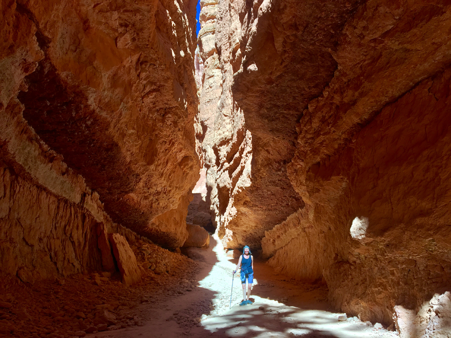
There are two options to get to Sunset Point. The Two bridges Trail or the Wall Street Trail. Wall Street was highly recommended as we learned. It absolutely stunning. It passes through a narrow slot canyon with huge steep walls. As great as our overall hiking experience up to that point in Bryce Canyon had been, it was about to get even better.
Shortly after making the choice to head this route, we entered into an enchanted canyon. The first thing I noticed was that there was a stream on our left, so there were lots of trees down here. It seemed like a bit of a lost shangri-la. We stopped to have a power bar and birds sat just above our heads waiting for us to drop a piece so they could have lunch.
Continuing along, we then entered a deep, dark slot canyon, which were very narrow in places, sometimes only a few feet wide. The temperature dropped noticeably as we entered this shadowy corridor and the crumbly walls had to be a couple of hundred feet tall. They were coarse and covered with ridges and folds. It was almost impossible to capture the scene as the canyon was too tall for me to get everything into the frame but I did manage to catch this shot of Yim below with a bit of blue sky up above to give you a little idea of the scale.


Coming up between the hoodoos on the switchbacks of Wall Street
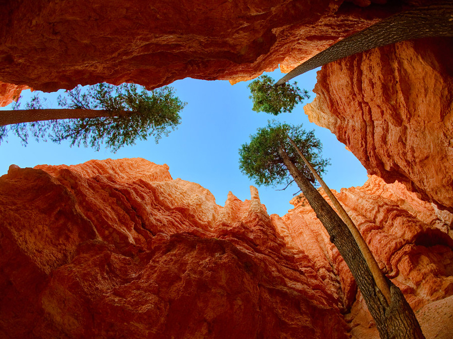
The best part of the Wall Street hike was near the middle of the canyon, where a handful of trees shot up through the slot. They were mammoth Douglas firs, some 500 years old. Enormous in size, they reached all the way to the top of the canyon walls. Very few branches extended out from their soaring trunks, but they were bushy at their tops where they could safely escape the shady canyon. I was fascinated that trees could grow so grand and proud in such a desolate landscape. It wasn’t quite desert, but these trees flourished in a mostly dry, incredibly rocky and sandy area amidst a steep dark canyon.
Once we emerged, it was time to start our climb up to Sunset Point. There was another cluster of Douglas firs just outside the canyon, and then the path began to snake its way up along a series of switchbacks.
There had to be almost twenty relatively short, evenly sloped stretches of trail. It was like ascending out of a funnel, the switchbacks were close and tight at the bottom and slowly widened as the canyon walls grew farther apart, closer to the rim.
The climb wasn’t as bad as it looked though, because it was a consistent grade throughout the winding pathway. Instead of trying to hurry up to the rim, we took our time, hiking at a slow deliberate pace. We actually didn’t want to get to the top.
After a little break to look back at where we had just come from, we arrived at Sunset Point, over 500 feet higher than Wall Street, which was less than a mile down the trail. We spent a few minutes surrounded by a crowd of people and decided to head off towards the shuttle and catch a ride home.
This is a fantastic hike and I highly recommend that anyone who loves hiking make the trip to Bryce Canyon and do the three or four hikes I have outlined above.
BRYCE CANYON HIKING TIPS
A few tips to help you enjoy your time in Bryce Canyon National Park and reduce your impact on the environment.
- Start your hike early: Parking fills up quickly and the trails can get very busy. Aim to hike early in the morning and later in the afternoon to make the most of cooler temperatures and fewer hikers.
- Wear sunscreen: Although it doesn’t get as hot as other national parks, the sun can be relentless and there is limited shade on many of sections of this trail.
- Stay hydrated: Make sure you pack enough water to hike with as the refill stations are up on the rim but not in the canyon.
- Wear good footwear: The hiking trails in Bryce Canyon are well maintained but the ground can be very dry. Loose dirt, gravel and rocks and make going down some of the steep sections quite dangerous if you don’t have footwear with good traction.
- Bring Hiking Poles. Trust me on this.
- Prepare and be smart: Research your trail and know how long it should take, the level of difficulty, and ensure you have enough food and water to sustain you during the hike. Check or current trail conditions and closures, and also check the weather.
- Print a physical map of the trail: There is limited cell service in the park so bring a physical map or download an offline map like AllTrails.
Our next stop on this trip is Horseshoe Bend. Follow our adventure here >

No Comments