The Duncan Caves Trail is a 12.4 kilometre moderately trafficked loop trail located between Ravenna and Kimberly that features a waterfall, Mills Creek and Metcalfe Rock and is rated as is a moderate hiking trail.
For our visits, we parked at the entrance along 9th Side Road. There’s a small parking lot there but people also park along the shoulder of the road. However, be warned, you will be issued a parking ticket for obstructing traffic during the summer season, or busy days, so parking on the street is not advisable and visitors should go to one of the other parking areas marked by waypoints.
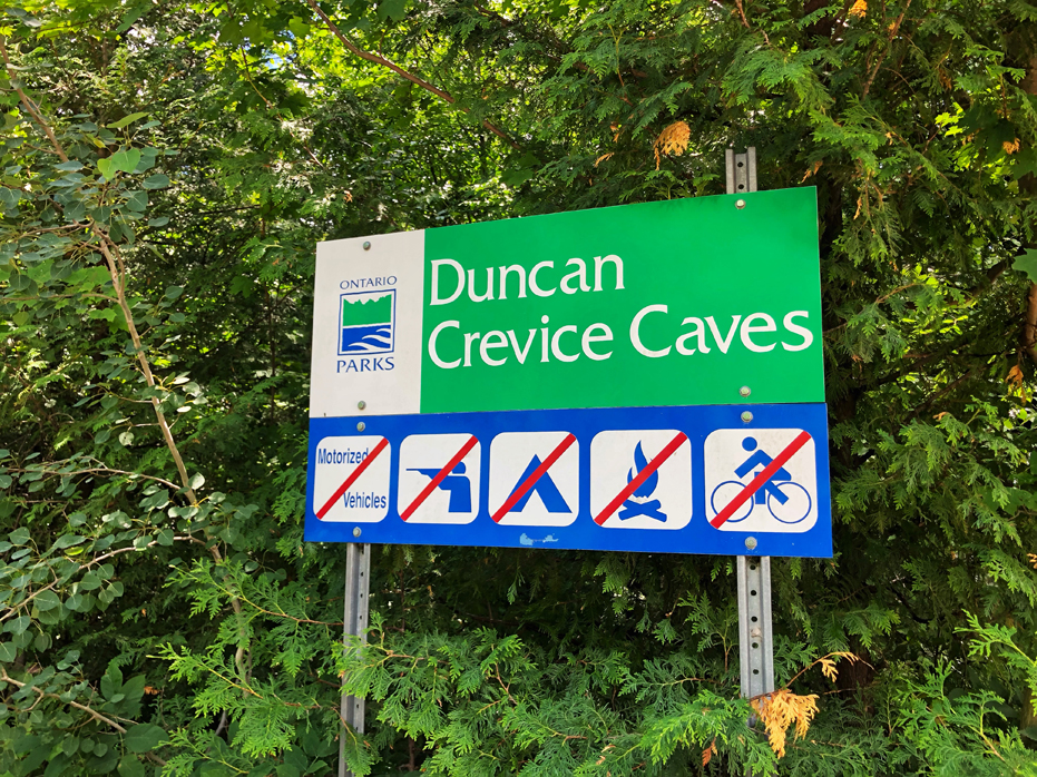
You may also notice that the sign says; Duncan Crevice Caves. My assumption is that it is an older sign but this is one of the entrances to the Duncan Escarpment Provincial Nature Reserve.
This is one of the better day hikes around us here in Collingwood but also an accessible hike for Torontonians willing to drive for an hour and a half.
Duncan Escarpment Provincial Nature Reserve is located within a portion of the Niagara Escarpment. The park comprises the Duncan Crevice Caves and a large portion of the Mitchell Creek Valley.
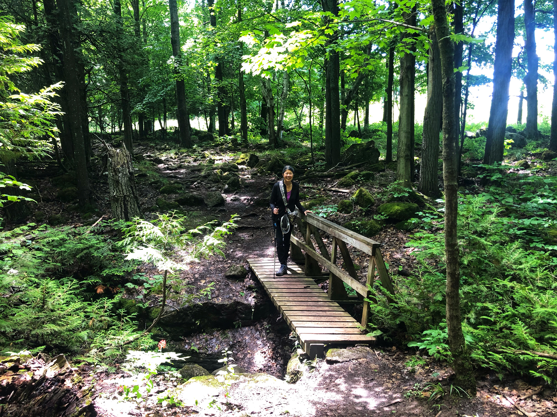
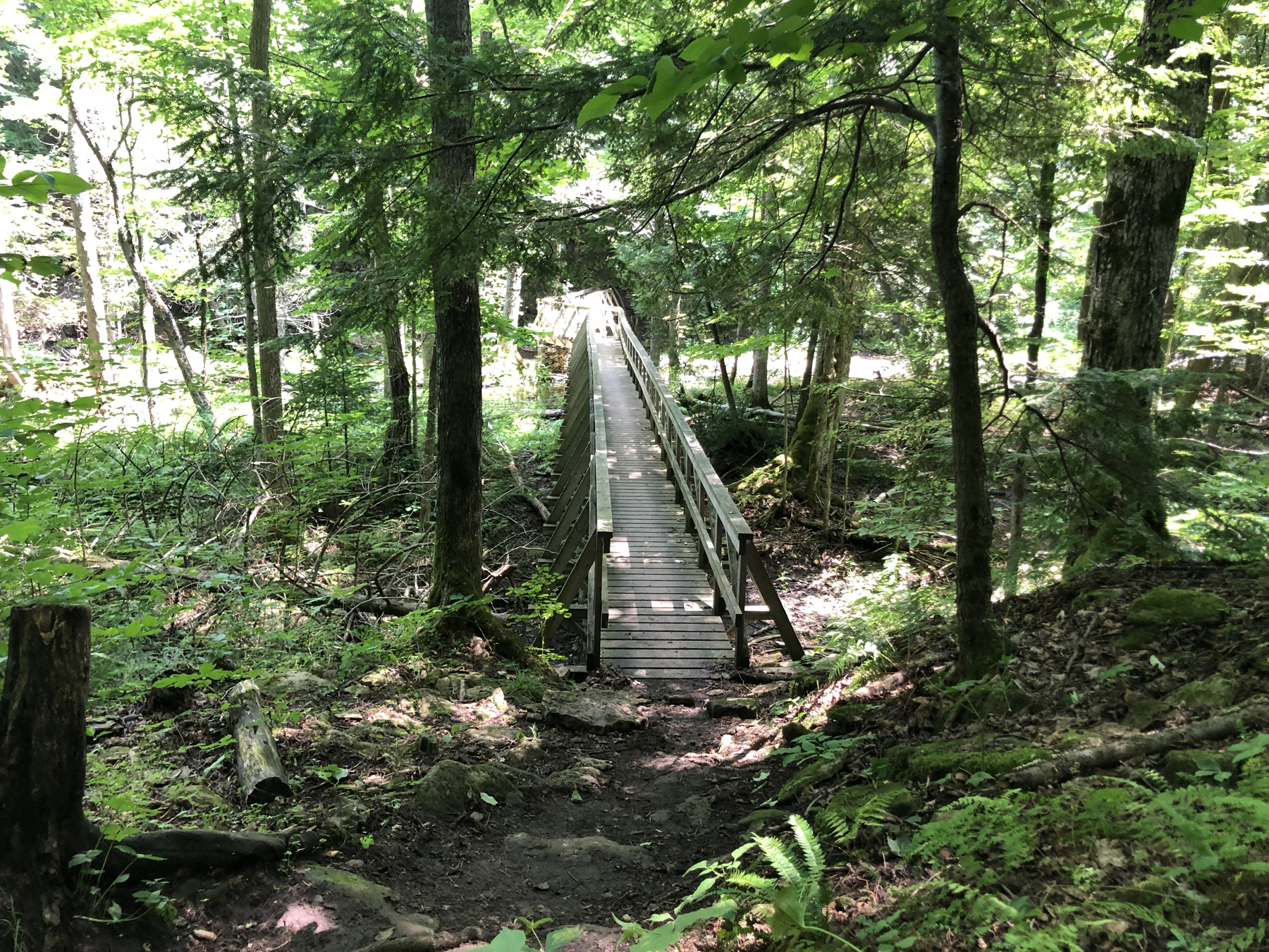
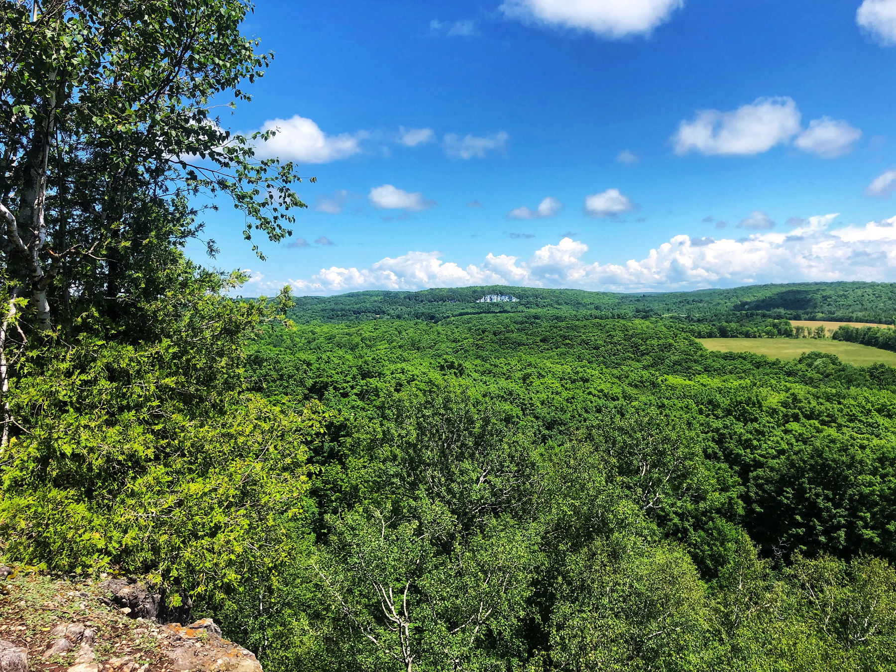
The hike offers a good mix of terrains with wooded areas, open fields, rock faces, crevices, elevated lookouts, waterfalls and good shade coverage by beautiful tree canopies. There is occasional steep scrambling required, which gives this route a bit more of a difficult challenge through parts of the crevices.
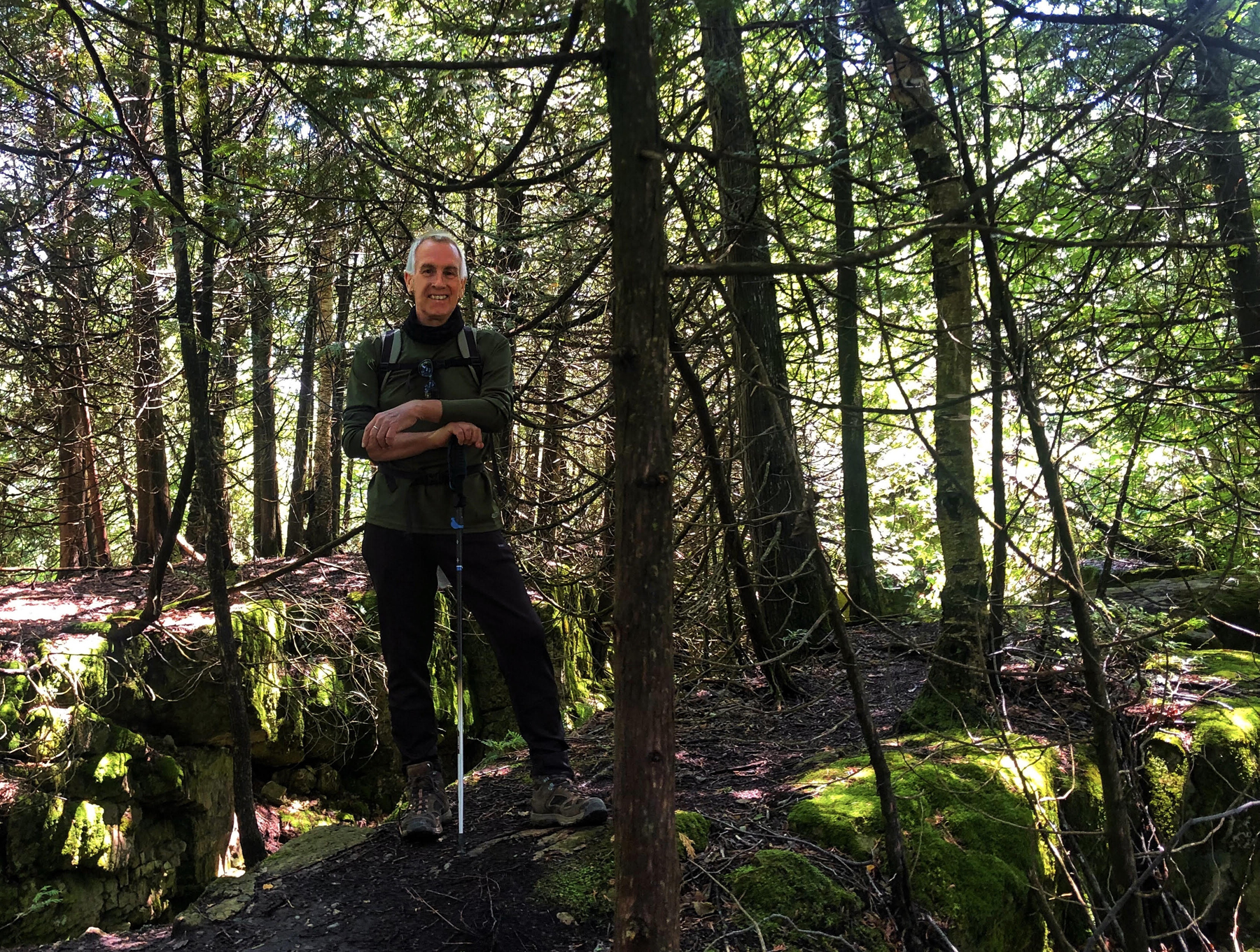
Bring hiking poles. Wear (or bring) light gloves. Bring water and snacks. It’s strenuous in parts.
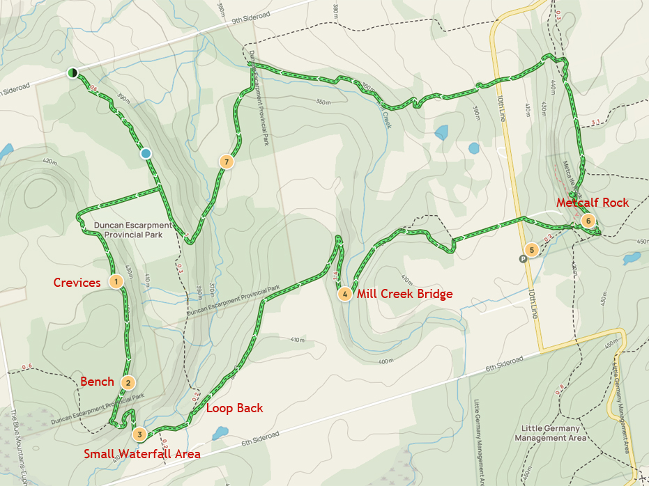
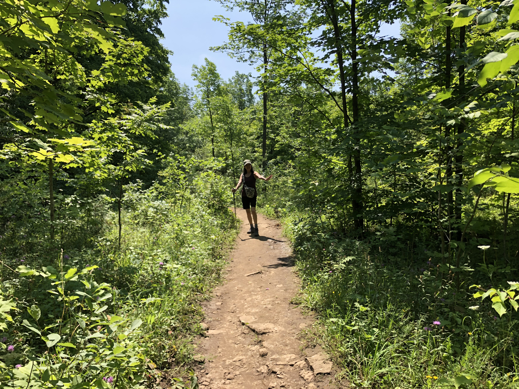
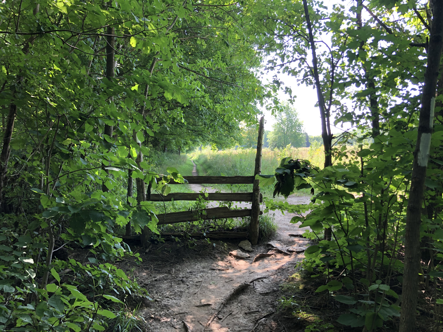
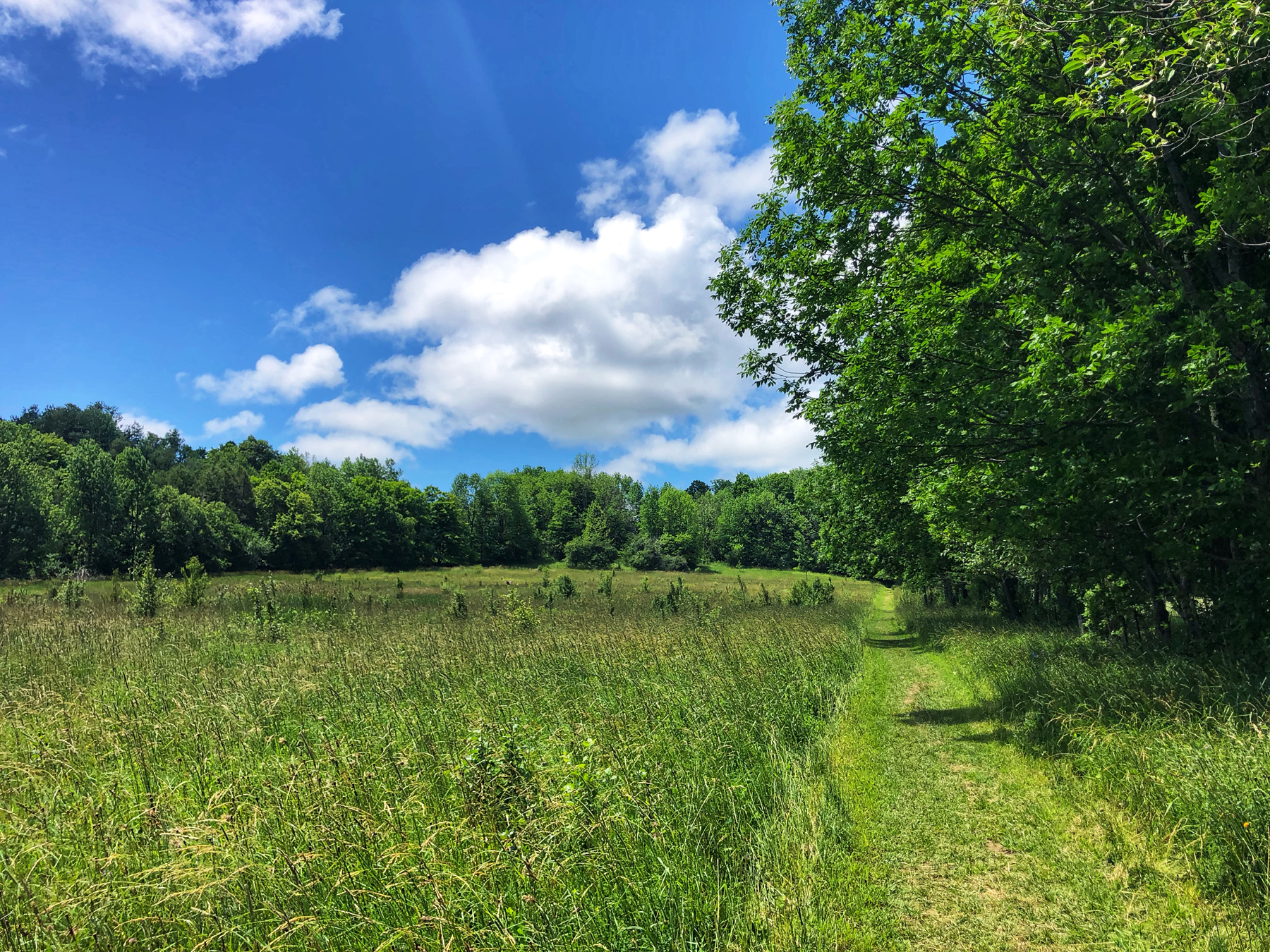
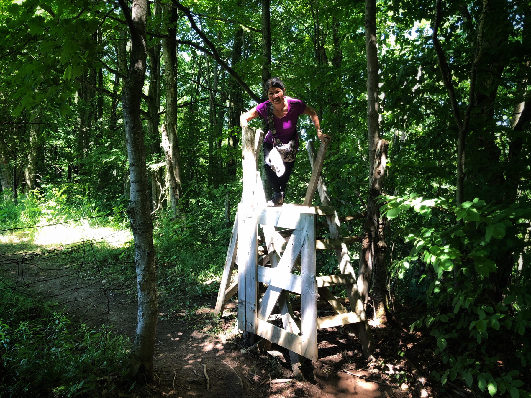
From the entrance we followed the white blazes along the Bruce Trail through a nice section of forest before coming to an old fence, which opens up into a field. There are two options at this point. Yo can go straight or turn to the right, which is the direction we took on our first hike through here.
We were not sure just how long or how accurate the duration of this hike would be and it seemed to us that we could cut the hike in half by doubling back along a blue side trail, which is what we did on out first visit. I marked that on the map above titled Loop Back. That is where we broke up our hikes.
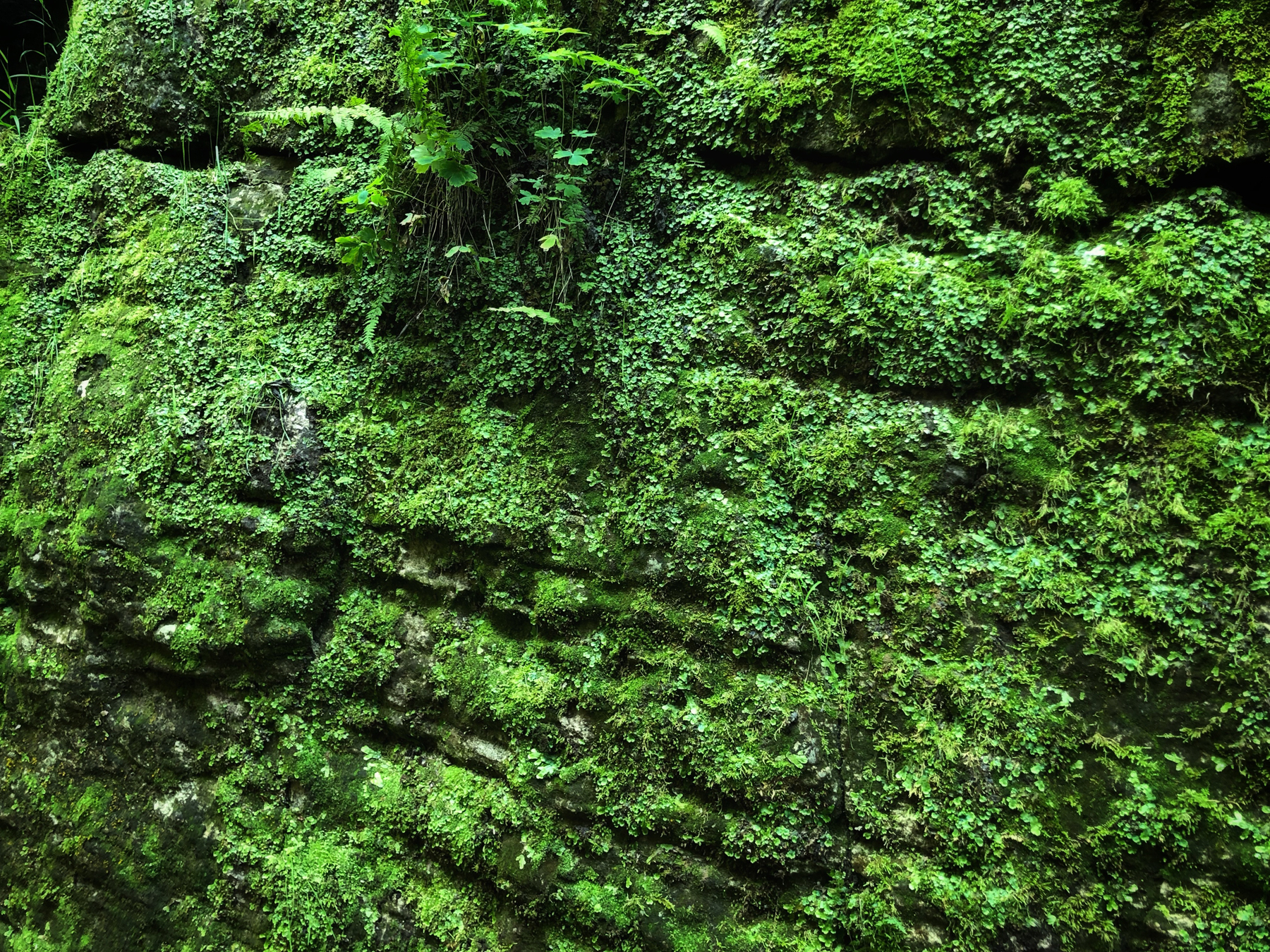
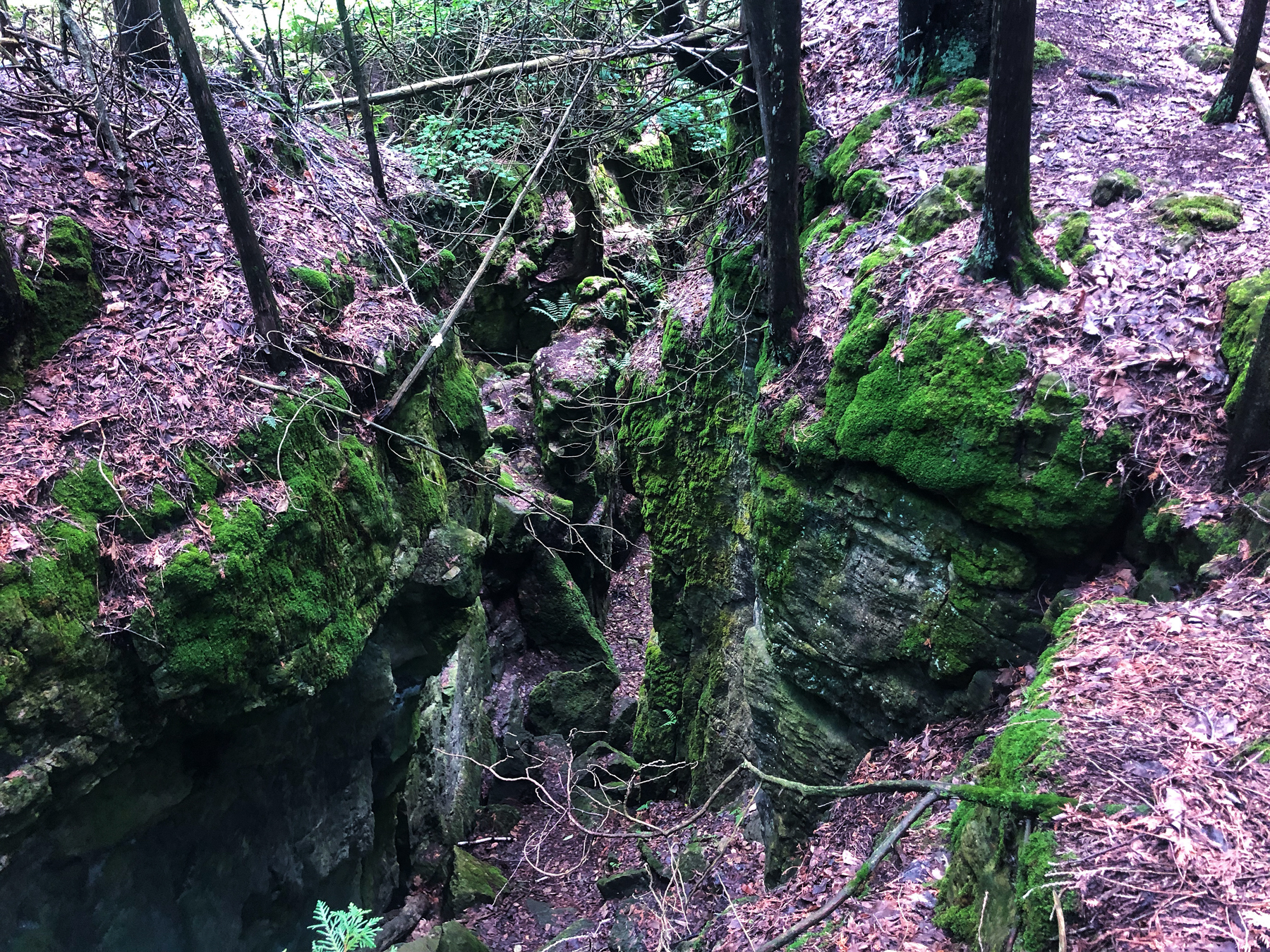
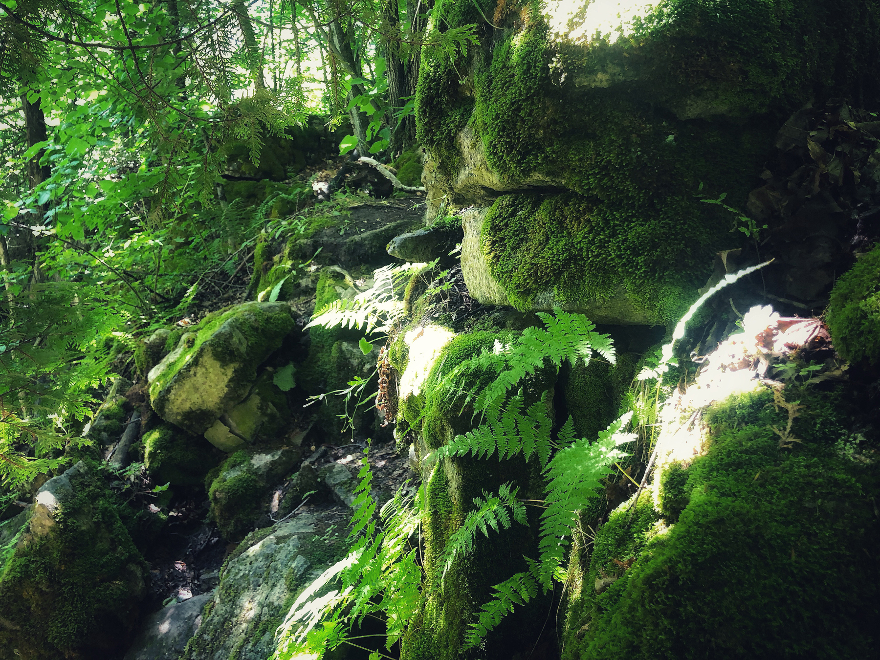
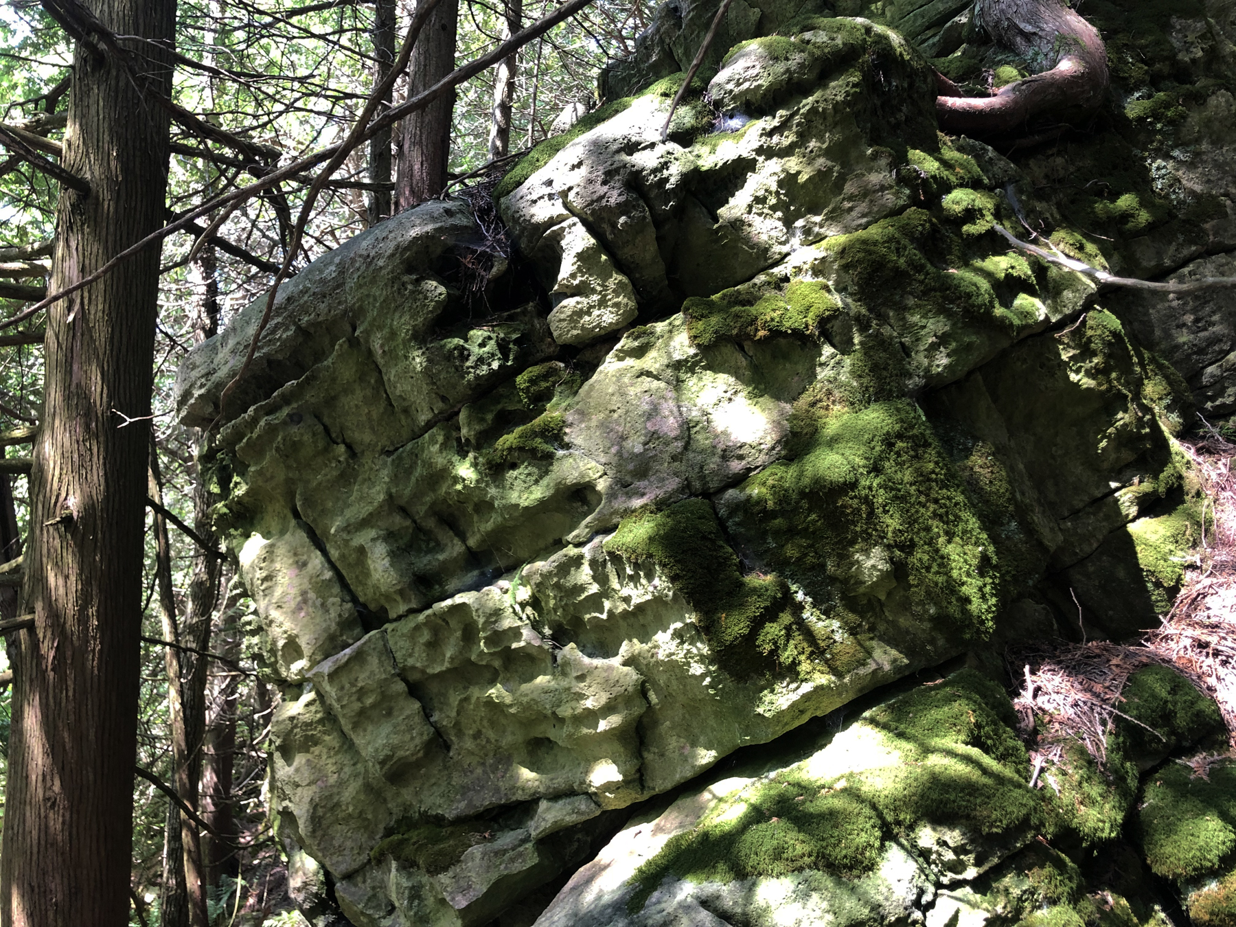
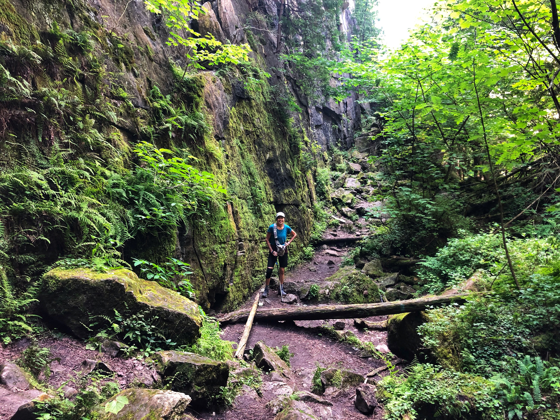
The Duncan Caves and the many crevices or boulders here have been formed after years of seasonal extremes in temperature and the forces of gravity, leaving large blocks of rock that have broken away from the main face of the Niagara Escarpment. The gradual shifting downwards of these huge blocks has produced the crevice caves of the Collingwood-Blue Mountain area.
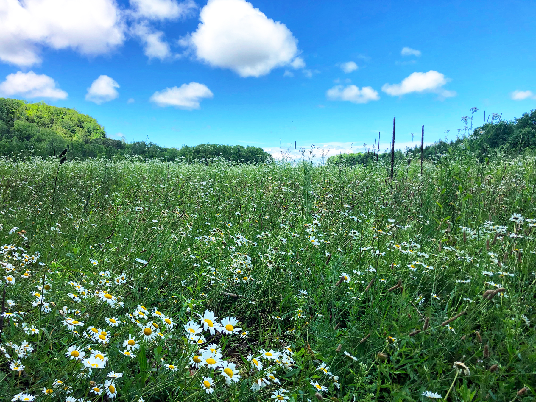
After making our choice of directions, we enjoyed the walk through a field and along a farmers property to our right until we began to ascend up and onto the escarpment. At one point, we were surrounded by a field of daisies…
There were a few spots where it was tricky and quite steep with less than ideal footing (think loose shale) but overall, this is a wonderful but long trail to try and do in one day. We tackled it in two sessions and it still took us almost 6 hours in total so I’m not sure exactly what the actual distance is. We think it is closer to 14 K in total.
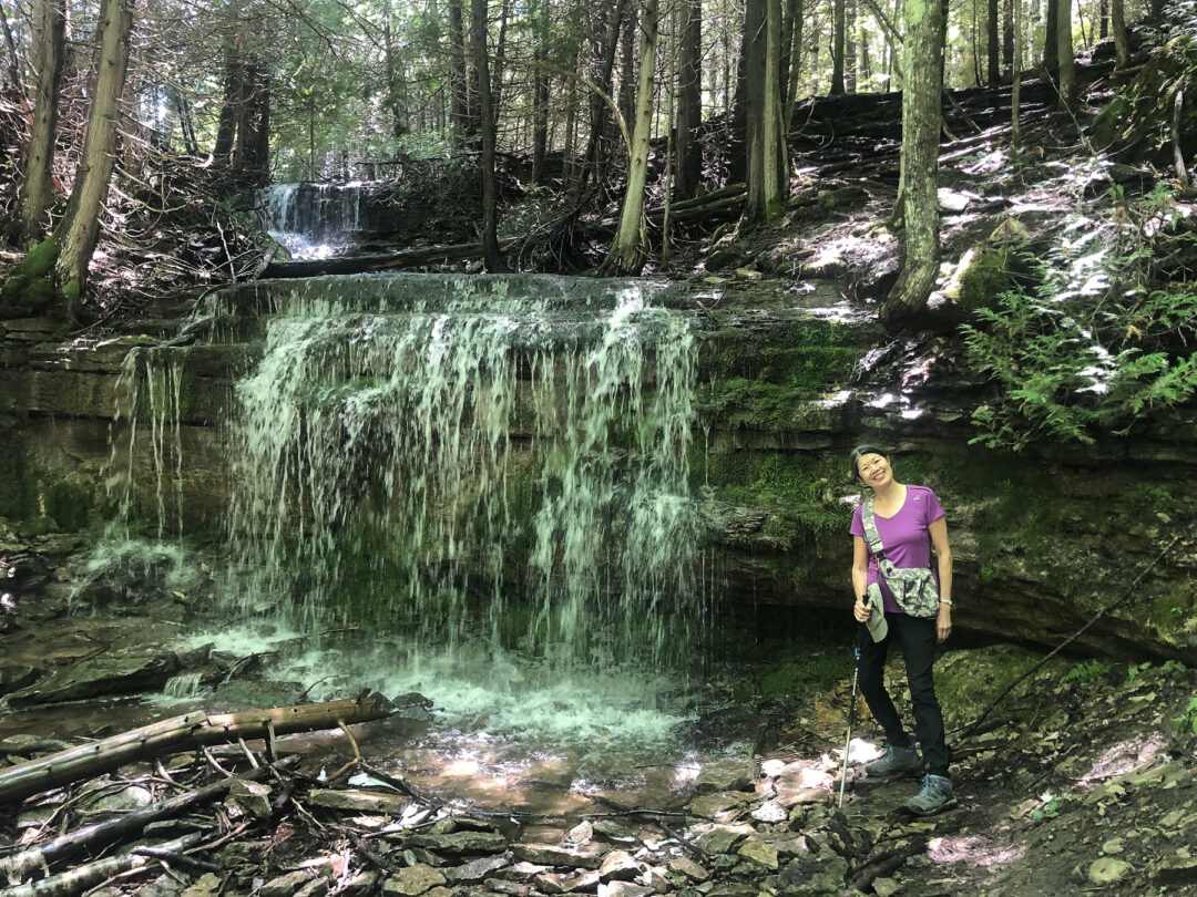
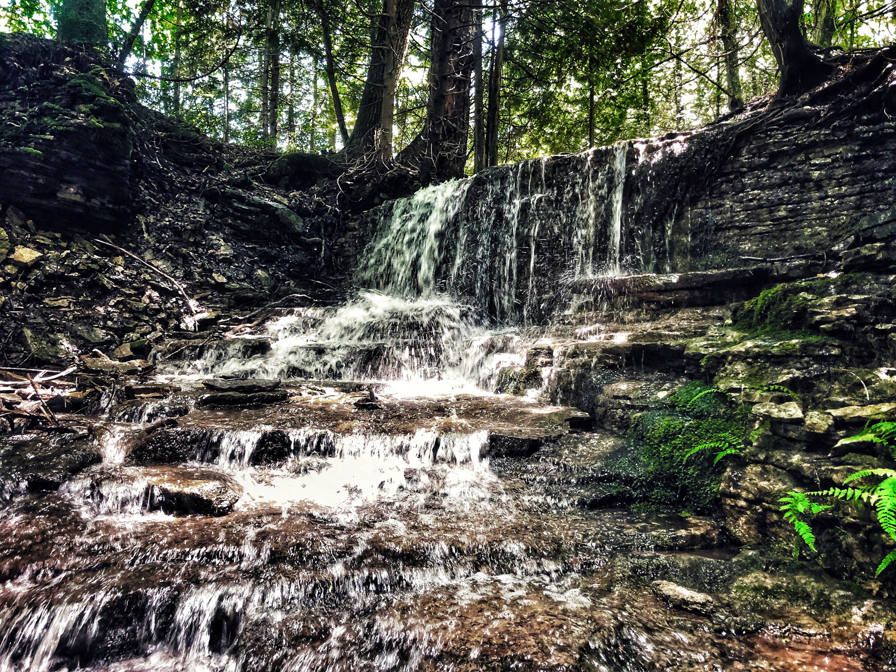
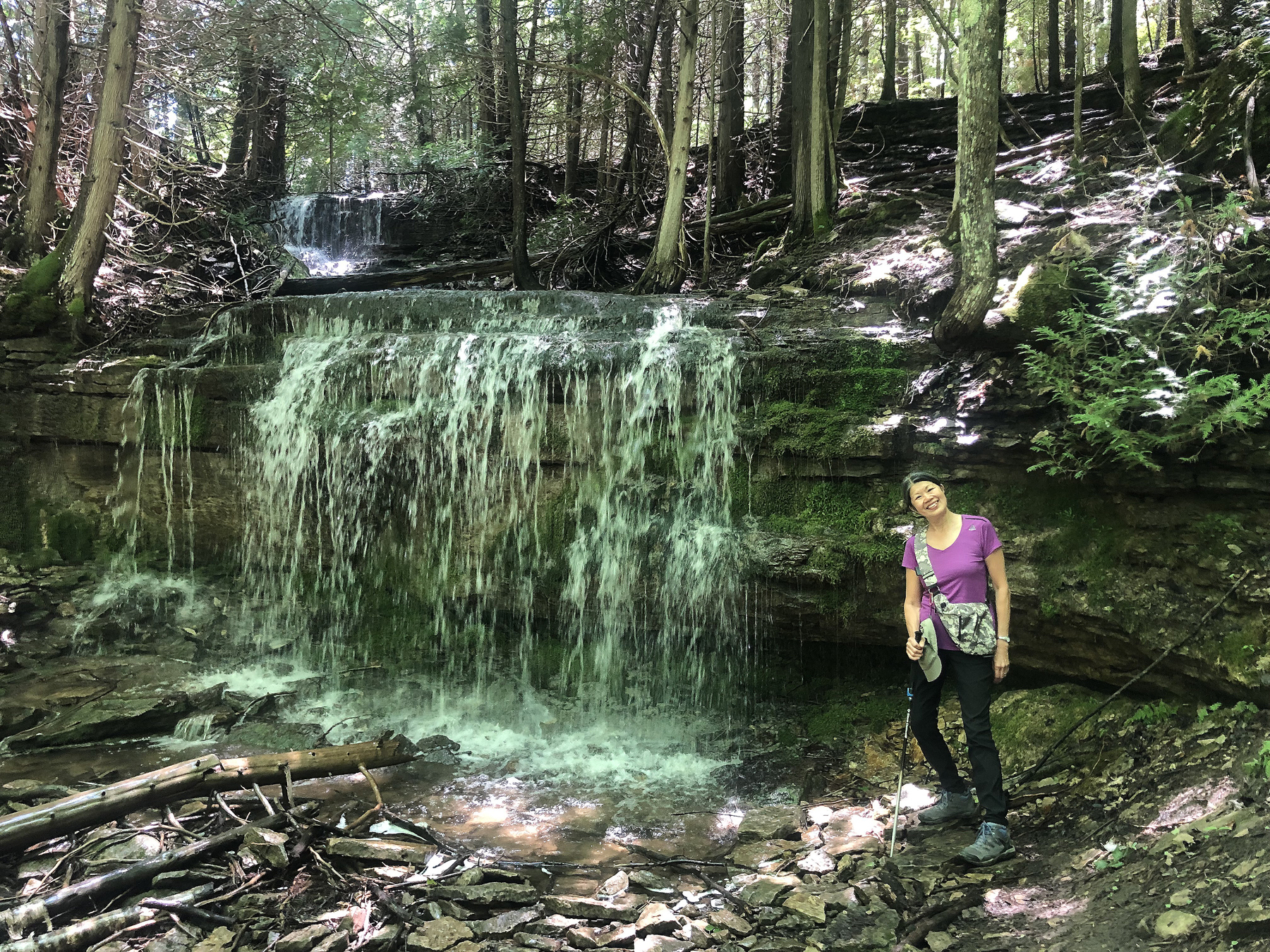
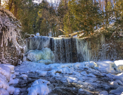
Once we passed the bench and made our way down that tricky part I mention, we came across a sparkling little waterfall, which is very beautiful as the waters cascade down sections of the shale structures of the escarpment. That section alone was worth the hike to me. The light was poking through the tree canopy and playing with beams, lighting up different sections here and there and made for a magical landscape.
The Duncan Caves (or Metcalfe Rocks), are the reason we went back to do the second section. They were formed after years of seasonal extremes in temperature and the forces of gravity, leaving large blocks of rock that have broken away from the main face of the Niagara Escarpment. The gradual shifting downwards of these huge blocks has produced the crevices & caves.
We have since learned that there are easier ways to hike to Metcalfe Rock. There is parking on the 10th line.
Here’s that trail and parking location below.
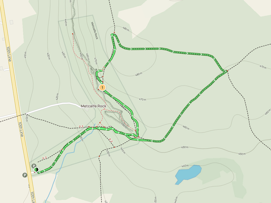
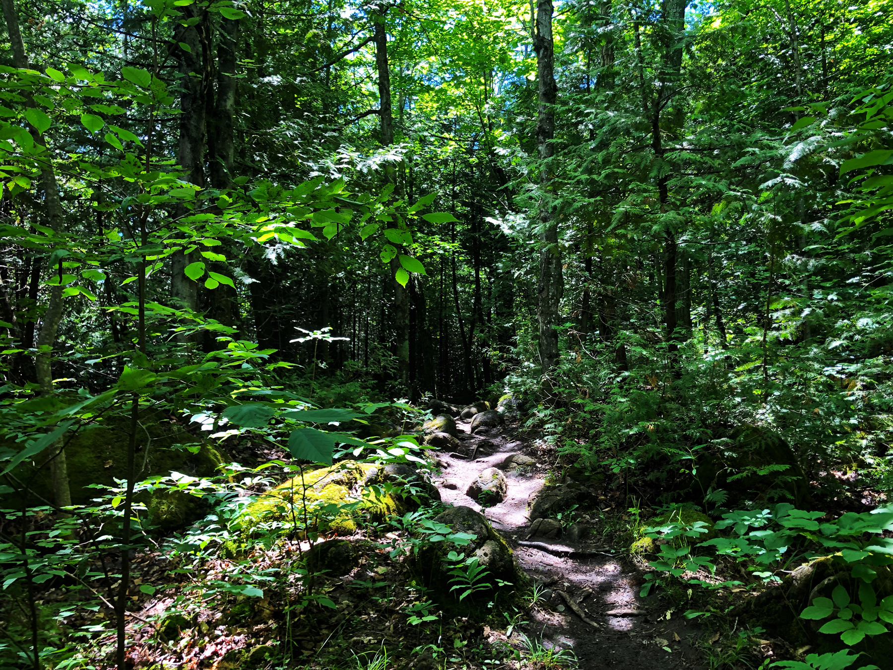
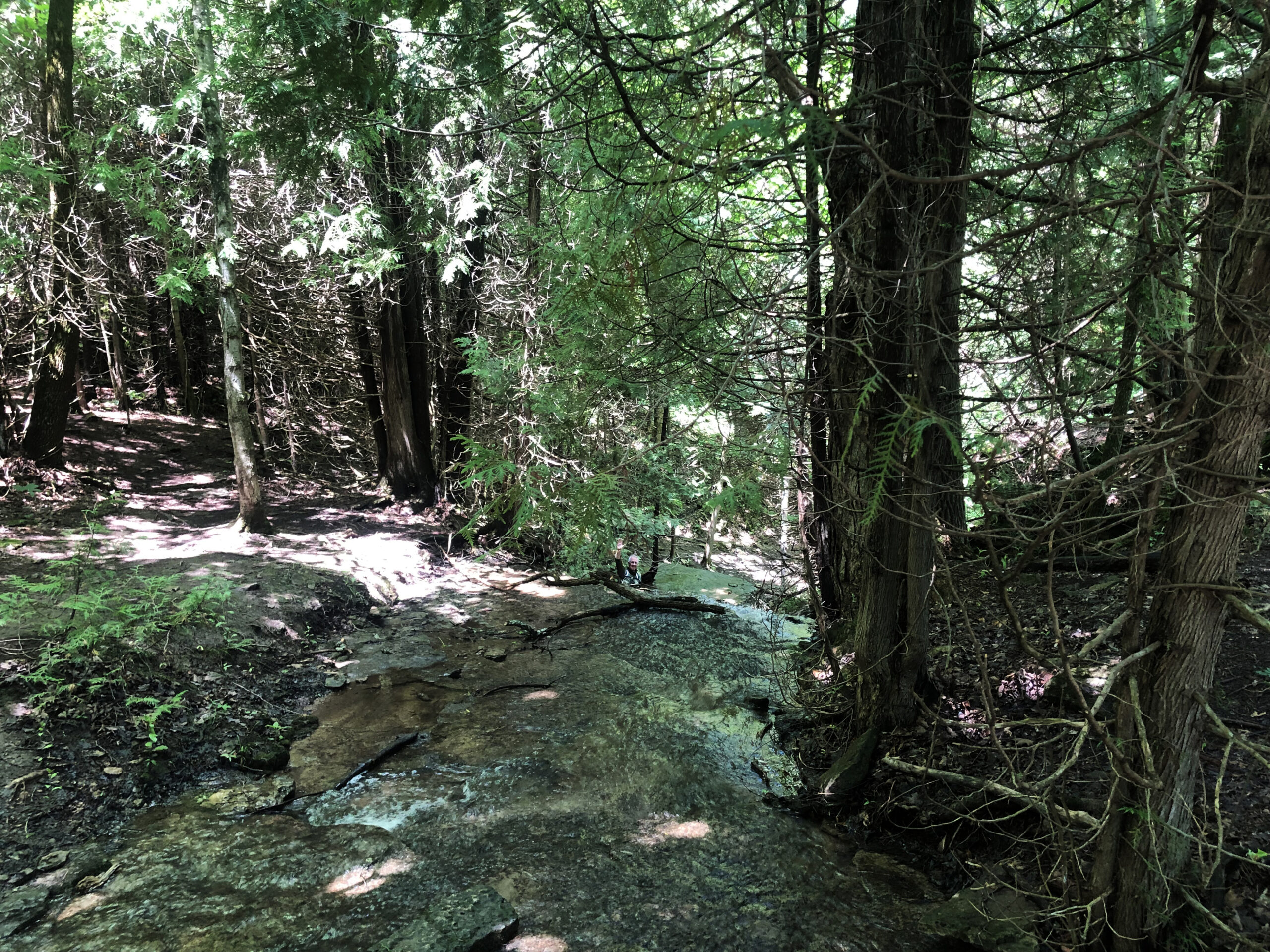
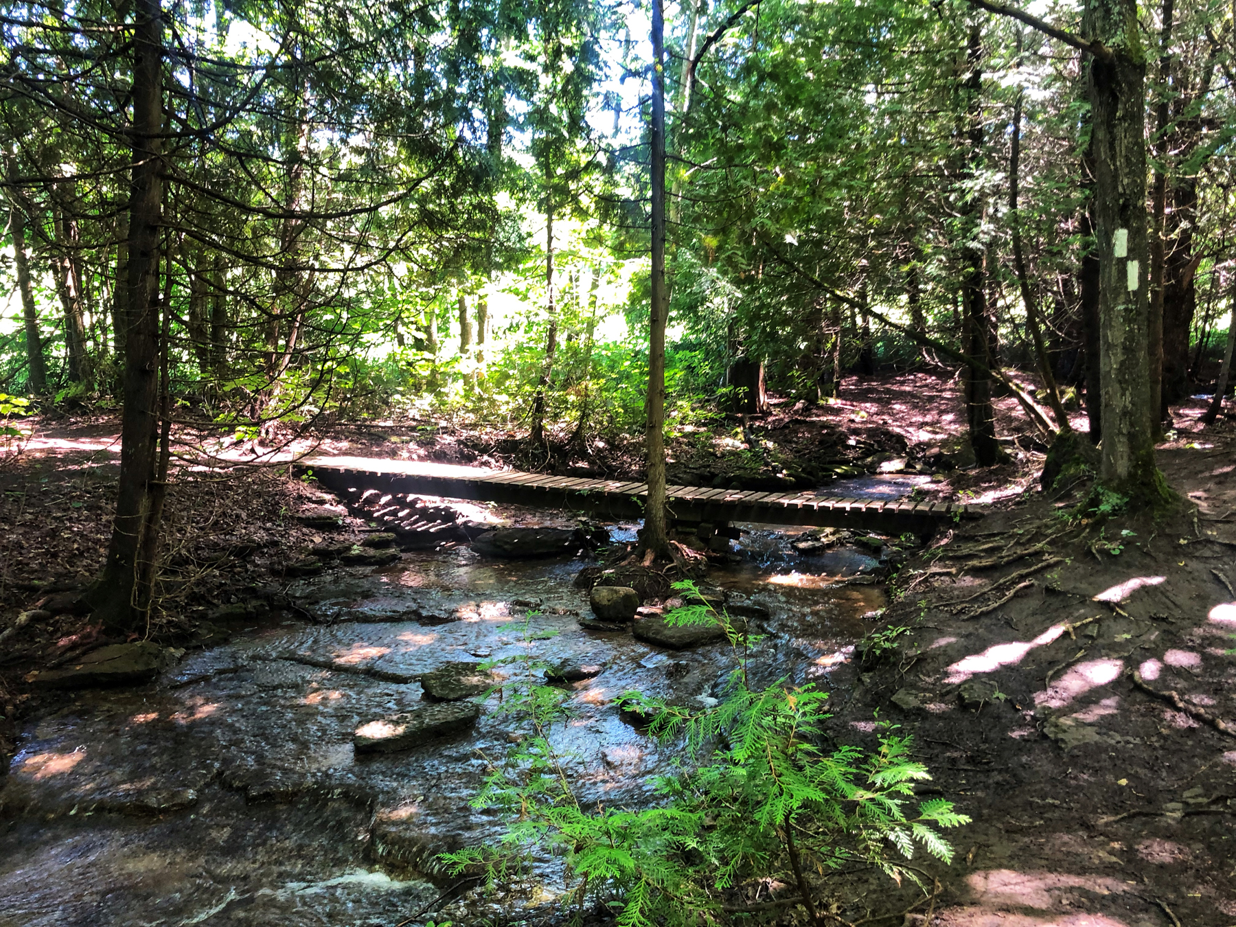
From there, the white blazes of the Bruce Trail cross a small stream and climb into the tumbled rock of the Niagara Escarpment. Here you have a choice of climbing to the top on either the main trail or via a blue-blazed side trail. The adventurous will want to take the latter through a rocky gorge 30 metres high. We did and it is worth the hike.
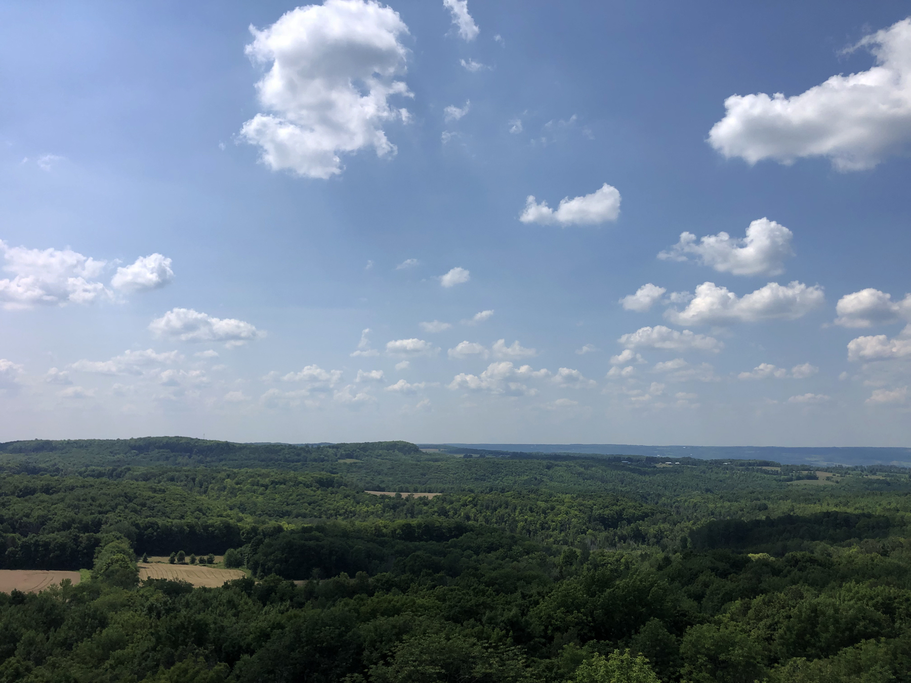
The Trail reaches the summit of Metcalfe’s Rock with splendid views to the west over Kolapore Creek Valley.
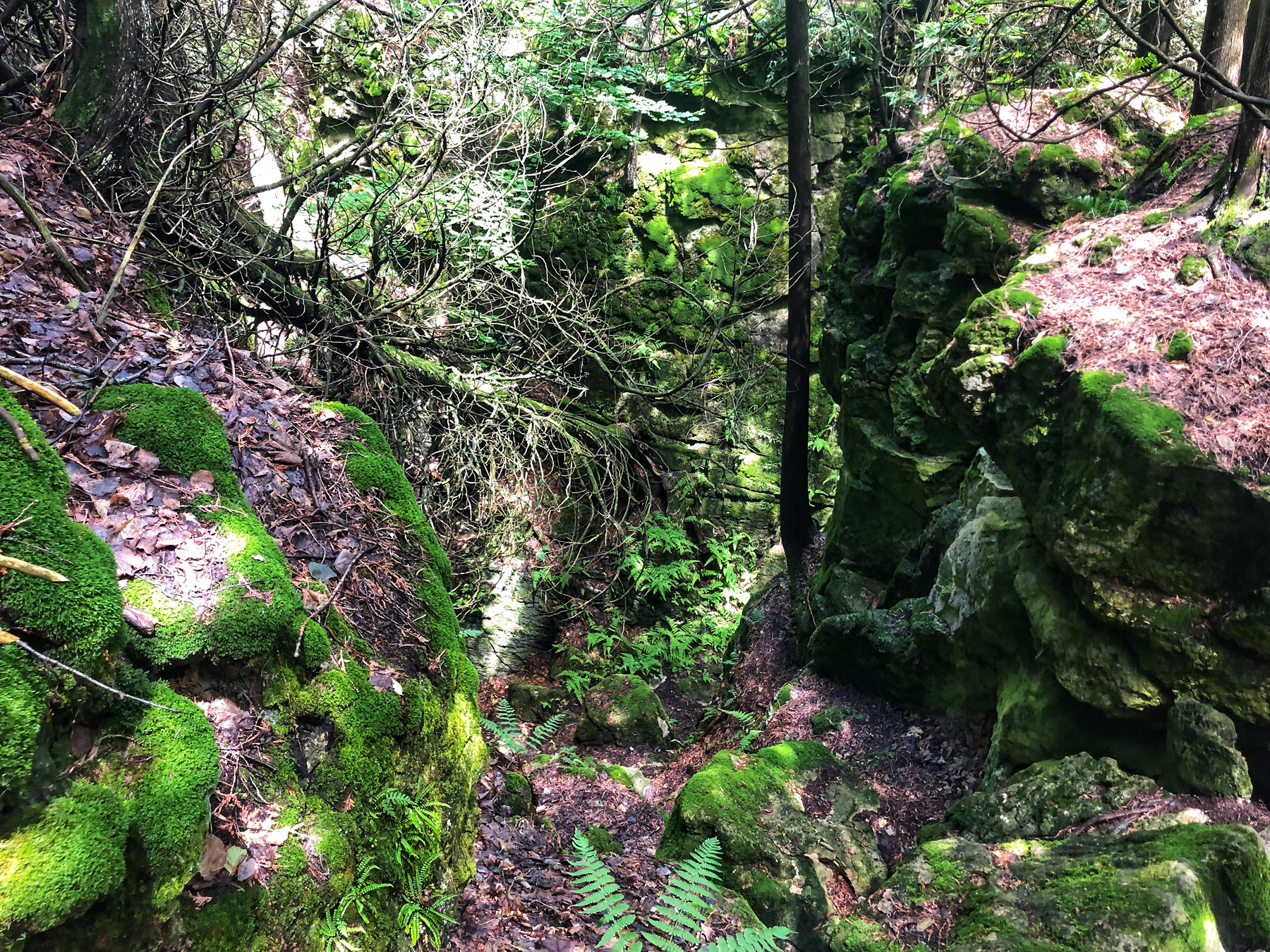
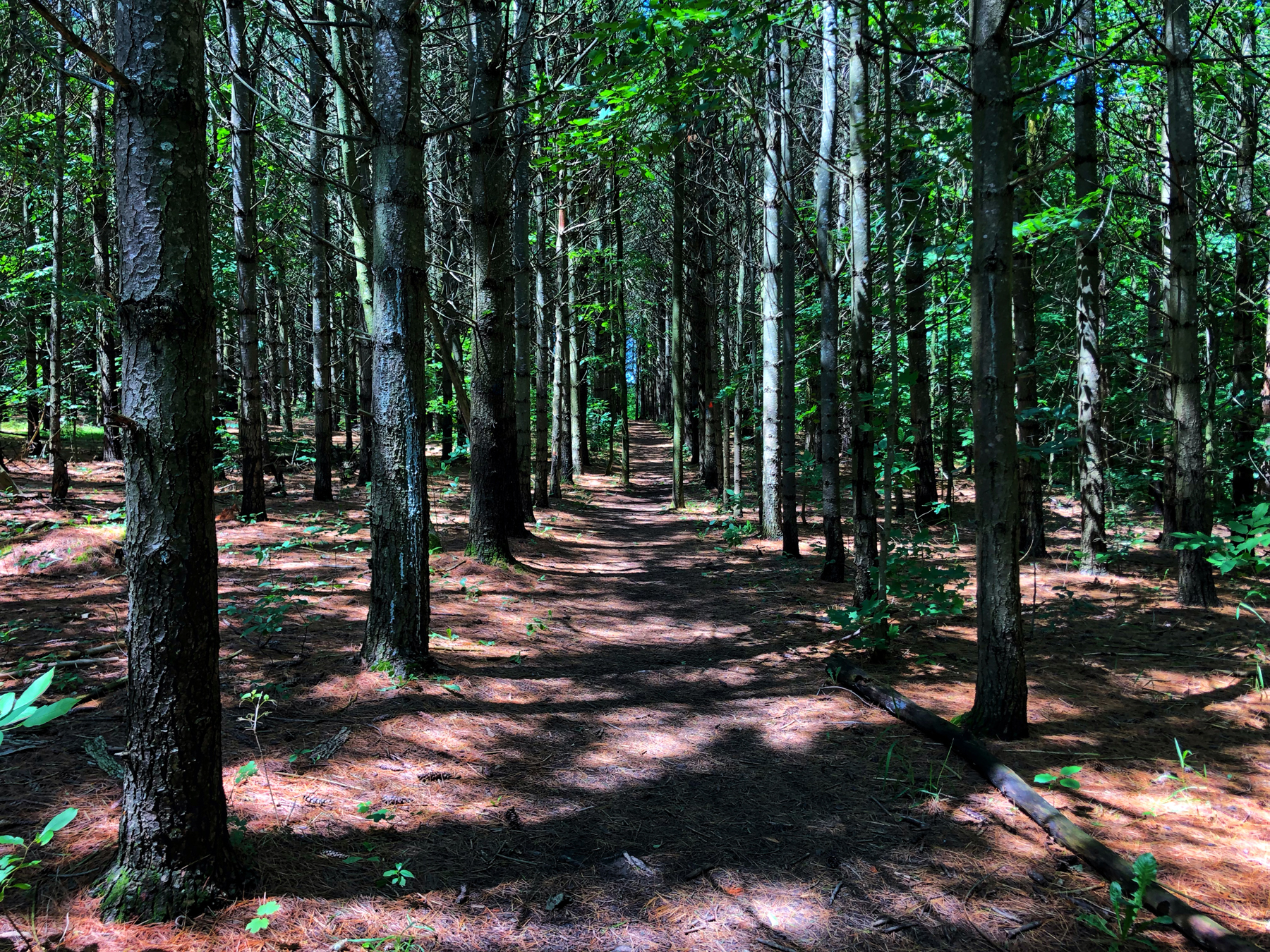
The Trail continues north through a succession forest. Then, where the white blazes turn sharply to the east (right), continue north on the blue-blazed Chuck Grant Side Trail. Soon the route drops sharply over the scarp edge, twisting around some fascinating rock formations. This is such a cool hiking experience, with so many crevices and caves to explore and wonder through in addition to the forest.
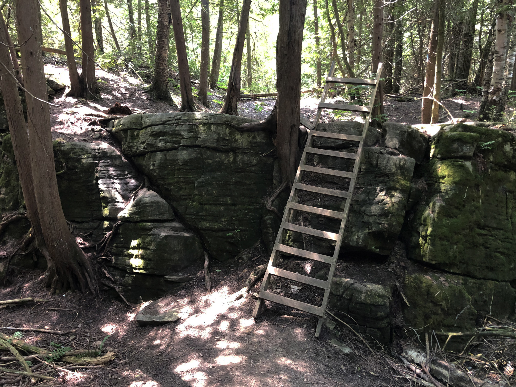
At this point, since we had parked on 9th Sideroad, we continued the hike along the Chuck Grant Loop, which explores the west side of the valley and the remainder of the Duncan Crevice Caves Nature Reserve. Keep in mind that is is almost two hours from here so it’s quite a hike to tack on. Along the way, we entered another section of crevices, where a series of ladders have been constructed to help you up and along the trail.
If, like us, you’ve parked on 9th, it’s a nice walk but it is long.
If we were doing this again, we would use both parking areas so we were not as tired at the end of the day.
That said, this can be broken into two very lovely day hikes, both featuring absolutely beautiful sections of the escarpment and the forces of nature.
Below I have added a photo gallery of our two hikes in chronological order in addition to the featured photos above.
Enjoy your hikes.

No Comments