Quidi Vidi Village (above).
After more than two years of waiting, we finally managed to get to Newfoundland this summer for two weeks with our friends Dorothy and Mark from Victoria.
After settling in to our hotels and a night out at O’Reilly’s listening to some Newfoundland music, the first spot on our visit list was Signal Hill, located very close to downtown St. Johns. Yim and I woke up at 5:30, talked for an hour then fell back to sleep for two hours. A perfect first vacation day start. Got up, showered, had a cup of tea and wandered down along the harbour front then headed to the airport to pick up our car. We had about two hours before Dorothy and Mark arrived so we bought some fresh fruit and a salad and drove up to Signal Hill to scope it out, which we returned to later in the day, then headed off to the airport, picked up Dorothy and Mark, dropped them off at their hotel and checked out Jellybean Row.
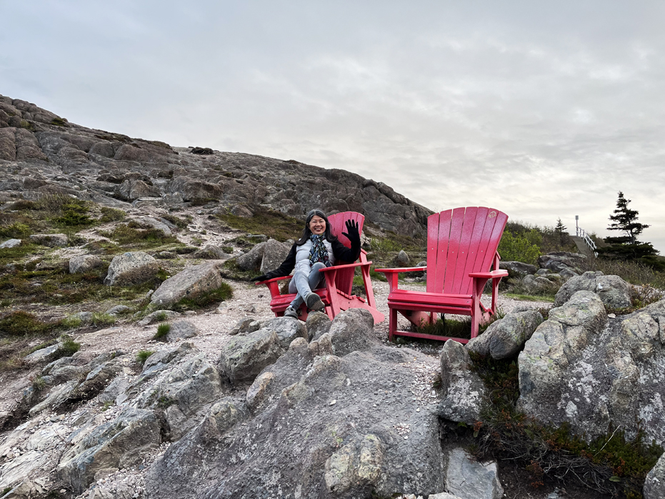
Once Dorothy and Mark were settled and had grabbed a bit of rest, we headed off to Signal Hill. Mostly a National Historic Site, the highest point is Ladies’ Lookout, above Cabot Tower. This is where the first transatlantic wireless transmission was received by Guglielmo Marconi on December 12, 1901.
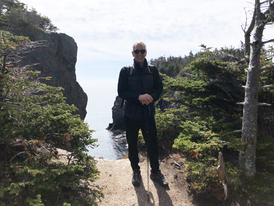
Yim taking a break on the North Head Trail (above).
Due to its strategic placement overlooking the Narrows – the only entrance to the harbour – fortifications here date back to the mid 17th century.
Signal Hill has five main hiking trails; the North Head Trail, the Ladies Lookout Trail, the Citadel Trail, the Burma Road Trail, and the Gibbet Hill Trail. A short, fully accessible trail, known as the Lookout Trail, goes around the top of the hill, circling Cabot Tower and connecting various lookout points. In addition, a number of Grand Concourse connecting trails connect the Signal Hill Trails to the Grand Concourse Trail system, which winds its way throughout the city of St. John’s.
Signal Hill is St. John’s best known and most popular landmark. Its unparalleled view of the City and its sweeping vistas of the Atlantic Ocean make it a major attraction for both visitors and locals alike.
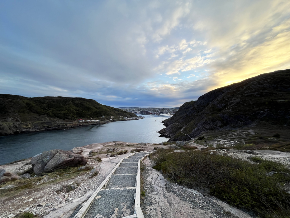
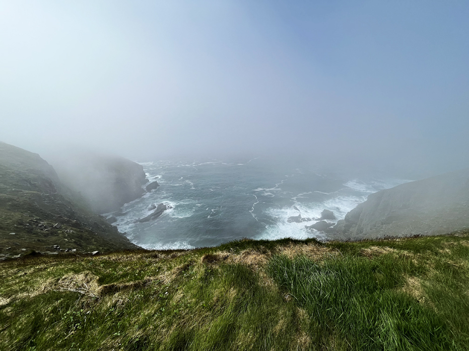
The North Head Trail is Signal Hill’s most popular and most difficult hiking trail. This 1.7 km trail takes approximately 90 mins and descends almost 500 feet. Beware, there are a lot of stairs so if you are not in fairly good shape, the walk back up can be fairly strenuous. Hikers connect with this trail from Signal Hill’s top parking lot. From there they descend down boardwalk stairs, follow a footpath to North Head at the entrance to the St. John’s Harbour, & hike along the narrows to Lower Battery Road. There’s some great views at the bottom and in my opinion, was well worth the effort, especially at sunset.
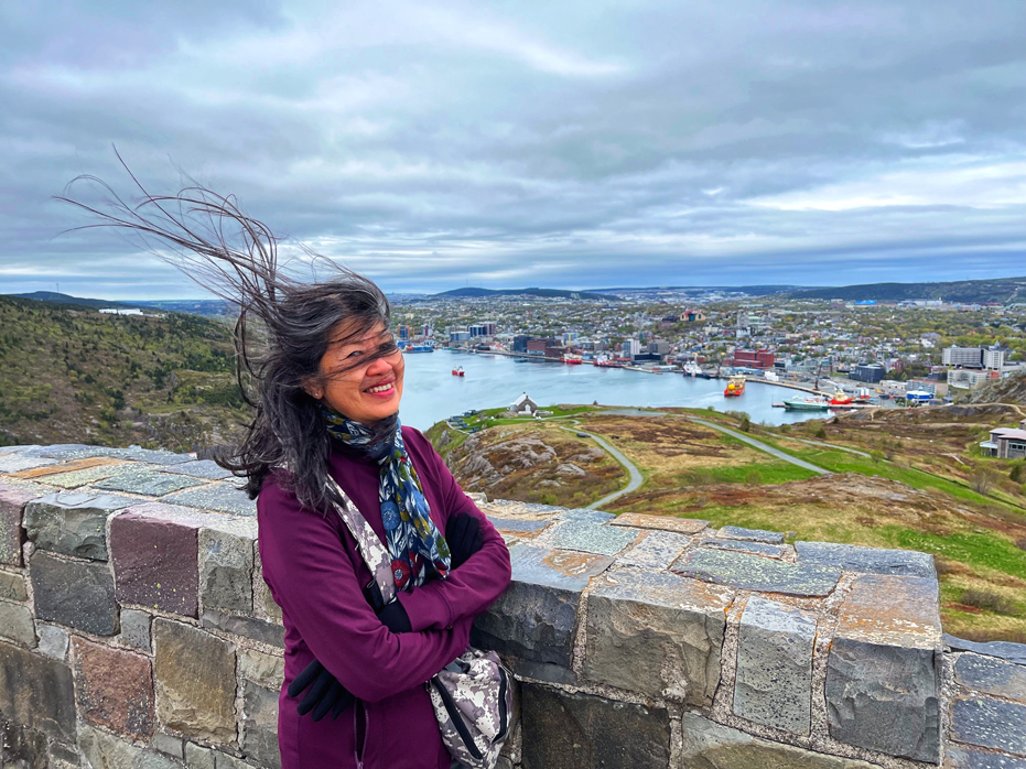
Lookout Trail is the shortest of the Signal Hill Trails, at just 300m, and circles the summit of Signal Hill. It is rated easy, and is fully accessible. The trail is a loop that enters from, and exits to, the parking lot. Starting at the city side, you simply access a boardwalk which runs along the length of the parking lot on that side. The boardwalk ends on a gravel portion of trail that leads around to the back of Cabot Tower. This portion of trail provides a beautiful panoramic view of the city.
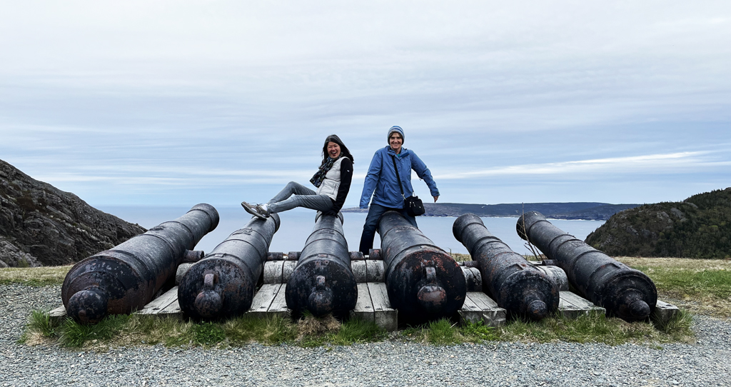
Dorothy and Yim hamming it up on the cannons.
We also chose to take the path down to The Citadel Trail as we wanted a close up look at the restored cannons. Though it is well maintained with an excellent walking surface and no difficult terrain to navigate over, the trail does have a rather steep grade. There are, however, stairs to make the walk more manageable in some of the challenging areas.
Though the fortification of Signal Hill began during the Napoleonic Wars the Queen’s Battery Barracks, used for housing troops, was not built until the 1830s. In 1983 a project was undertaken for the restoration of the barracks. It is a very interesting stop along the trail that gives a glimpse into the life of the 19th century soldier stationed on Signal Hill. I’d say in total, we spent a few hours wandering around the area and inside the Cabot Tower.
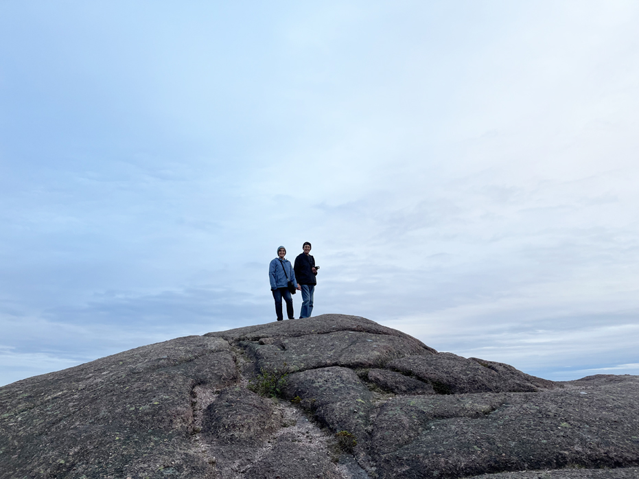
Dorothy & Mark on the North Head Trail (above).
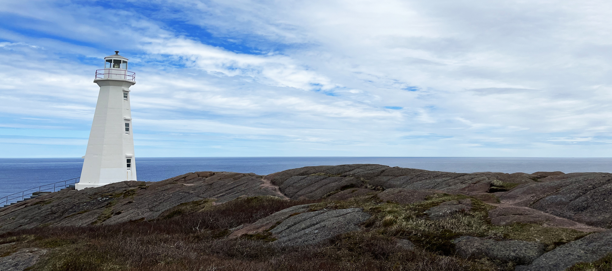
Cape Spear – the most easterly point in Canada.
If you stand here, your back to the sea, the entire population of North America stretches out in front of you and there’s nothing behind you until Ireland. Perched on a rugged cliff, at our continent’s most easterly point, sits the Cape Spear Lighthouse – the oldest surviving lighthouse in the province, a National Historic Site, and an iconic symbol of Newfoundland and Labrador’s marine history. It was something I wanted to see and experience, if for no other reason than to say I had been coast to coast in Canada.
Constructed in 1836, Cape Spear Lighthouse is a striking example of the unique lighthouse architecture of the period. Rising up from the centre of the square lightkeeper’s residence, the all-important light was a beacon of safe passage until 1955, the year I was born, when a new lighthouse tower (see below) was built nearby, using the original light.
The human history of Cape Spear Lighthouse is the story of the Cantwells. For over 150 years, generations of this famous family of lightkeepers resided at Cape Spear and worked tirelessly to maintain a light vital to mariners.
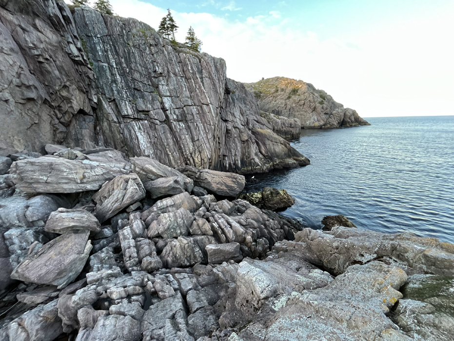
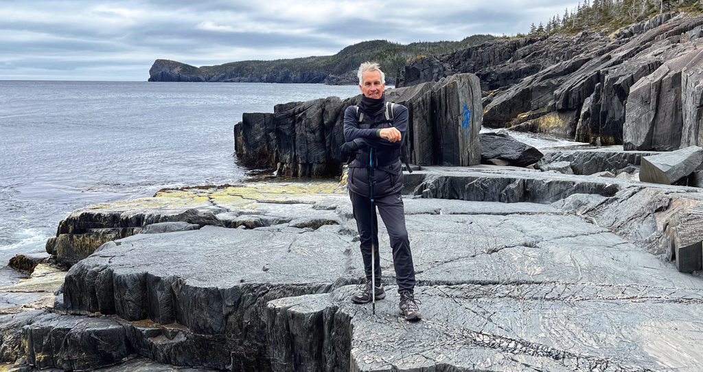
It’s a short drive from St. John’s and while the hike along the coastline is relatively barren, you will be walking along the most easterly shores in Canada. We walked along the shoreline for about an hour and turned back. The trail runs along the ocean and is flanked on the right by bogs… so not too much room to wander off the path and we felt that an hour was long enough.
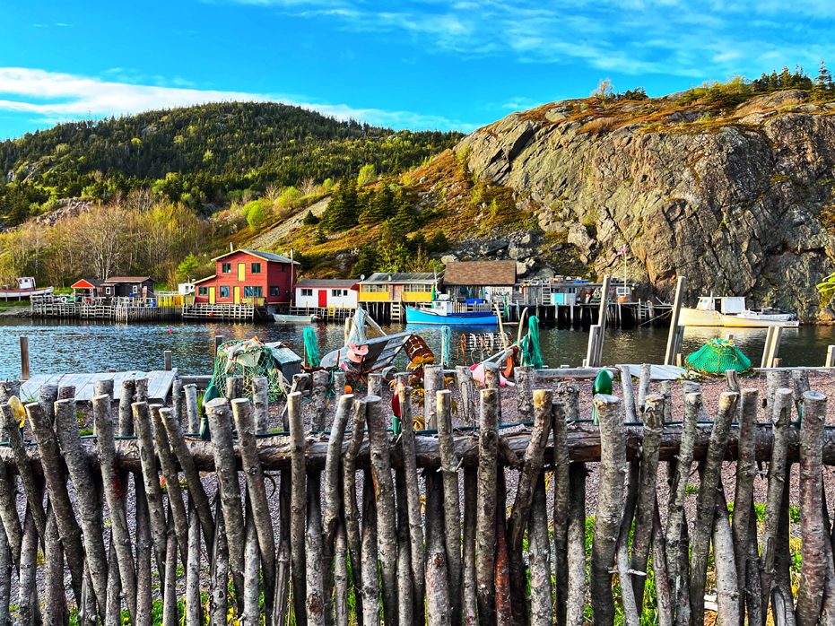
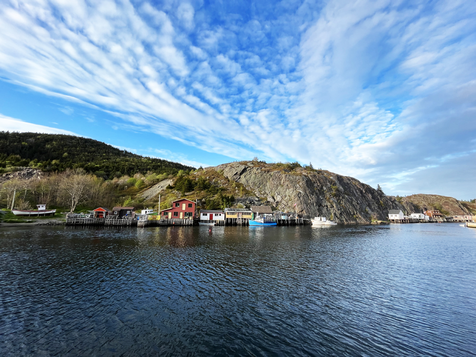
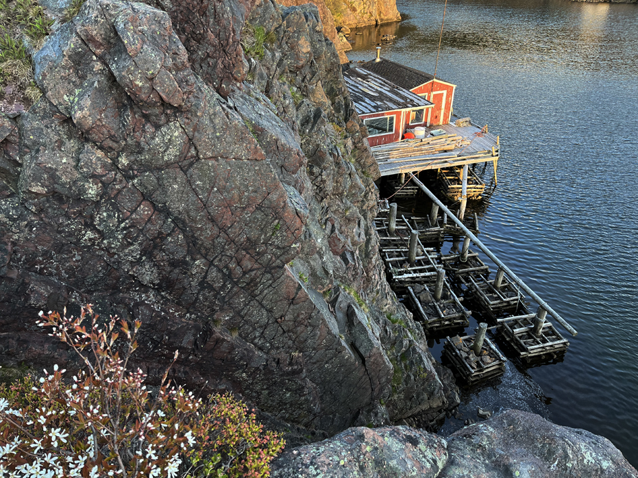
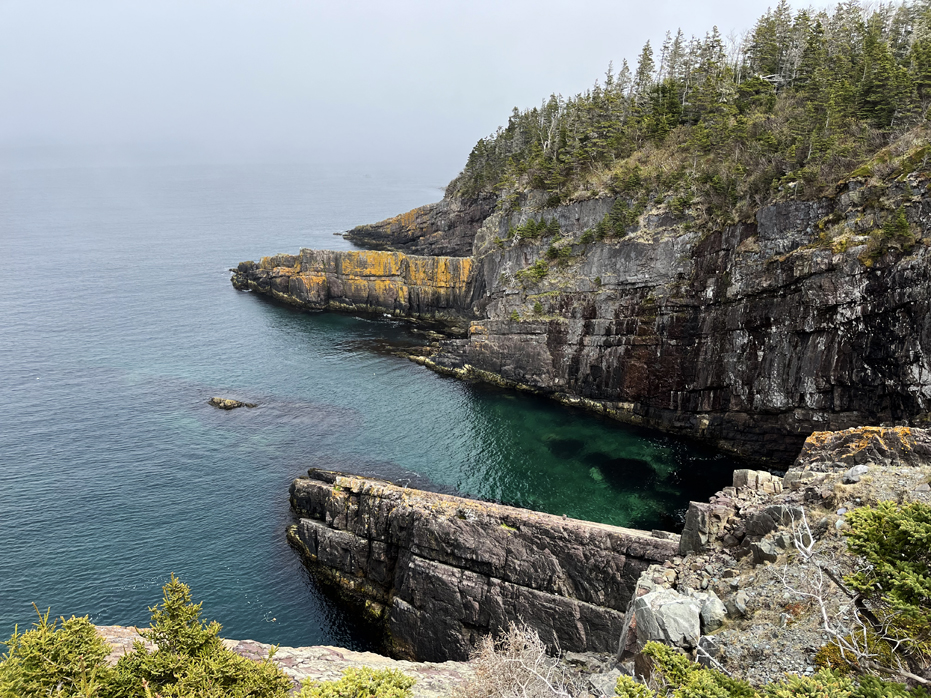
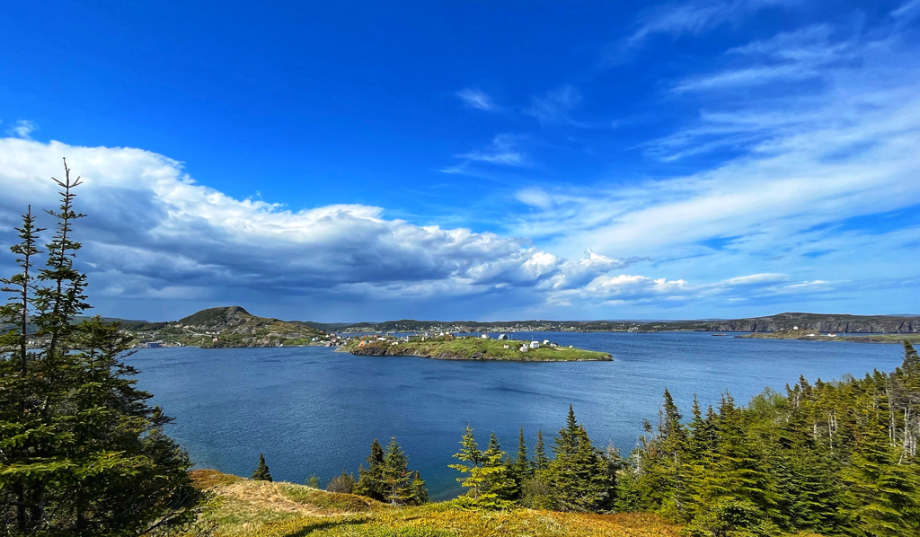
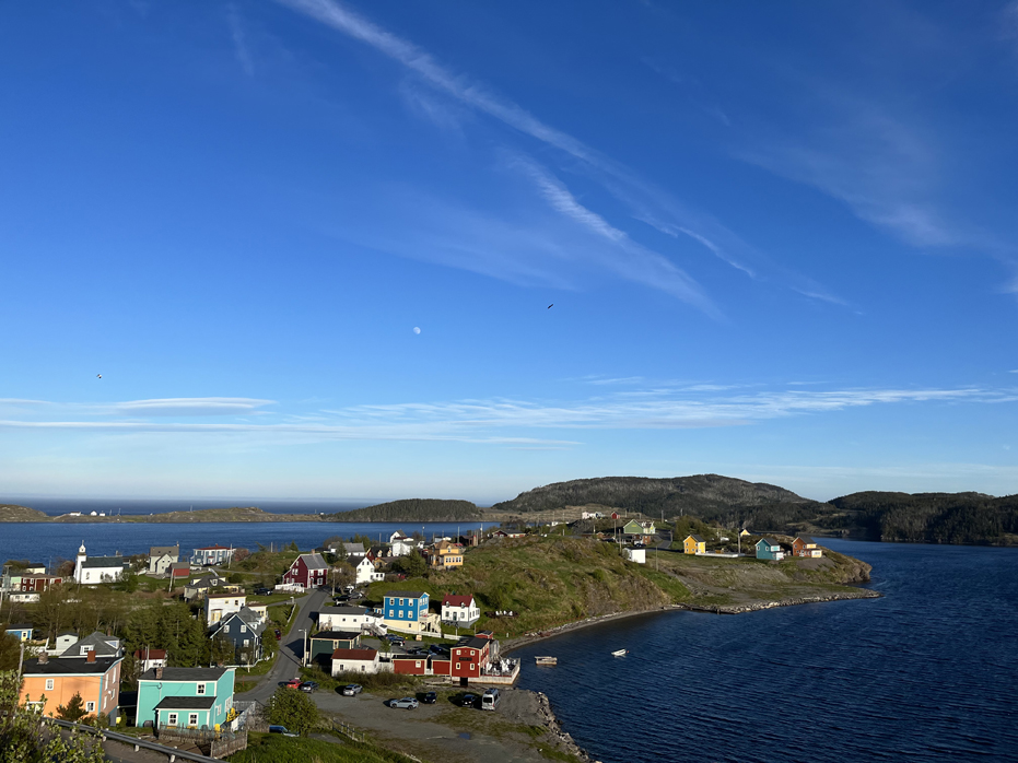
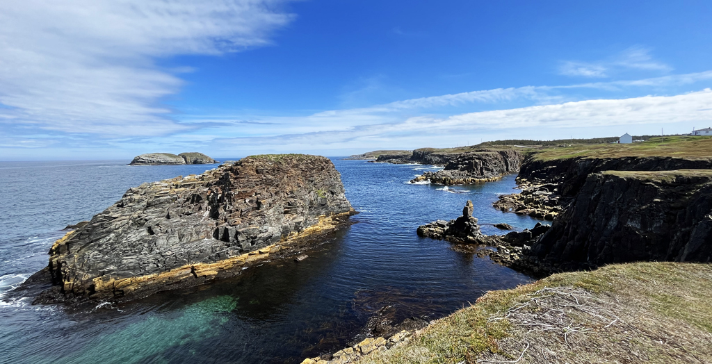
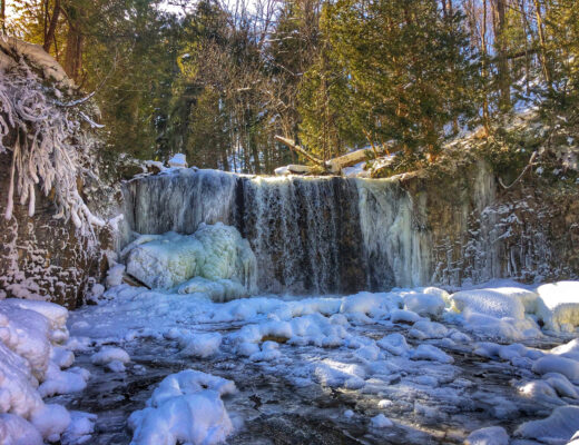
Quidi Vidi Village
This quaint fishing village, located just 10 minutes from downtown St. Johns, in the east end of St. John’s will transport you to a different time. We were lucky enough to arrive just as the sun was starting to set in the sky, which illuminated the row of houses along the rocks. Popularly known as “Newfoundland‘s Prettiest Village,” Quidi Vidi is a small fishing village filled to the brim with history and charm. From its colourful houses, idyllic cottages and delightful pubs, it’s a must-see while you’re visiting Newfoundland.
We wandered along the docks trying to find the perfect photograph and lighting and into the Quidi Vidi Brewing Company before heading up the Sugarloaf Path, where the views looking down provided us a very different perspective. However, we did arrive a bit too late to complete this hike up along the coast and chose the safe route of heading down the mountain before the sun set on us.
Unfortunately, we also seem to have arrived in Newfoundland about two weeks too early as many things were simply not open as yet so we simply strolled the village enjoying the scenery.
The name Quidi Vidi is a real mystery. Even locals can’t seem to agree on where the name comes from. Some say it was named by the Portuguese, who called it “quey de video,” meaning, “what a beautiful sight.” Others claim it’s Latin, since… well it sounds like Latin. There is also a local legend that says it’s named after a hotel bar that once sat on the edge of the lake. The owner of said bar was named “Kitty Vitty” and they went about naming the whole area after her. Up until the 1900s, the area was even written as “Kitty Vitty” on local maps.
However you pronounce it (or spell it), everyone can agree that the history of Quidi Vidi revolves around fishing. In the 1600s, fishermen arrived every Spring to fish the rich sources of cod they found in the area. The fishermen liked to set up small fishing huts on the harbour until the cold weather arrived. Soon, men began to stay behind to face the cold winter.
By staying behind, they were able to set up in advance for the fishermen, who would arrive come the Spring. These “Overwinterers” were some of the first to build homes in the area. Many of these immigrants were from southeast Ireland but instead of returning home in the spring, they remained forever.
I loved Quidi Vidi and could have returned several times just for the photography.
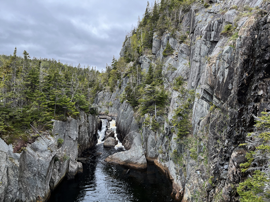
The La Manche Village Hike
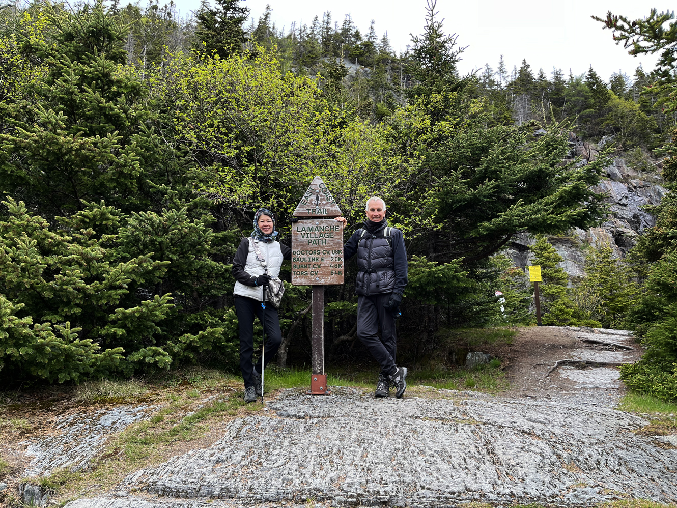 We started the La Manche Village Trail at the end of a gravel road after exiting highway 10 onto road 10-33. It was about a 45 minute drive from St. Johns. This trail is not a loop and the first 20 minutes is spent along a good but rocky path. A lot of the time you should be watching your step because the rocks are loose but it is an easy walk overall. Along the way, you will come to a clearing. Stay left to continue into the remnants of the village and you will come across a nice pond fed by a cascading waterfall before seeing the suspension bridge and the village.
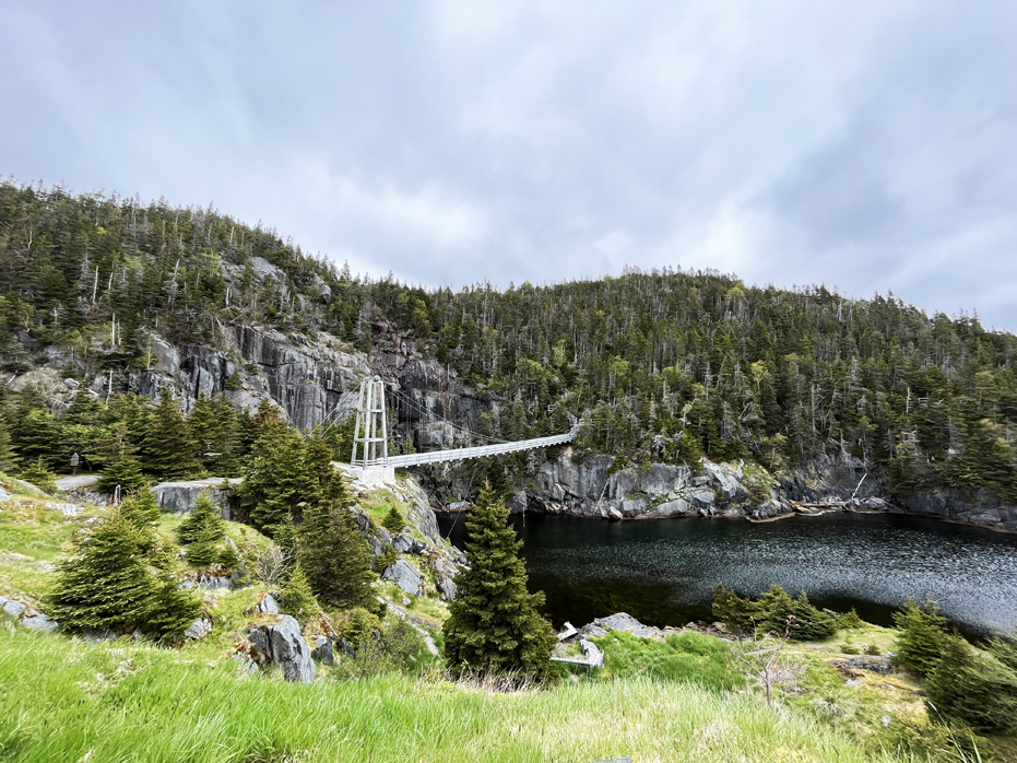
La Manche, (french for “The Sleeve”) was first settled in the 1840s. They had a small church, a school and a suspension bridge that crossed the inlet. However, in January of 1966 – a winter storm caused the people of La Manche to abandon its home as the storm destroyed the wharfs and collapsed their suspension bridge. In 1999, the East Coast Trail Association rebuilt the current suspension bridge to connect the trail to the East Coast Trail.
La Manche Village Path is a shortish hike, and while there are a few climbs (most notably as you approach La Manche Village itself), it’s not a strenuous walk.
After spending some time visiting the village and enjoying the harbour view, we headed across the bridge and up a series of fairly well maintained steps, which then led us along the path to Doctors Cove, which was a wonderful geological surprise and then we headed back to the car. Round trip – 3 hours. I think it may have been nicer to do this hike on a sunnier day but the great thing about it not be a perfect day is we were virtually the only people on the path and that’s always a nice thing.
Flat Rock
Flatrock is situated 12 kilometres northwest of the capital city of St. John’s , Newfoundland and a short walk around the shoreline will quickly show visitors how the community got its name. Flatrock was settled in 1762 by Norwegian and Irish families as well as people from England, Scotland, France and Norway.
I wanted to visit this because of this large flat rock which extends out almost a mile into the Atlantic Ocean. Standing on one side, the surface is completely flat and if you were on it in the winter and slipped, I imagine there would be no way to stop the slide right into the bay.
One of the things I became aware of during our visit is that there is very little soil in Newfoundland. It’s all rock and so there’s few trees of any sort and on a surface like this outcropping, the only thing that is really growing is lichens and bog grasses.
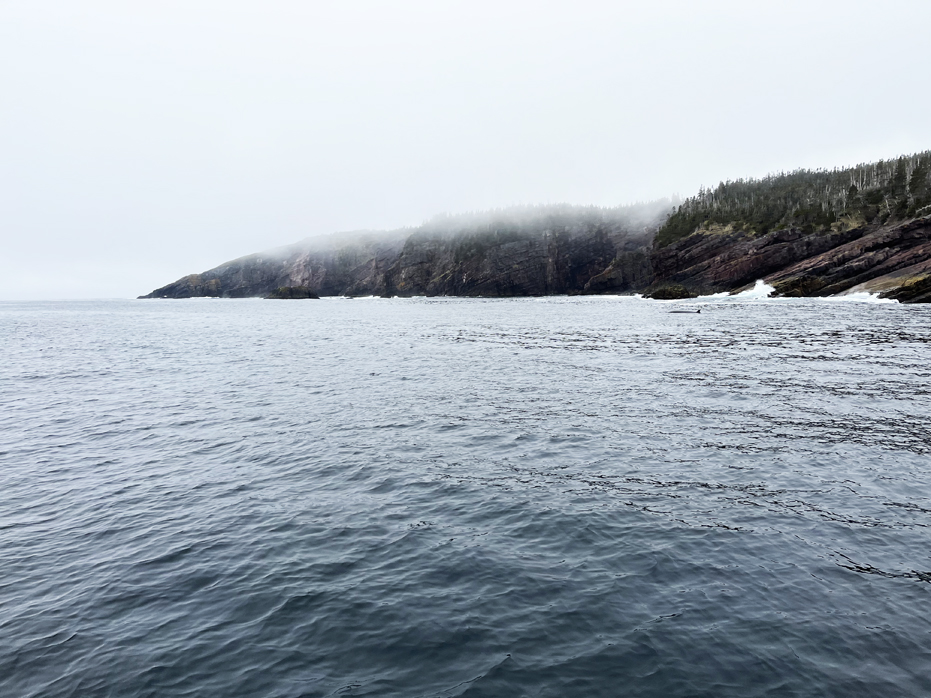
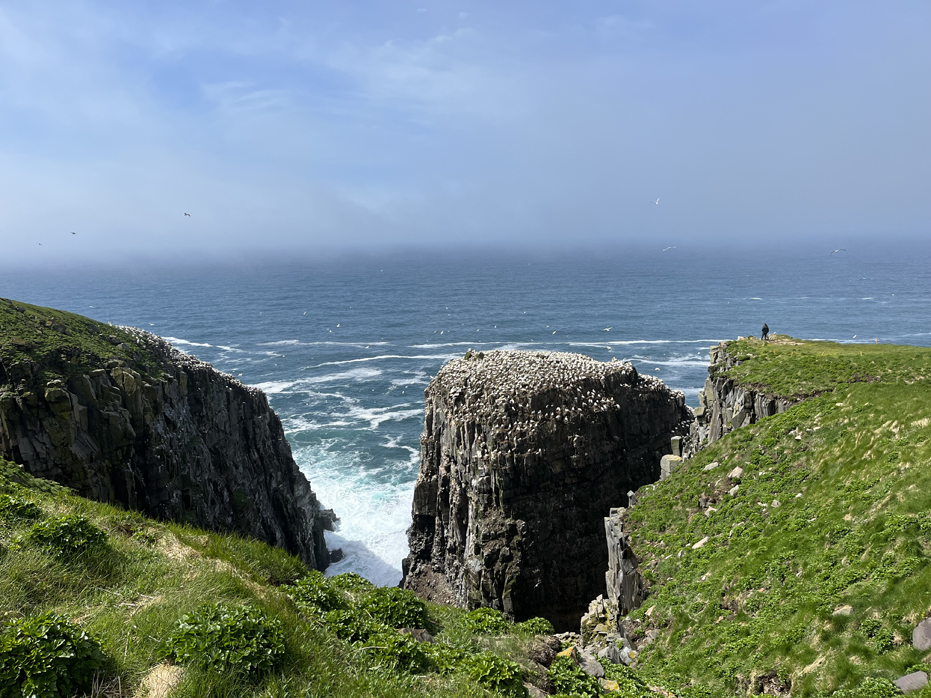
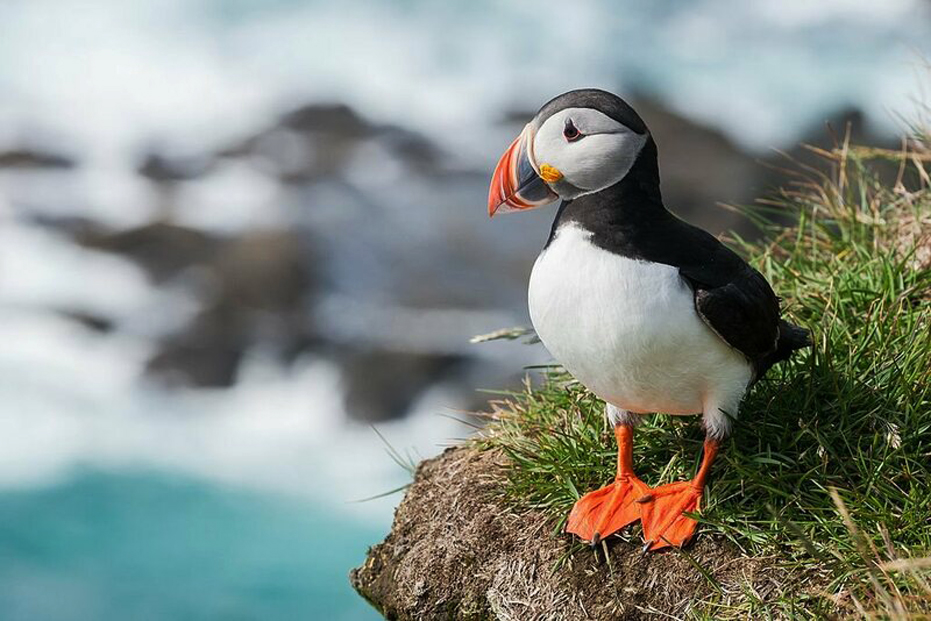
The Witless Bay Ecological Reserve
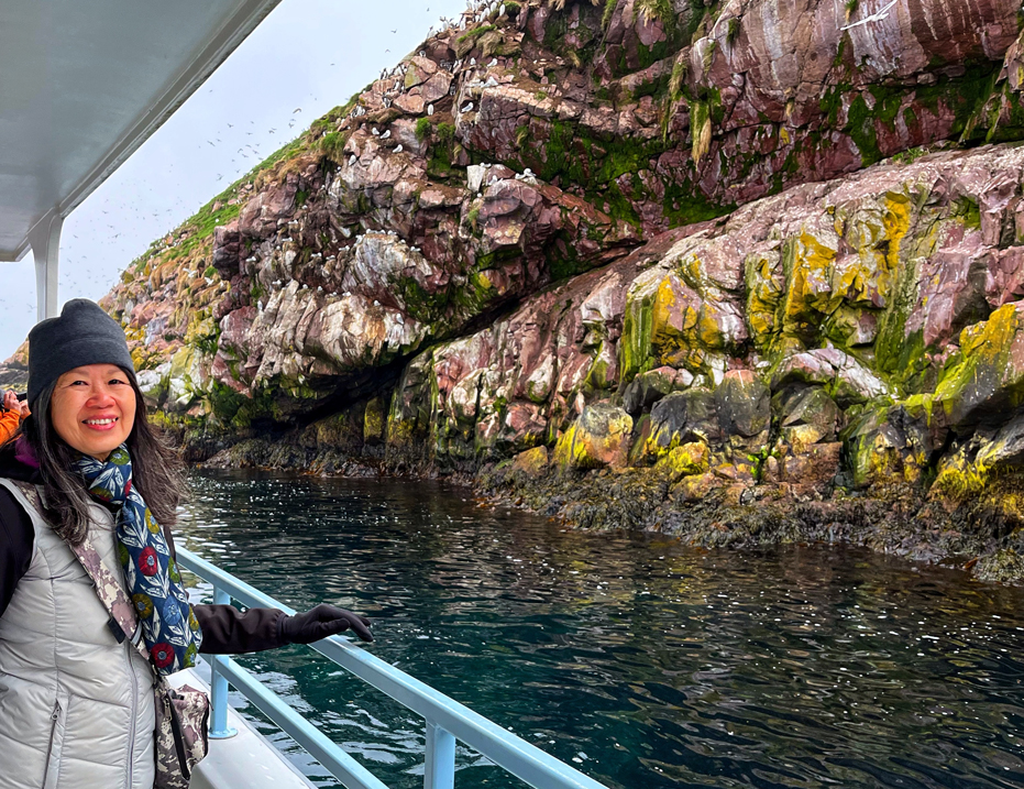
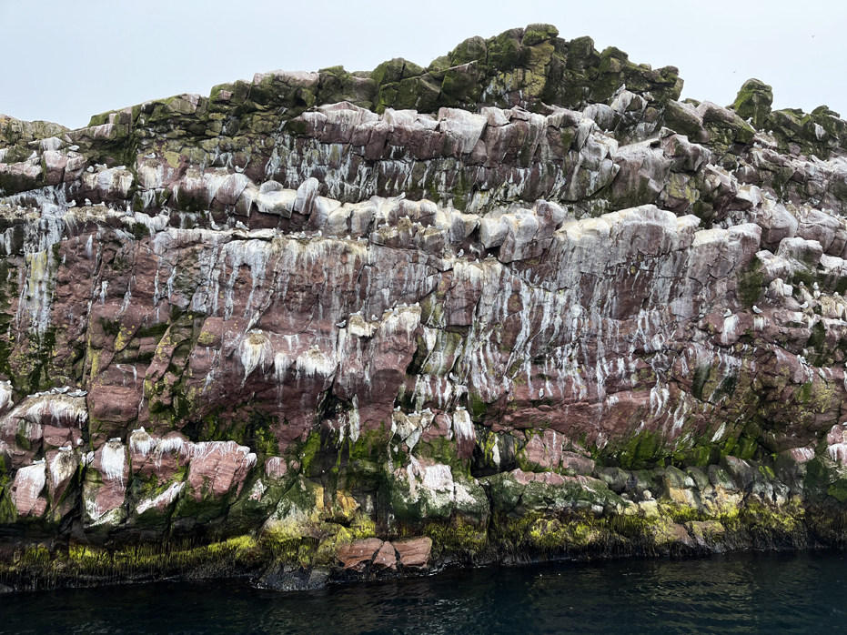
The Witless Bay Ecological Reserve contains four islands – Gull, Green, Great, and Pee Pee – that teem with bird life during the seabird breeding season. The reserve contains North America’s largest Atlantic Puffin colony. More than 260,000 pairs of the province’s official bird nest here during the late spring and summer. Notably, Witless Bay Ecological Reserve also hosts the second-largest Leach’s Storm-petrel colony in the world-more than 620,000 pairs come here to nest.
In addition, Black-legged Kittiwakes and Common Murres appear in the thousands. The islands lie just a few kilometres off the east coast of Newfoundland’s Avalon Peninsula, between the communities of Bay Bulls and Bauline East, half an hour south of St. John’s.
Seabirds generally spend most of the year at sea and only return to land from May to August to breed and raise their young. For the most part, public observation of their activities must be done from boats-landing on the islands themselves requires a scientific research or special access permit.
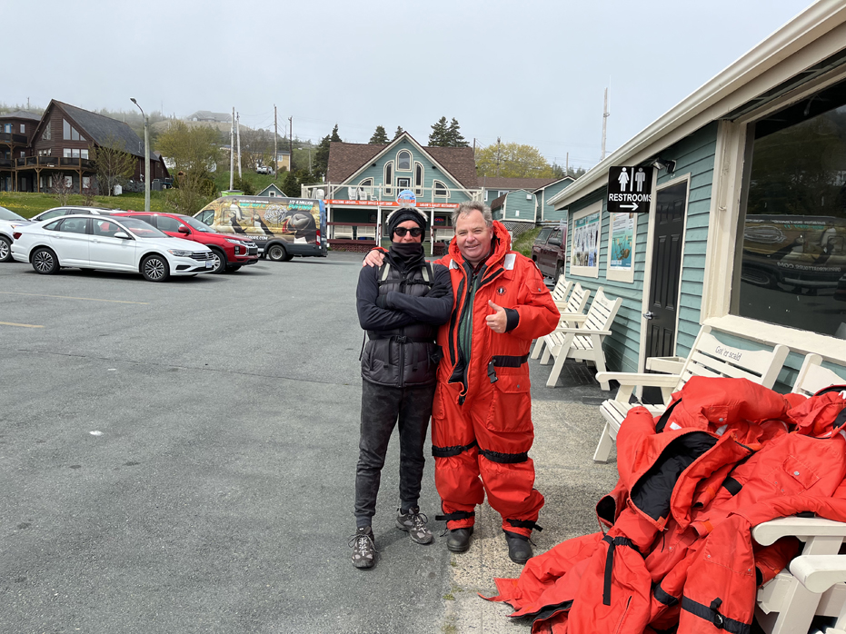
Several licensed tour-boat companies operate out of the communities near the islands. Running spring through fall, these boat tours also provide opportunities to spot icebergs, whales, and other wildlife. We chose to take the tour with O’Briens Boat Tours out of Bay Bulls and we were very pleased with that choice. Our tour guide, Noah, was a terrific, well informed animator and while we were fortunate enough to spot a Minke Whale (below) which followed us for the first 15 – 20 minutes of the ride out, Noah made sure to keep the anecdotes coming. He had a clever sense of humour and quite a good singing voice as he managed to fit in a couple of traditional Newfoundland songs. The Captain of the boat took the time to talk with me about water clarity, temperatures at depth and diving, of which we both agreed that it was simply too fricking cold to dive in Newfoundland.
The Canadian Wildlife Service and Memorial University of Newfoundland carry out extensive research programs in the Witless Bay Ecological Reserve. Their studies of the birds’ behaviour and population trends, as well as the area’s ecology, help guide the management of all the province’s seabird reserves. However, you are NOT allowed to set foot on this island without the permission of the government. Fines start at $10,000.00 !
The Witless Bay Islands are part of the Maritime Barrens-Southeastern Barrens subregion. The Islands were originally designated a wildlife reserve in 1964. They became the Witless Bay Ecological Reserve in 1983, three years after the Wilderness and Ecological Reserves Act was passed.
As you can see above, we got within 20 feet of the shoreline for an extended period of time. Well done to O’Briens Boat Tours. A great trip, even in the fog.
Mickeleens Path
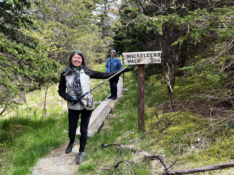
After our morning on the boat visiting The Witless Bay Ecological reserve, we hiked Mickeleen’s Trail. It is not a loop and is 11.7 kilometres in length, a little longer than we all wanted to do on a foggy day.
Generally considered a moderately challenging route, it takes an average of 4 hours and 30 minutes to complete. We did not complete the entire trail but rather turned back after about 90 minutes after the second major outlook point, making our loop about 3 hours.
The trail begins after a short walk from the turnaround at the end of Quay’s Road. Turning left towards the shore, the trail crosses planks through massive patches of raspberries, then for a couple of kilometres, the trail passes through woods with rocky shores and cliffs on the left, until it passes above Island Cove, the site of a nice view (below) as the trail passes through a meadow at the top of the cove. From there, the trail skirts around Big Cove and Chest Cove, where a waterfall is visible from the viewpoint overlooking it. This is where we turned back.
Towards the end of the hike, we ran into some of the staff from the east Coast Trail Association and I had the chance to discuss our viewpoints regarding the simple blaze system our own Bruce Trail incorporates and he said that they knew of The Bruce Trail but were understaffed at maintaining the trail system. I found that sad, considering all the advertising Newfoundland and Labrador does to promote the trail. I suggested they lobby the government to reduce the tourism advertising budget to help improve the east Coast Trail. I doubt I will ever find out since this was a one time trip for us.
Cape St. Marys Ecological Reserve
Before I talk about the ecological reserve, I have to talk about Betty and Hilda at The Capeway Inn in St. Brides. Betty welcomed us with the most lovely conversation I think we have ever enjoyed at a hotel and after 15 minutes, had convinced me to try my Newfoundland Screech but without the Coke. She and Yim chatted away like old friends and we learned about the local schools, grocery store locations and local population decline. I learned that most of the men in the village got up at 3 am to go out on the boats and returned home for a snack at dinner, bed and then out to the sea again – a tough life. With a bit of help, Betty gave us directions to the only restaurant open for 50 miles because the daughter of the local restaurant was getting married and everyone had taken the day off.
When we returned from dinner, Hilda, the owner was waiting on us and a second lovely conversation began. Hilda told us the story of becoming owners of The Capeway Inn and how they had been in business for 27 years but were still having trouble finding staff because of the pandemic. The Inn is tastefully furnished and our room, which we shared as a suite with Dorothy and Mark, was well appointed and had fresh coffee waiting for us.
Located about 200 km southwest of St. John’s, Cape St. Mary’s Ecological Reserve also known as “The Cape”, is one of Newfoundland and Labrador’s major seabird colonies. During the breeding season, it is home to 24,000 Northern gannet, 20,000 black-legged kittiwake, 20,000 common murre, and 2,000 thick-billed murre. In addition, more than 100 pairs of razorbill, more than 60 pairs of black guillemot, plus double-crested and great cormorant, and Northern fulmar nest there.
What makes it so spectacular, however, is that all these birds can be seen from land, as close as 10 metres away.
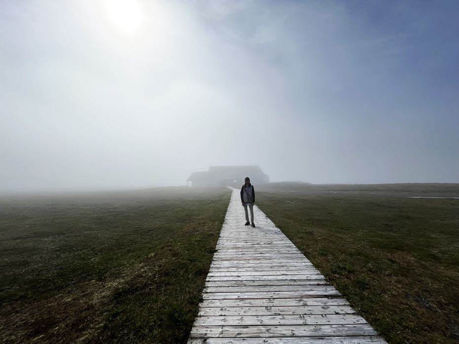
When we arrived, the fog was thick and I drove right by the Interpretive Centre before turning around and snapping this photo of Yim just before the winds started to clear the air.
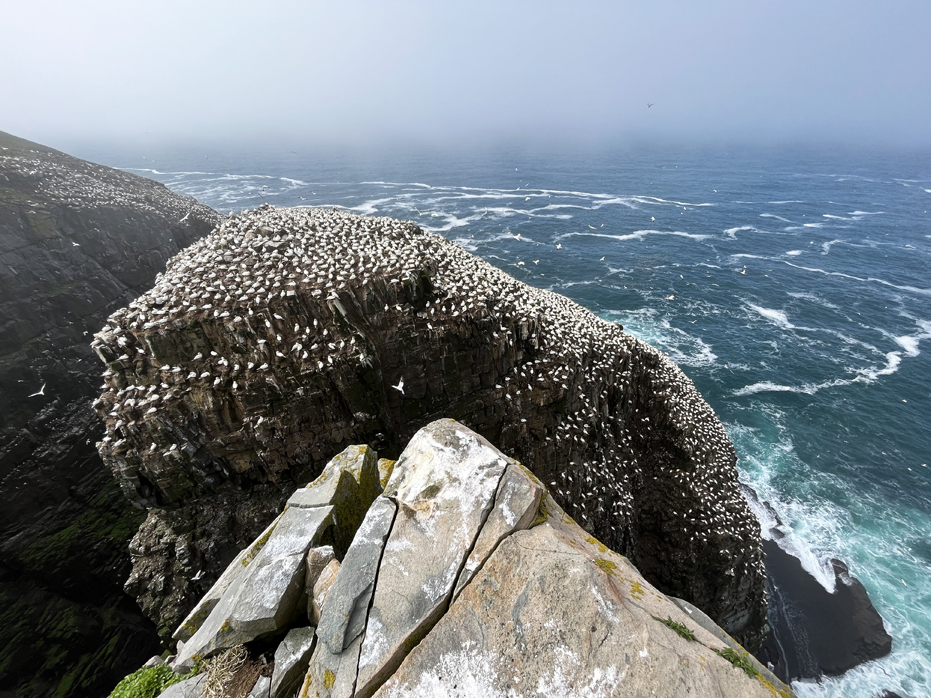
As we walked down the open meadows of the 1.3 kilometre trail to Bird Rock – a 100 metre tall stack of sandstone that is separated from the viewing area by a chasm only a few metres wide – we watched as the fog began to blow over and the shoreline opened up below to reveal steep cliffs. As with many of our trips, as we began the descent to Bird Rock, the skies cleared almost completely and there we were, standing looking at 100,000 birds fly around us, maybe 25 feet away from us. Most of the birds on the rock are Northern Gannets. The gannets’ courtship, nesting, and feeding behaviours, interactions, and delicate flying manoeuvres over the crowded sea stack are endlessly fascinating and easily observed from the natural, cliff-top viewing area.
Cape St. Mary’s is within the Eastern Hyper-oceanic Barrens ecoregion, one of the world’s most southerly expanses of sub-Arctic tundra. Mosses, lichens, alpine wildflowers and low-growing shrubs carpet the seemingly treeless plateau over which visitors walk. The area has ponds, bogs, brooks and sheer cliffs plunging down to the sea. Offshore, during the summer, whale spouts can often be spotted.
Particularly in the early part of the breeding season (April through June), the weather at Cape St. Mary’s can be damp, foggy, and cool as we found out but the winds make for an ever shifting climate conditions. The average temperature in July is 14 ℃ and there are 200 days of fog a year, on average, at the Cape. On such days, the attractions of the modern, bright Interpretive Centre are particularly strong. The birds and their environment are interpreted inside. The building is located near the parking lot and Coast Guard operated lighthouse, which was originally built in 1860.
Bird Rock (above) to give a perspective of how close it is to land.
Cape St. Mary’s Ecological Reserve was established as an ecological reserve in 1983. I think this was totally worth the visit.
That said, we picked the foggiest day of out trip to make the drive from St. Johns and it ended up taking us six hours through windy foggy roads. From Cape Race, where the Interpretive Centre was closed until July 1, Yim has said she was hungry and for the next three and a half hours we could not find one open restaurant. I don’t regret it because it was a creepy drive through bogs and made me feel like I was in The British Moors.
Trinity
I chose Trinity as a destination within our trip because of the natural beauty of it’s location and the proximity to The Skerwink Trail.
Trinity has been a viable North Atlantic community for hundreds of years. Its defensible harbour, which you have to actually see to believe how safe it is, with abundant room for the ships of the day and shores well suited for outbuildings, wharves and fish-flakes, made it ideal for the early migratory fishermen. Later, merchants from Poole, England, made Trinity the base for a new-world fishery.
During the 1720’s Trinity was home to about 30 permanent families and host to 200-300 seasonal fishermen per year. By 1869, the population peaked at more than 800 people. Until recently, the inshore, Grand Bank and Labrador fisheries sustained the community. Lumbering, coopering, shipbuilding and other trades have been prominent. Historically, education was an important component of the community, with navigation and business education being taught at Trinity’s Commercial School. The teachers who taught in these schools included some of Newfoundland’s leading educators and scholars.
The preservation of Trinity’s cultural and built heritage has made it perhaps the most notable “Heritage Community” in the province. Sustainable growth in existing and new businesses, including theatre, is clearly evident as Trinitarians, along with residents of the surrounding communities, play host to thousands of visitors per year. There is a natural beauty to the geographic setting of Trinity, both in the facts that the sunrise and sunsets illuminate many of the heritage structures. To me, there’s nothing better than low light and the water to add drama to photography. Throw in the chance that there will be gorgeous cloud formations moving through the area and voila. a photographers dream spot.
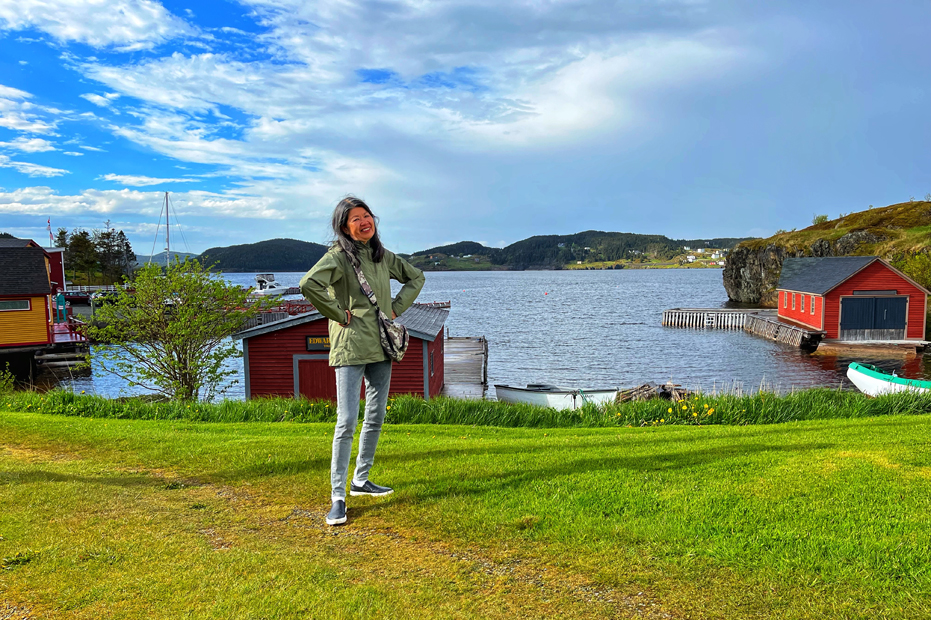
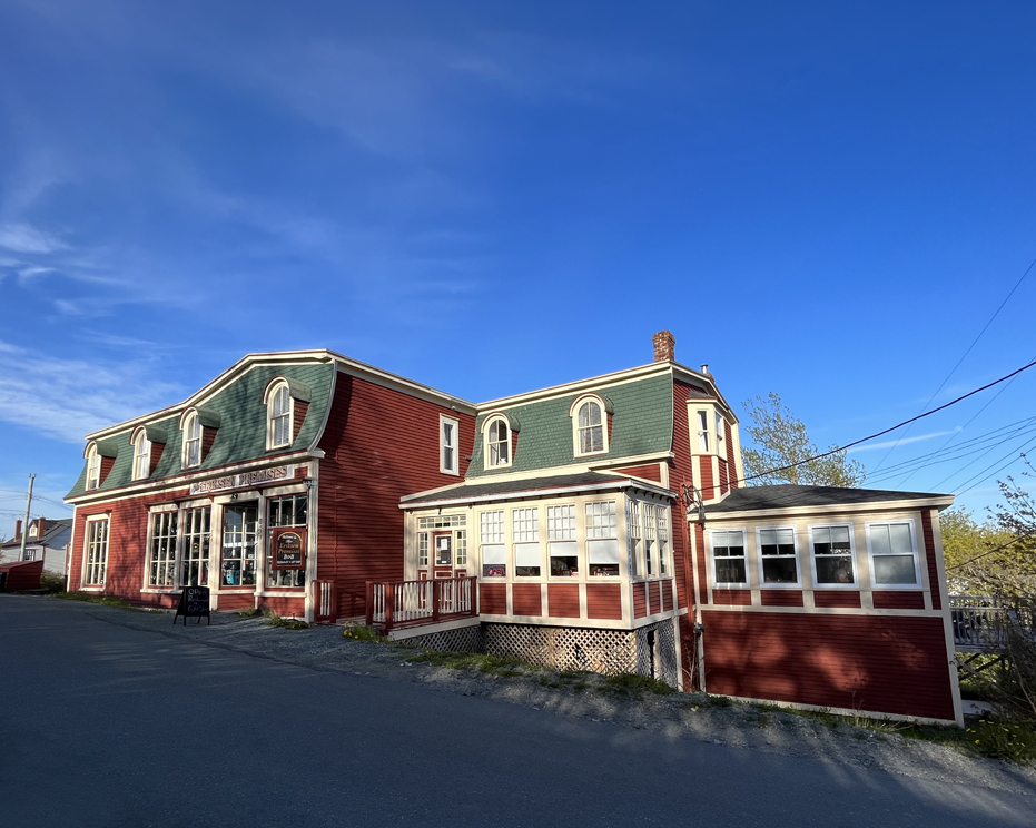
We stayed at Eriksen Premises. Built in the late 1800’s and given as a dowry from the Pittman family to Mr. Albert Eriksen, a Norwegian whaling Engineer, upon marriage to their daughter, Frances, the Eriksen Premises operated for almost a century as a general store. The Eriksens also called the Premises home and operated a tearoom in the current dining room for a number of years. In 1950’s, the Batson family purchased the property and continued operation of the general store until the late 1970’s. After that time, the building lay in disrepair until purchased by Christine Whelan in the early 1990’s and was restored to house a country inn.
Today, the Eriksen Premises has 7 tastefully appointed guest rooms, a casual fine dining restaurant and a gift store featuring Newfoundland produced gifts, preserves, crafts, jewelry, artwork & literature. They also have an excellent restaurant and 3 hot women in the kitchen who occasionally set off the fire alarm with their cooking. Stay here…
Trinity is centrally located and generally within an hour’s drive of other points of interest on the Bonavista Peninsula. It is about 3 hours by road from the capital city, St. John’s.
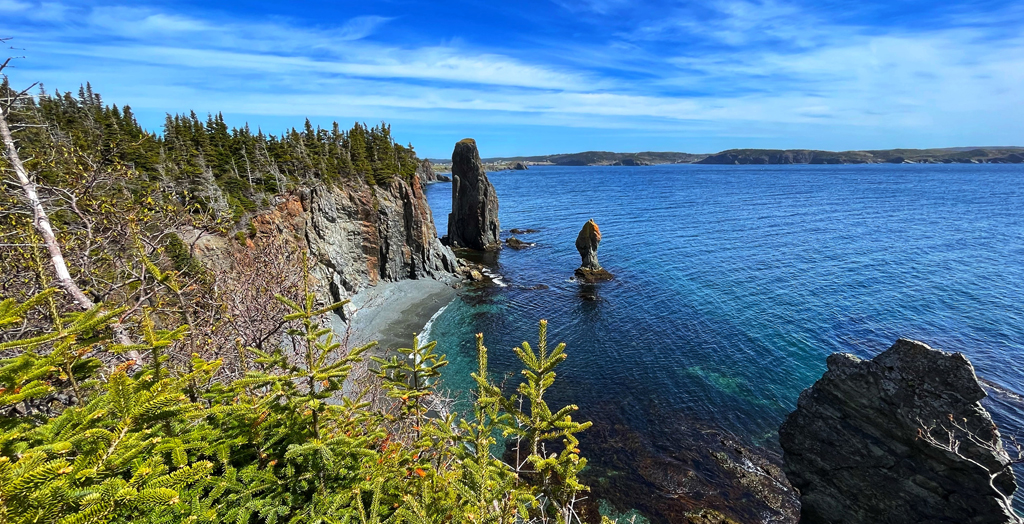
The Skerwink Trail
The Skerwink Trail is a classic meeting of ocean and land, winding through wind-swept spruce and fir forests, bogs and open grassy meadows and along the way, there are great views of Port Rexton and Trinity. But it’s the coastline that will stop you in your tracks, with its memorable beaches and sea stacks (eroded rock formations)—the latter having names such as Music Box because of the sound produced when the wind blows.
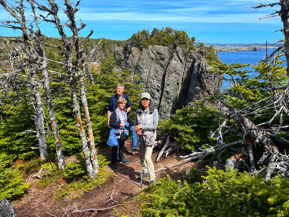
The 5.3 kilometre trail is rated easy to moderate. Along the way, you can glance over the side of sheer cliffs to see secluded beaches. Most of these are capelin beaches, where the tiny fish come to spawn each summer. You’ll also likely come across plenty of seabirds, like kittiwakes and gannets. Depending on your timing, you may see breaching humpbacks or minke whales. The entire hike took us 3 hours and 15 minutes because Mark and I both stop often to take photos so I suppose it could be done more quickly but not the way we hike.
The trail takes you through low-lying marshland filled with Tuckamore, as well as dense forest. You’ll come across crowberry, and old man’s beard, and water lilies in the bog. The grand finale is a rocky beach causeway with a perfect view of the lighthouse across the bay in Trinity. Remnants of burned out beach fires surrounded by logs make for a nice place to pause and take it all in.
From there, the trail takes you back to where you started. Parking was easily available.
People have already asked me about how I would rate this trail considering that it has been named one of the Top 35 Hikes in North America. I suppose it could be in my top 35 but it has a lot of competition from the trails we’ve hiked. It was also very more crowded than what we are used to and that took away some of the pristine feeling we usually feel on our hikes. It was easily accessible…
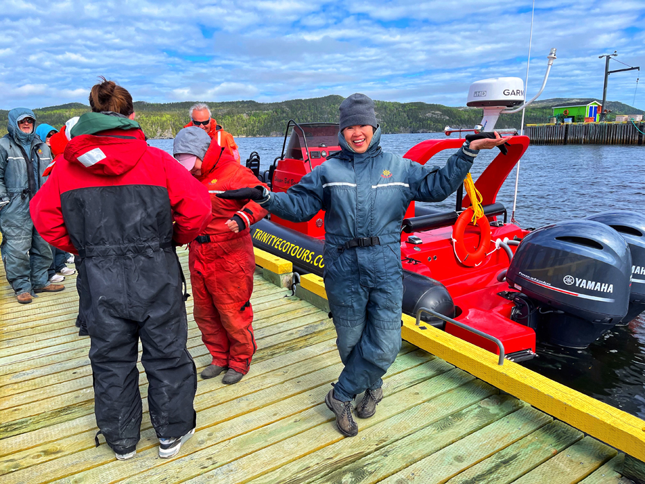
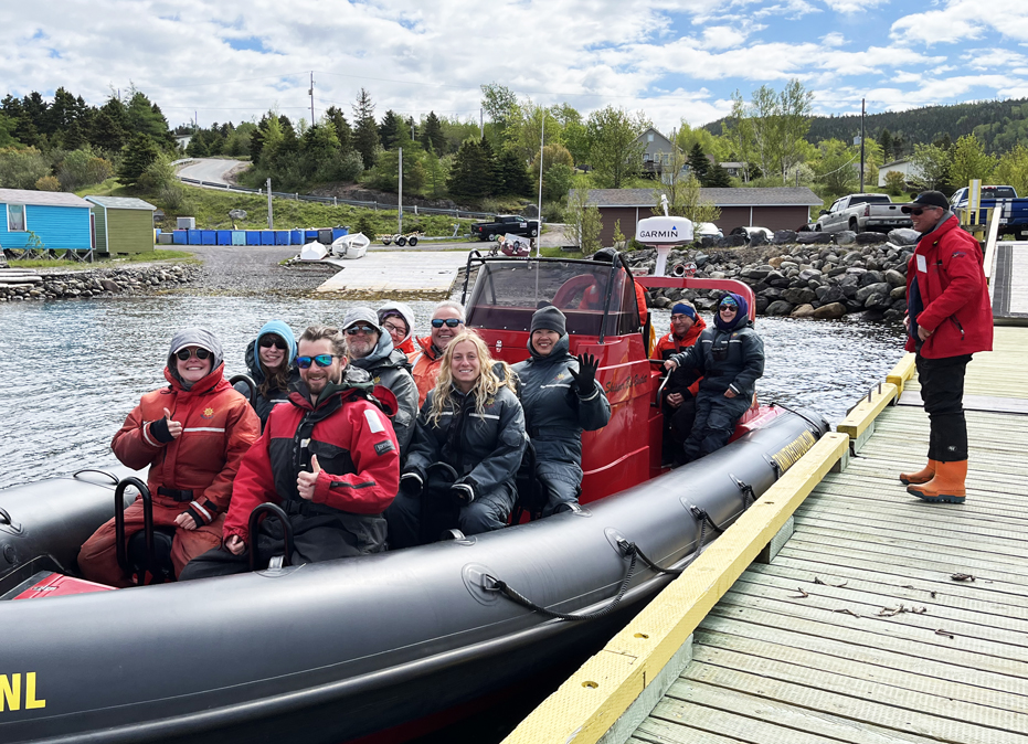
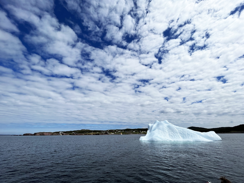
Iceberg Hunting
I wanted to see an iceberg up close and I wanted to be in a small boat, so we booked a tour with Trinity Eco Tours on a 12 person Zodiac. After meeting up in Trinity, we set off to travel across the Bonavista peninsula where we could launch the zodiac in an area close to where an iceberg had been spotted. It was going to be cold on the water so we all got very bundled up.
Icebergs are edges of glaciers that have broken off and slipped into the ocean. Roughly 90% of icebergs seen off Newfoundland and Labrador come from the glaciers of western Greenland, while the rest come from glaciers in Canada’s Arctic. Their sheer size will amaze you, and that’s without seeing the ninety-percent still below the surface of the ocean.
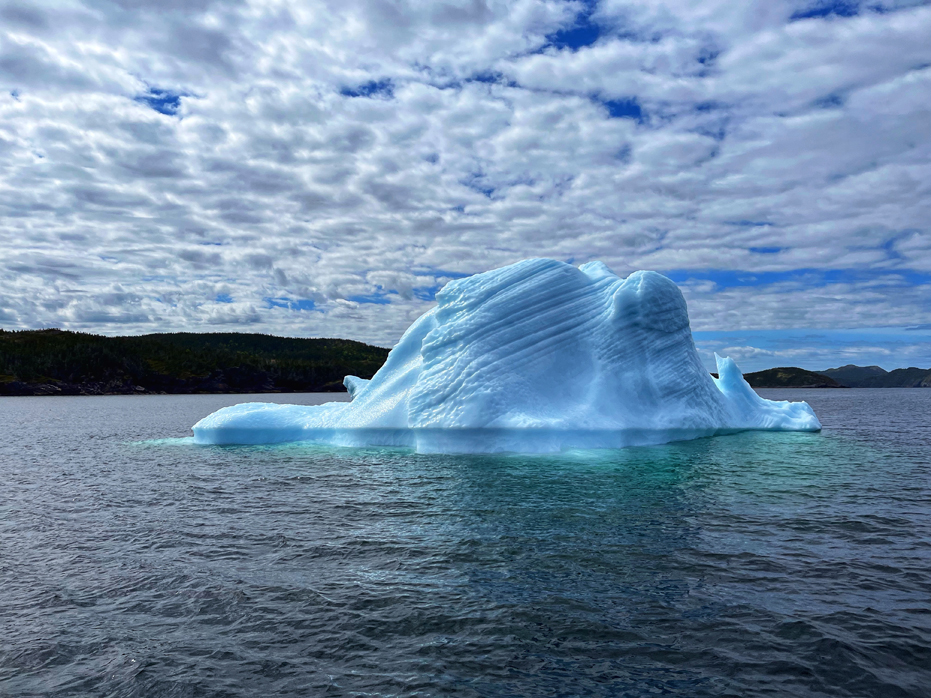
Within a half hour of heading out to sea, I spotted what was the iceberg, and it had grounded itself off the village of Open Hall. When we reached it, we circled it several times so everyone on board could get photos and learned that 90% of the iceberg is under the water. Our Captain explained that he gave the iceberg a wide berth because they have been known to flip due to melt in the spring and if they did, we would be prudent to be a sufficient distance away. No one argued.
To my delight, I took at least two dozen quite striking photos of the berg. I was a happy boy.
Ellistion
Perched at the top of the Bonavista Peninsula is the tiny community of Elliston, the Root Cellar Capital of the World. These traditional food storage systems – used mainly for root vegetables like potatoes and carrots – are built right into the ground, mainly into small hills and banks. The natural humidity and moisture keeps things cool in the summer and prevents freezing in the winter.
Elliston has more than 130 documented root cellars in the small town and surrounding area. Of those, half are still in working condition and used today.
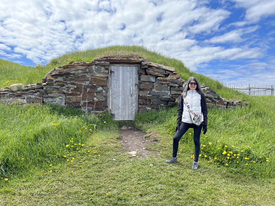
In the days before electricity, root cellars were integral to surviving the harsh winters on the northeast coast of Newfoundland. With the current issues surrounding energy costs, food safety and accessibility, looking towards agricultural solutions like the ones used in Elliston could provide some real solutions for the future. They also serve as a reminder that in many places around Newfoundland and Labrador, local food has really never gone out of fashion.
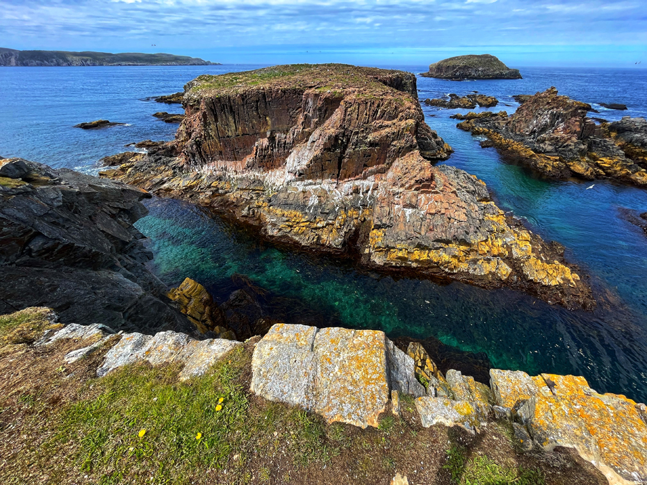
Elsewhere in Elliston, and the reason we visited, is the puffin viewing site, which is accessible by a 10 minute walk and offers the closest view of puffins from land in North America. During the spring, you can also watch as icebergs float by the coastline and catch a glimpse of a whale not far from shore. We loved this simple little trip, which was completely unexpected and the short walk was a delight. The pathway wandered through a spectacular little piece of land with unbelievably gorgeous views of the rocky outcropping the Puffins nest on.
If you do visit, please make sure to donate generously to the Puffin Program, situated at the entrance to the trail.
Also, stop by the gift shop and buy a jar of Nanny Hayleys Partridgeberry Jam. Yummy.
Places to Eat & Drink, Travel with and Stay along the way in Newfoundland
We had a wonderful time hiking, driving, eating and drinking our way across parts of Newfoundland. With our Pescatarian diet front and centre, we still had no issues finding good food along the way.
 Here’s a few of our favourite stops to eat and stay along the way;
• The Alt Hotel, St. John’s. I’ve stayed in Alt Hotels before in Montreal and when we were booking the trip, I had warned Yim that there may not be enough closet space but everything about this Alt was perfect. The staff was uber friendly and the room was great. We actually had more closet space than we used and if we needed anything, the staff was super attentive. I would not hesitate to recommend this hotel if your are planning a trip to St. John’s.
• O’Reilly’s Pub in St. John’s. Our first night in St. John’s and we needed some music and found it here. We ordered some food and the portions were small but reasonably priced. Kind of an expected dingy resto/bar with local music. We enjoyed the music. I did not enjoy the food as much here. I found several of these bars to be very dingy looking during the day and wasn’t very impressed at how much garbage was on the streets of the city, given that tourism is a central part of their economy.
• Bad Bones Ramen in St. John’s. I loved this place. It was kind of down to earth but also had an exclusivity buzz about it – but the simple fact was, the ramen was excellent.
• Gingergrass in St. John’s. Vietnamese & Thai. Loved this place. Food was excellent and the service was the friendliest we found in St. John’s, and that’s saying something because people are friendly here.
• Piatto Pizza in St. John’s. This place makes the best, most authentic Neapolitan pizzas. That’s about all I can say.
• Sprout in St. John’s. Cozy, eclectically decorated vegetarian eatery with many vegan items, local beers & brunch. We enjoyed our dinner here.
• O’Briens Boat Tours, Bay Bulls. I could not write enough about this boat tour. Our Animator, Noah, was entertaining and knowledgeable about the sea life and birds and the Captain made my trip by discussing water depth, visibility and wetsuits with me. I highly recommend O’Brien’s.
• The Gateway Inn, Cape St. Mary’s. This was my favourite atop along the way mostly because of two women. Betty, the housekeeper, which made our arrival after a harrowing six hour drive through the fox an absolute delight and managed to get me drinking a mickie of Newfie Screech and Hilda, the owner, who spent at least a half hour chatting with us about where we were from and the history of The Capeway Inn. The rooms were impeccably clean and the beds were as comfortable as home.
• Eriksen Premises, Trinity. Built in the late 1800’s and given as a dowry from the Pittman family to Mr. Albert Eriksen, a Norwegian whaling Engineer, upon marriage to their daughter, Frances, the Eriksen Premises operated for almost a century as a general store. The Eriksens also called the Premises home and operated a tearoom in the current dining room for a number of years. In 1950’s, the Batson family purchased the property and continued operation of the general store until the late 1970’s. After that time, the building lay in disrepair until purchased by Christine Whelan in the early 1990’s and was restored to house a country inn. Today, the Eriksen Premises has 7 tastefully appointed guest rooms, a casual fine dining restaurant and a gift store featuring Newfoundland produced gifts, preserves, crafts, jewelry, artwork & literature. They also have an excellent restaurant and 3 hot women in the kitchen who occasionally set off the fire alarm with their cooking. Stay here…
• Dock Marina, Trinity. The Dock Restaurant is a restored 300 year old fishing premises. It is the last of the commercial buildings on the once bustling Trinity waterfront. For hundreds of years, the building was used to store locally made salt cod before it was shipped by schooner to Spain, Portugal and the West Indies. Today, there are still large amounts of seafood here – not for shipment overseas but for your dining pleasure. They specialize in seafood and traditional meals. Seafood delicacies include cod, snow crab, mussels, shrimp, scallops, salmon, lobster and their famous lightly battered fish and chips. They are also proficient in calling male visitors My Darling… which I quite enjoyed.
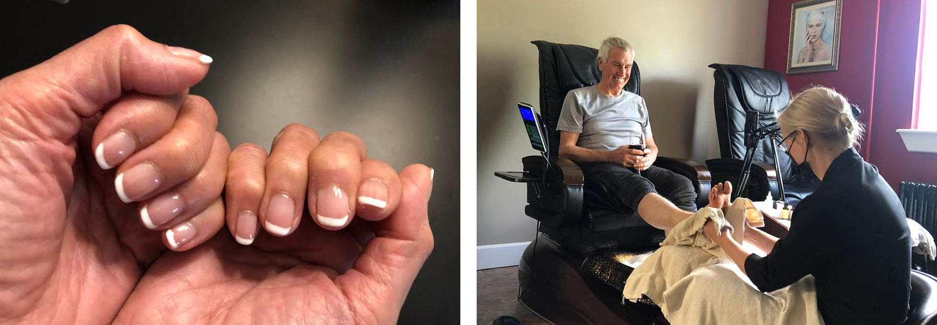
• The Monastery & Spa, St. John’s. We ended our stay here and treated ourselves to a pedicure for me and a manicure for Yim. It’s hard for me to write about this because I had never had a pedicure before but Dana was a pure pleasure to have working on my feet. She entertained me and did a fabulous job on my toes and heels and I can’t say enough about my treatment. Yim had her nails done – I think it is called a French Manicure and she loves them. I like when she is happy.
• The Celtic Hearth, St. John’s. Warm Irish-style tavern supplying draft beers, traditional Newfoundland seafood & classic pub grub including some excellent French Onion Soup. Open 24 hours a day.
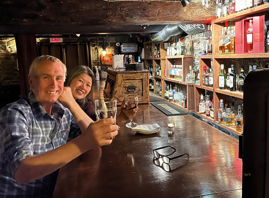
• Yellow Belly Brewery. Our last night out and Yim wanted a Fig and Arugula Pizza, which Yellow Belly had on their menu and they led us down into the dungeon, where they kept all the whiskies and we sat at the bar and tried a Spanish wine and some of their Lagers. At first, I couldn’t see a thing and got grumpy and wanted to leave and they brought in candles and I was still grumpy so we compromised and sat at the bar and that was okay for me.
• Don’t visit before July 1. Many of the Interpretive Centres we hoped to visit were not yet open for the season. I found that really bad planning on the Tourism Departments…
All said and done, I don’t think I’ve been called My Darling more often in my life than I was in the past two weeks…

1 Comment
Steve Roper
July 31, 2022 at 3:38 pmThanks Delia.