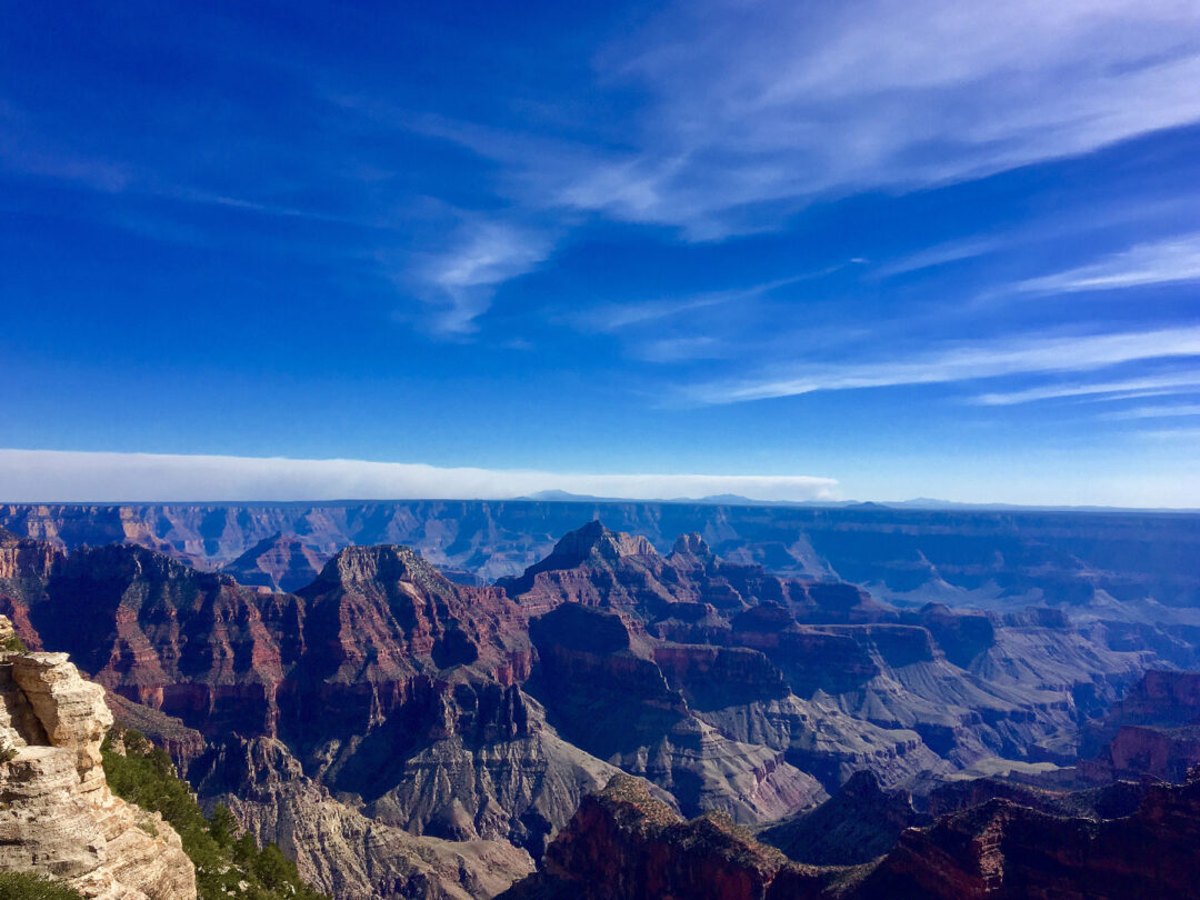
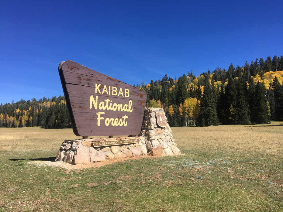
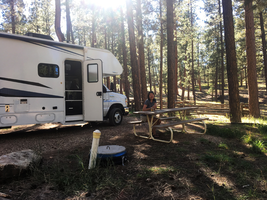
The Grand Canyon North Rim is very close to the Utah Border. It is more remote and less visitors make it to the North side. Further from any freeways, it is ONLY open seasonally from May 15th through October 15th each year.
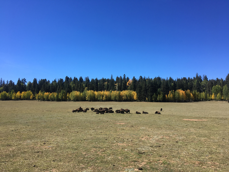
We travelled to The North Rim from Page, Arizona, past Marble Canyon and the Vermillion Cliffs before entering the winding road which leads south to the campsite. The drive in offered us spectacular views interspersed with herds of buffalo grazing, which was a treat.
The North Rim offers a sense of solitude and I personally loved it here, if only for a couple of days. I’m glad we visited.

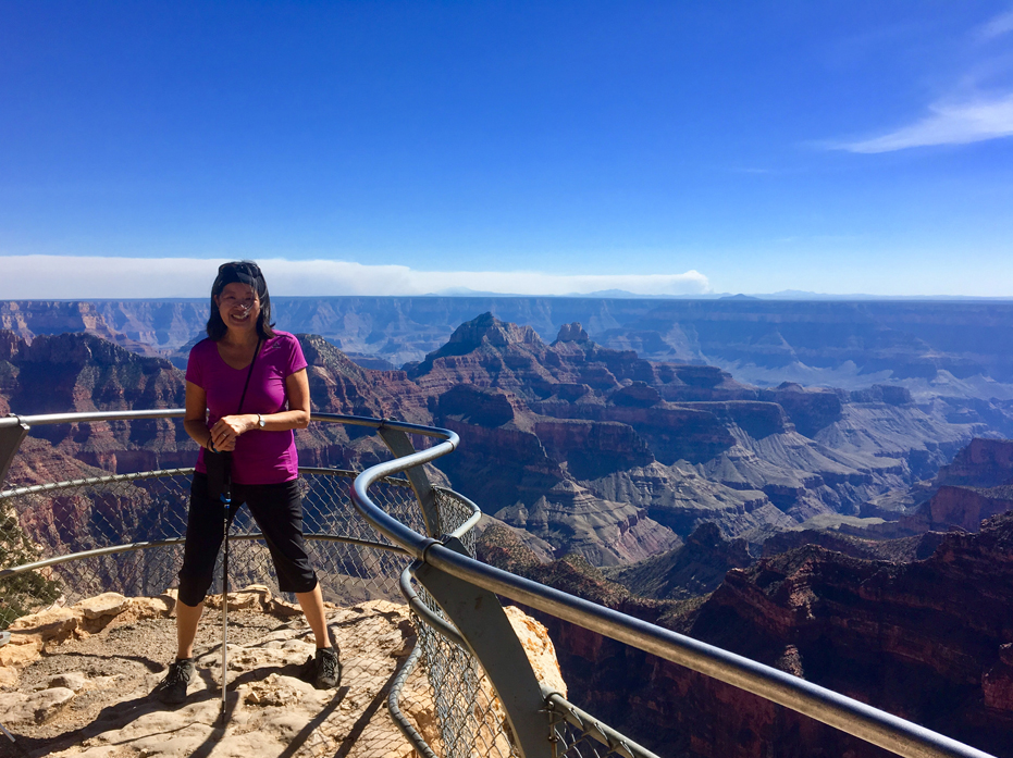
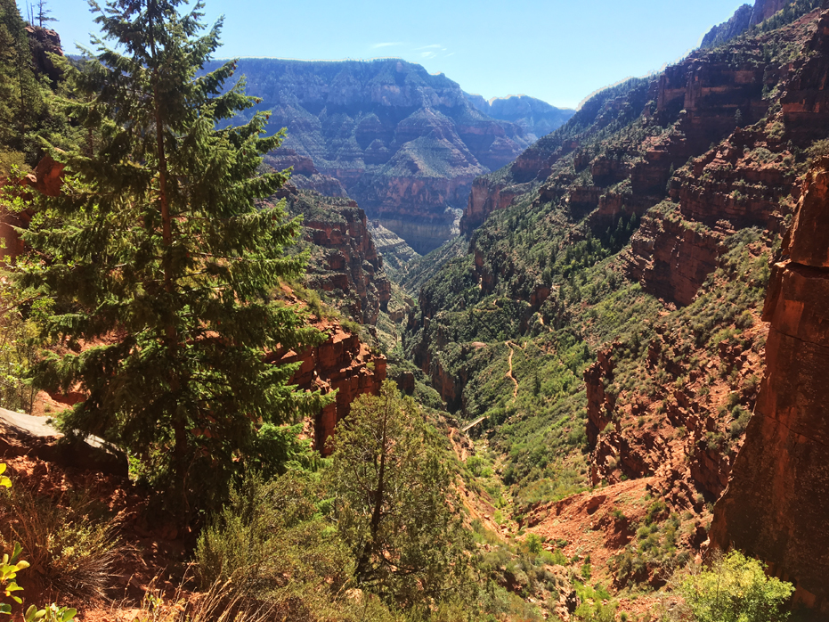
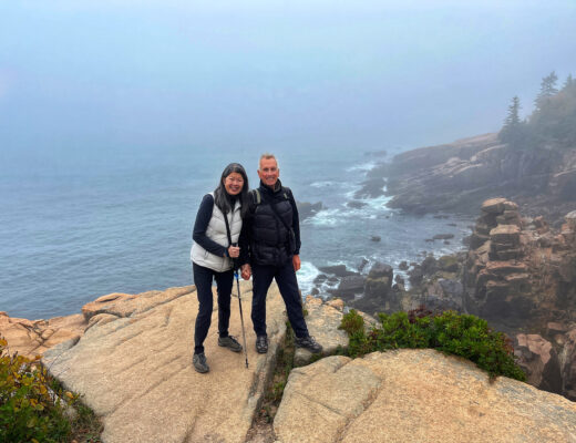
Bright Angel Point
The park is well maintained and the upper paths are a very easy day’s walk… especially the Bright Angel Point trail right along the edge of the canyon. It is only ½ mile each way, paved, and takes you to one of the most spectacular views in the Grand Canyon. It’s also a fabulous walk to do at sunset, which seems to emphasize all the details obscured mid-day when the sun is directly overhead.
I think just walking up to Bright Angel Point with Yim and letting her see the Grand Canyon for the first time made the entire trip worth it. It was one of her bucket list trips.
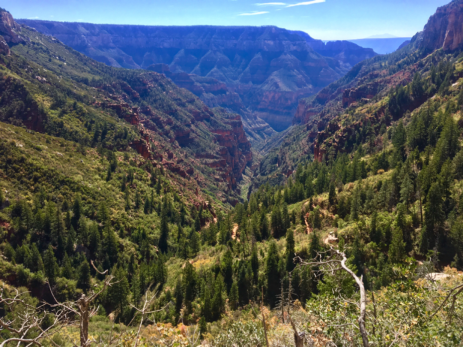
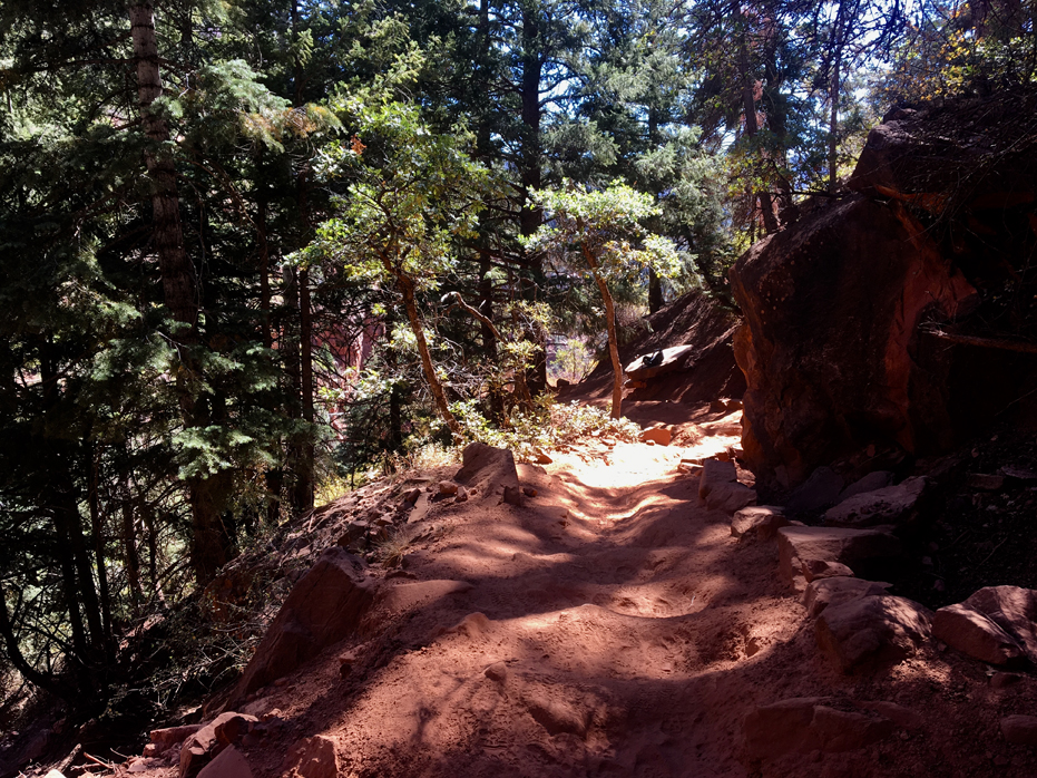
But the main trail is the North Kaibab Trail which is the only maintained trail from the North Rim that can take you all the way down to the Colorado River. It is 14 miles one way to the river—with over a mile drop in elevation—and NOT a day hike. However, there are several destinations that make great day hikes. Be aware that the trail begins at 8,000 feet in elevation, and therefore is pretty strenuous hiking back out no matter how you look at it.
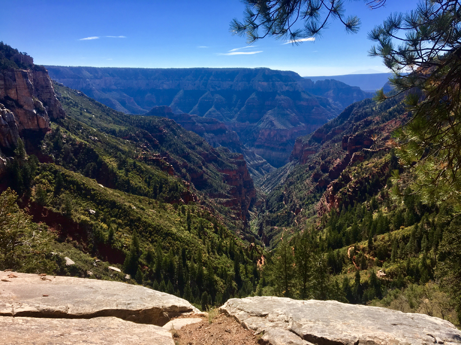
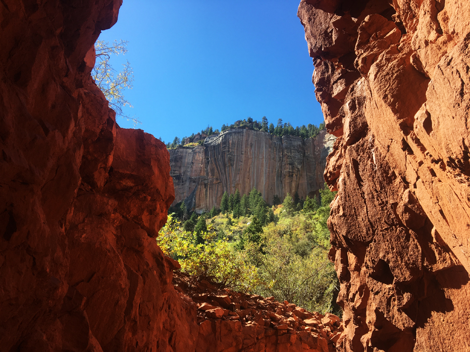
In spite of this challenge, I highly recommend a hike to the Coconino Overlook for nearly anyone. To get to this incredible viewpoint is only ¾ mile one way and provides one of the greatest views to be seen from the North Rim. It was one of our favourite spots along the North Kaibab Trail.
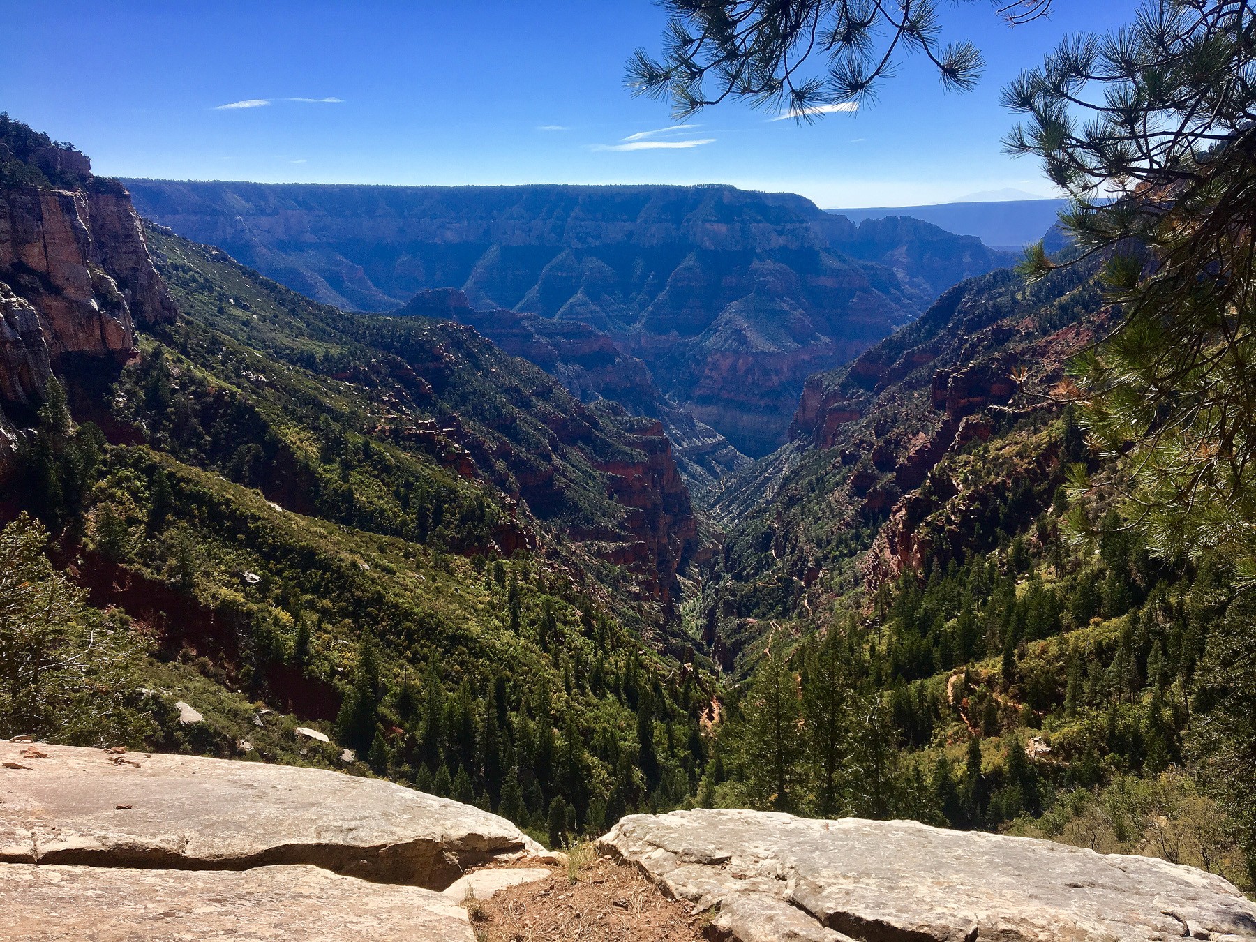
Coconino Overlook
The journey to Coconino Overlook is a 1.3-mile roundtrip, out-and-back hike that takes you through Douglas firs and Engleman spruce trees until you reach the first sweeping vista on the North Kaibab Trail — the Coconino Overlook. Named for the Coconino sandstone on which you stand at the viewpoint, the Coconino Overlook makes a great destination hike for families and kids of all ages — plus, it’s a great introduction to the Grand Canyon’s unique geology.
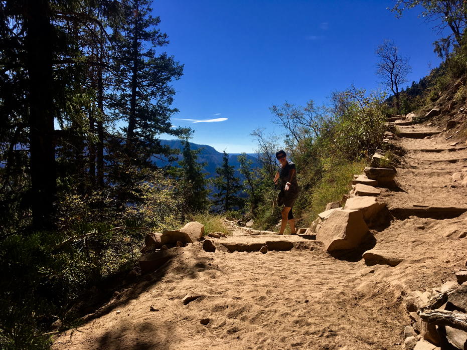
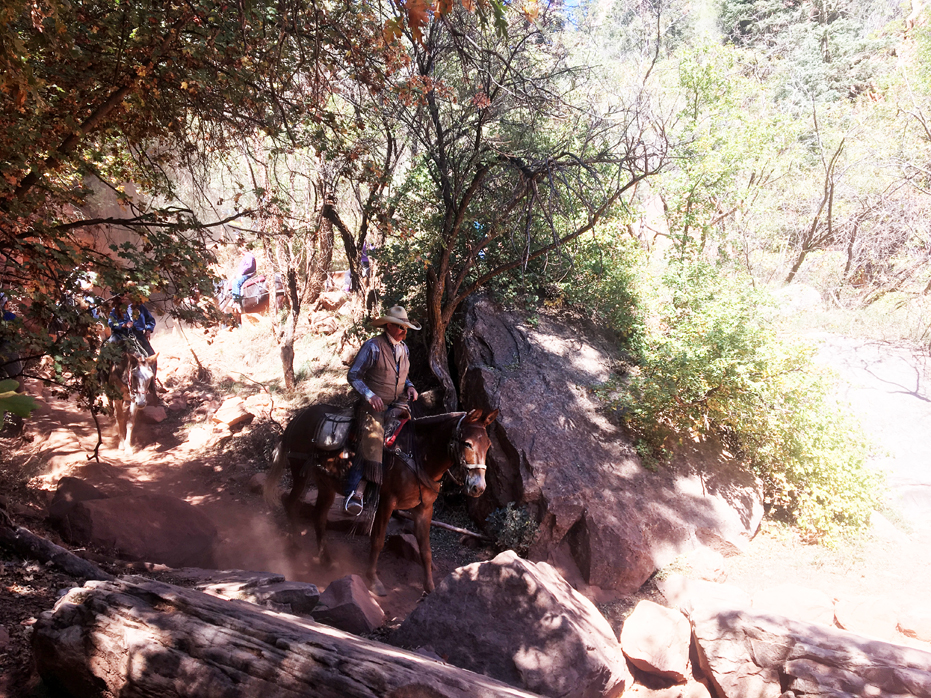
Another ½ mile from the Coconino Overlook, two miles from the rim, is the Supai Tunnel. This is the turning around point for a lot of short day mule trips. There are toilets here as well as a water faucet (check availability before counting on water here). This is a common turn around point for day hikers who don’t want to get into much strenuous hiking. Be very careful leaving packs unattended here as the squirrels can destroy them in seconds looking for food.
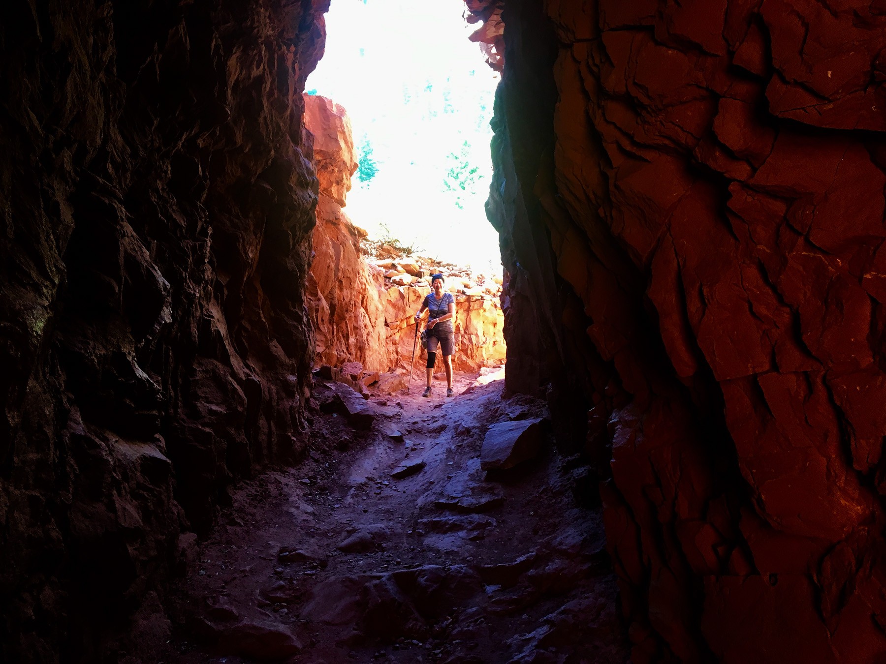
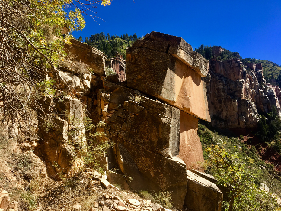
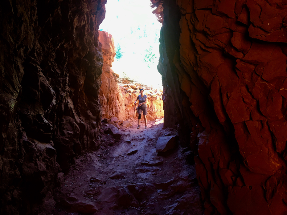
The Supai Tunnel
This 3/4 mile roundtrip out-and-back hike takes you down through pinyon pines and junipers to a tunnel blasted out of the Supai formation — the fifth layer of Grand Canyon’s remarkable geology. As you look up the trail, the Supai Tunnel artfully frames a colorfully streaked slab of Coconino sandstone — a sight you will not soon forget. Supai Tunnel provides access to bathrooms and seasonal water, making it a great place to stop for a picnic.
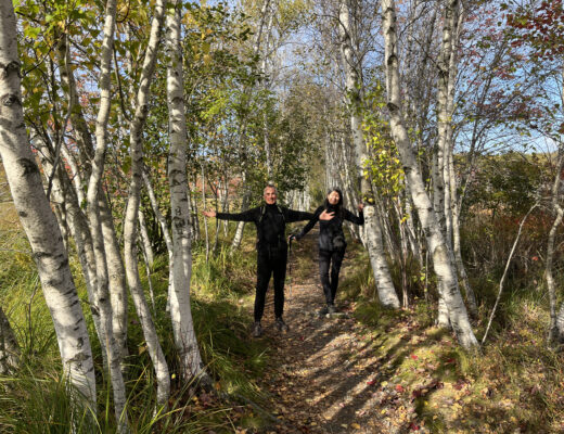
The North Kaibab Trail was constructed in the 1920s, following an old trail local schoolteacher David Rust used to get to and from Rust’s Camp, now known as Phantom Ranch. The trail was later rerouted to intersect with the North Rim Entrance Road — Highway 67. The Park Service used dynamite to blast the Supai Tunnel – you can see Yim standing within it in the gallery – and “half tunnels” along the Redwall limestone, making the North Kaibab trail a feat of engineering designed to draw in tourists in an already awe-inspiring setting.
Today, the North Kaibab trail crosses Bright Angel Creek seven times, using steel and concrete bridges — an improvement over the original 94 creek water crossings of Rust’s original trail. We never got that far down.
While we had good intentions, we descended almost 3,000 feet and then decided, since we had no intention of making it to the bottom, to turn around since we then had to hike back up the 3,000 feet.
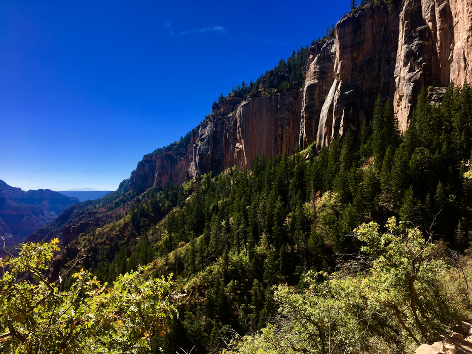
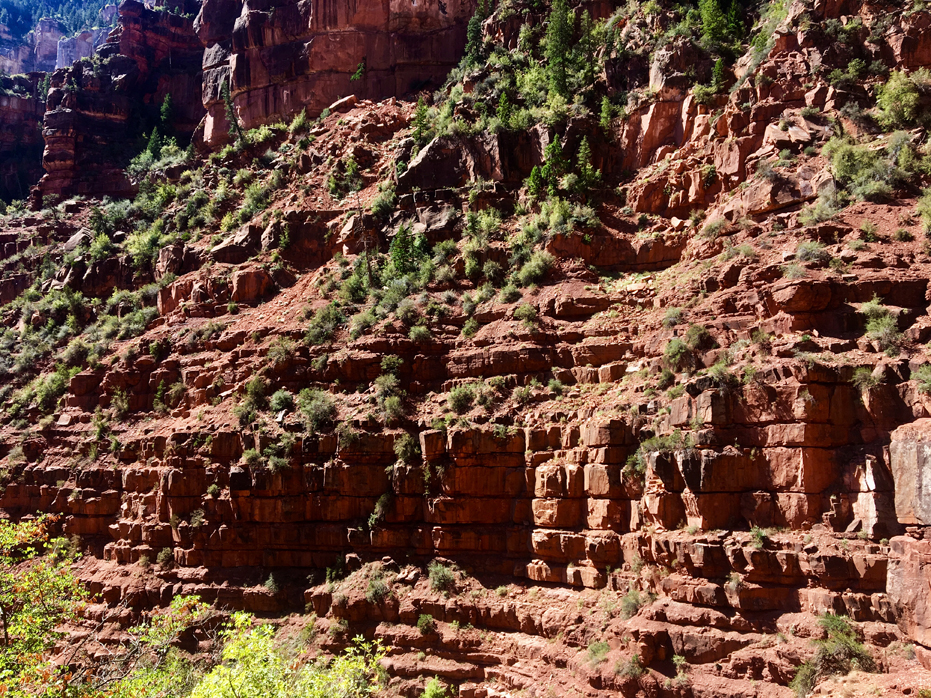
The North Kaibab Trail is well maintained, and there are endless possibilities for day hikes and backpacking trips.
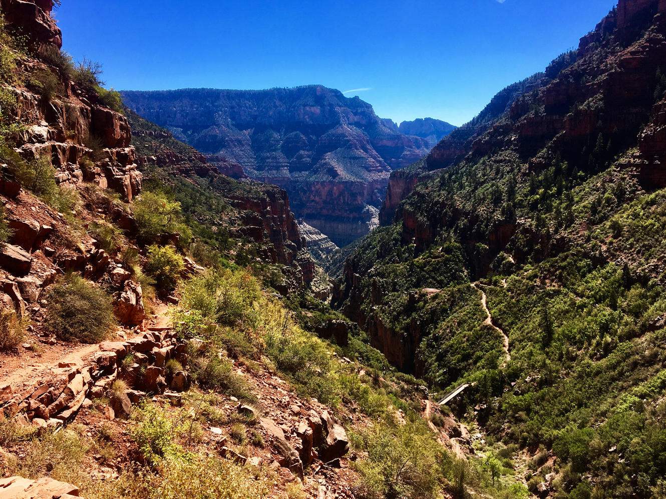
The North Kaibab Trail
We continued down after this point but did NOT make it as far as Roaring Springs which is nearly five miles and 3050 feet down. This is an extremely strenuous hike and takes a full day to do. We turned around and it took us almost 50% longer going back up than going down but this was a hike I would not miss. Just be aware of your limitations.
In retrospect, the North Rim offers a sense of solitude when compared to the South Rim yet both are worth visiting.


No Comments