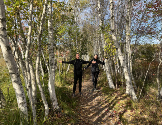
This is a nice trail to take from Harrison Park to Inglis Falls.
There is a great parking lot available in Harrison Park and if you are so inclined, before you enter the Inglis Falls Trail, you can scoot off to see Weavers Falls, which is a very short trail halfway through the park. It’s not really much of a hike, more of a short walk and you cannot get close to the Falls but the brook running through the largely board-walked path is pleasant enough.
The Inglis Falls Trail is a 6.3 km there and back trail and is an easy route. It will take about 2 hours to complete, depending on how many of the scenic areas along the way you stop at and how long you send enjoying Inglis Falls.
We usually plan to have lunch at the falls, which makes this a nice afternoon hike.
Harrison Park
Harrison Park straddles the scenic Sydenham River and features beautiful landscapes, century-old trees, hiking and cycling trails, boat rentals, mini-putt, a bird sanctuary, playgrounds and campground.
Once you get settled, if you plan to hike the short Weaver’s Falls section, you head towards the campgrounds. That path will be on your right quite near a water pumping station. It veers off along a boardwalk into the woods for a short distance and as I have said, you cannot get to the falls themselves. The trail stops quite a distance from them.
Once you are done, you head back out the same boardwalk and after the water pumping station, keep right until the end of the paved camping access road until you come to a choice between crossing a bridge or turning right up a blue marked trail.
For a short while, you head up a trail that is a clay path and it brings you to a option shortly along the way. We usually head to the right which brings us through an arboretum of sorts and continues along until it meets up with the path right before you cross the bridge featured above.
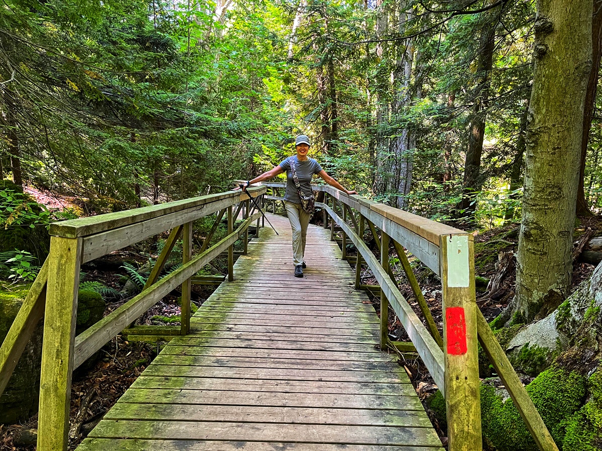
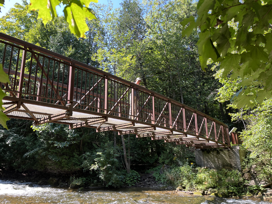
After crossing the bridge, the path heads to the right towards Inglis Falls but from here, it’s still 30 – 45 minutes off depending on how quickly you hike.
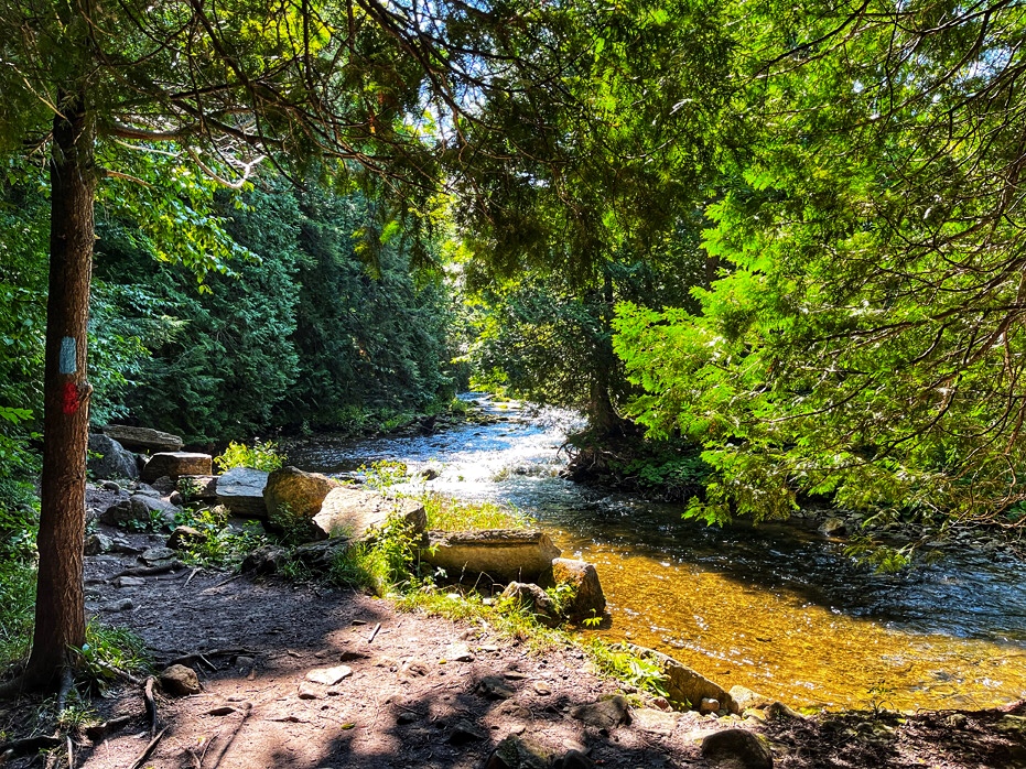
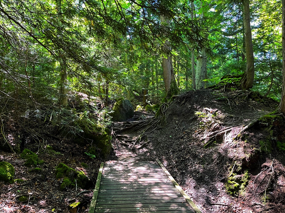
There are several bridges and boardwalks set up along the way and the babbling river to the right contributes a nice visual along with the sounds of water flowing nearby.
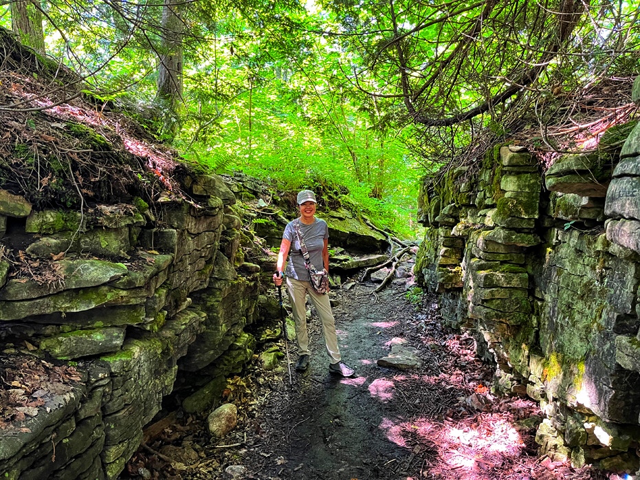
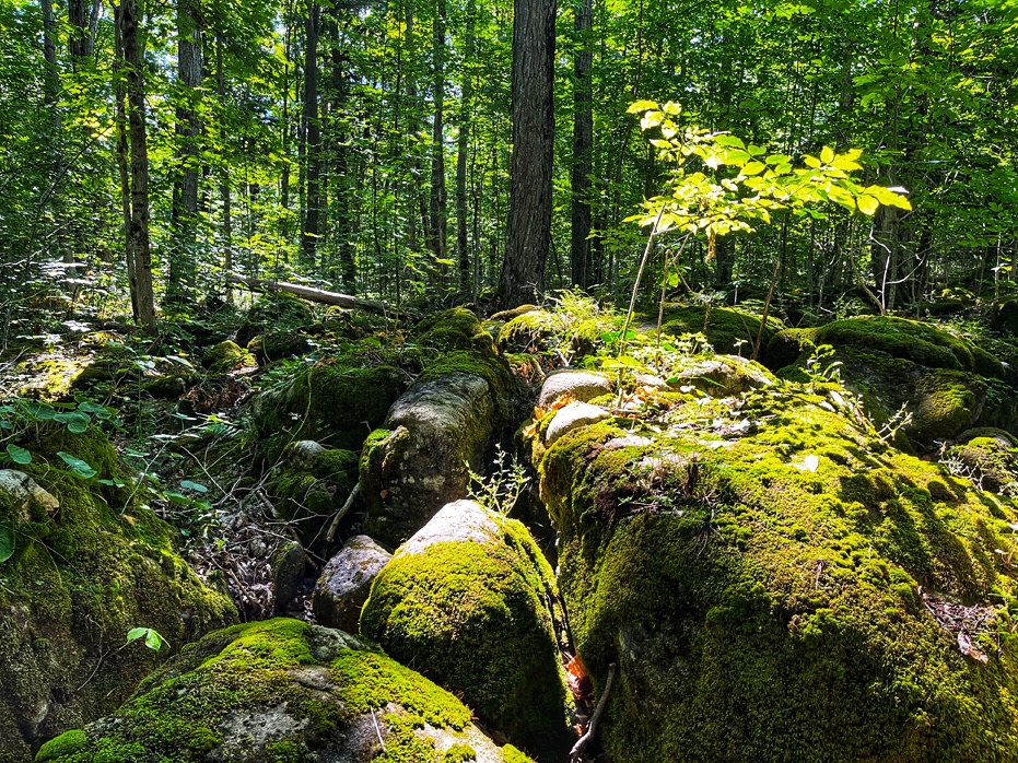
About halfway along, you will pass through a very cool natural pathway through a section of shale rocks. Whether or not this section was man made or not, it seems very natural and walking through it, you can feel the change in temperature that the shale holds.
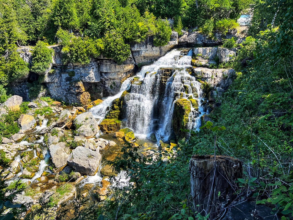
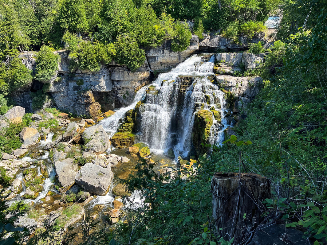
Inglis Falls
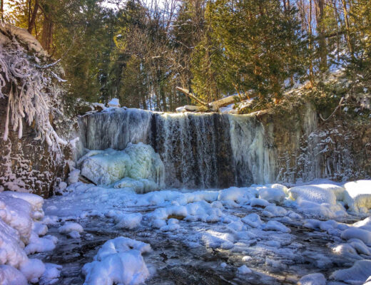
Situated in the heart of the 200-hectare Inglis Falls Conservation Area, Inglis Falls is an 18 metre high cascading waterfall, created by the Sydenham River meeting the edge of the Niagara Escarpment. The erosive power of the water has carved a deep gorge at the base of the falls. It is the largest and most impressive of three waterfalls that surround the city of Owen Sound, Ontario.
There is something here for everybody; A viewing platform for those unable to see over the stone wall, 7.5 km of trails of various difficulty, access to the Bruce Trail, a series of geological potholes, historical remains of a grist mill, washrooms, picnic facilities and a visitor information centre.
The property has been owned by the North Grey Region Conservation Authority, now the Grey Sauble Conservation Authority, since 1960.
At one time, the water over the falls was partially diverted for hydro electric power generation, grain milling, woolen milling and as drinking water for Owen Sound.
Scottish immigrant Peter Inglis built a four-storey grist mill at the top of the falls in 1862, replacing a partially-completed gristmill that had been built in 1842 by millwright Mr. Elliot. The Inglis mill was torn down in the 1870s and replaced with a woolen mill on the east side of the river. That mill burned down in 1885 and was rebuilt but burned down again in 1901. It was not rebuilt; instead, a sawmill was built a quarter mile downstream of the falls. A plant to filter water for Owen Sound residents was built in 1910; its ruins are still on site.
The Inglis family owned a mill at or near the falls until 1932 when the city obtained the property. Another individual, Emil Henkel, operated the mill until 1945 when it was extensively damaged by fire. The Conservation Area still contains a stone family home, a ruined mill below the falls and millstones.
If you are like us, by now you are hungry.
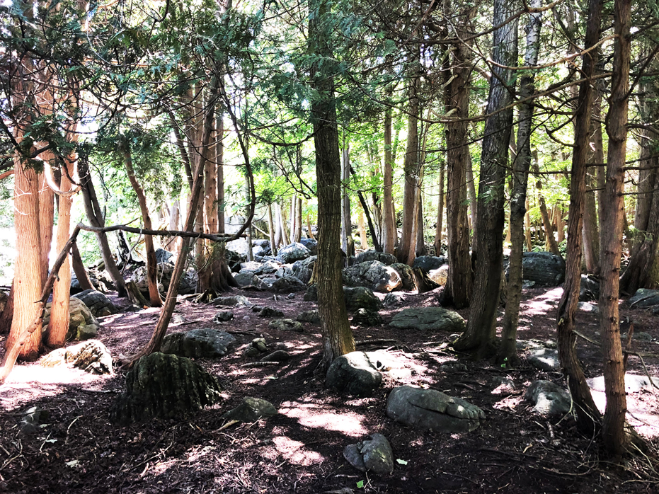
We have found that the nicest spot to have lunch is after you’ve enjoyed the views of the falls by walking through the pathway which was built just off the parking lot right at the falls. If you walk all the way through that, you will come to a clearing which is filled with very large boulders and carpeted with pine needles. It makes for a very relaxing place to catch your breath and enjoy lunch before heading back to Harrison Park.
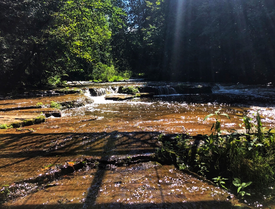
Along the walk back, once you arrive at the bridge again, take a minute to walk down to the water and enjoy the beautiful flat shale rocks along the shores. If the sun is out, you will be treated to beautiful reflections off the water and a chance to enjoy a moment in nature.
From here, remember that you will now take a different path after you cross the bridge. The fork that you took to the right at the beginning of this hike a couple of hours ago will now be straight in front of you. Don’t go that way. Turn right at the junction and that will take you through a shaded wooded area which takes you up and along a large dirt berm.
That path wanders along upwards and you will see the river getting further away from you on the right. The same path will descend into Harrison park, right where you began the hike.
Overall, we have enjoyed this hike on three separate occasions. On a nice summer day, it is a wonderful way to spend the afternoon.
Enjoy. Leave nothing but footprints.

No Comments