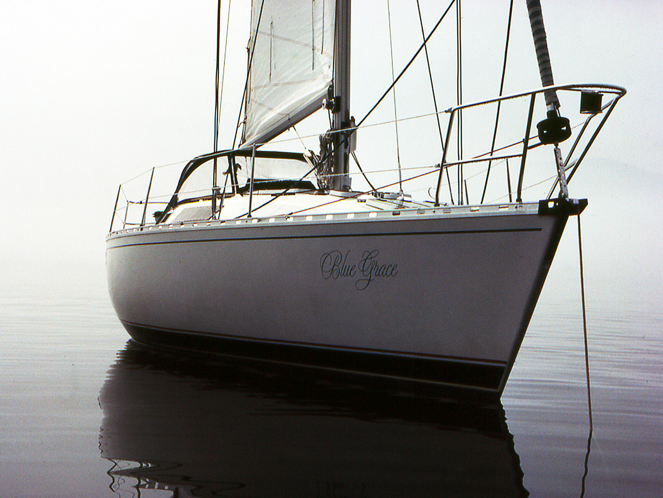
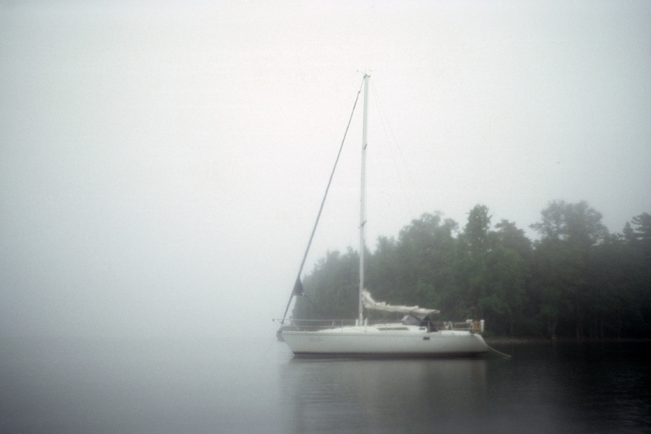
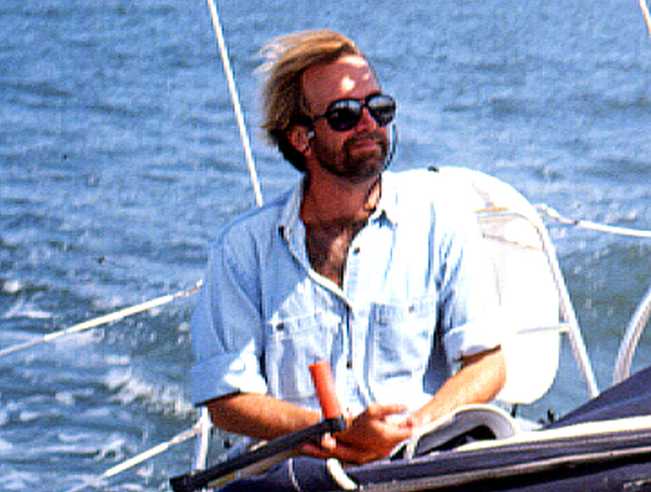
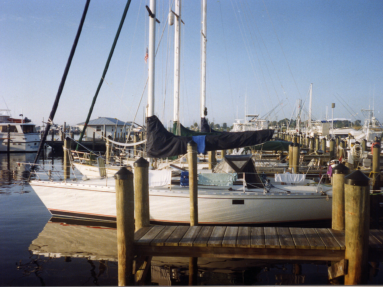
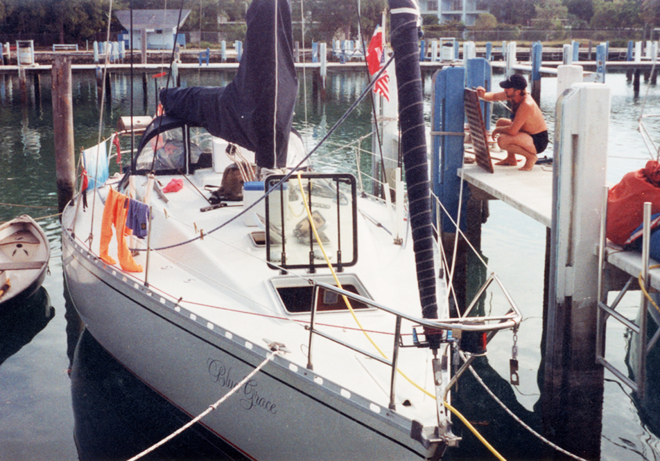
Blue Grace was a bit of a dream for me.
After returning from an eighteen month project on the island of St. Martin in 1987, where I had been introduced to big open water sailing between the islands of St. Martin, Anguilla and St. Barths while working on the first Tourism Magazine for the Island (there were a few assignments that required us to visit hotels on these islands and sailing there was less expensive than flying), I decided that once I returned to Montreal, I should buy myself a good size sailboat.
I owned a small cottage in Morin Heights and had rented it out while working in St. Martin. I sold it and used that money to buy a Beneteau First 35.
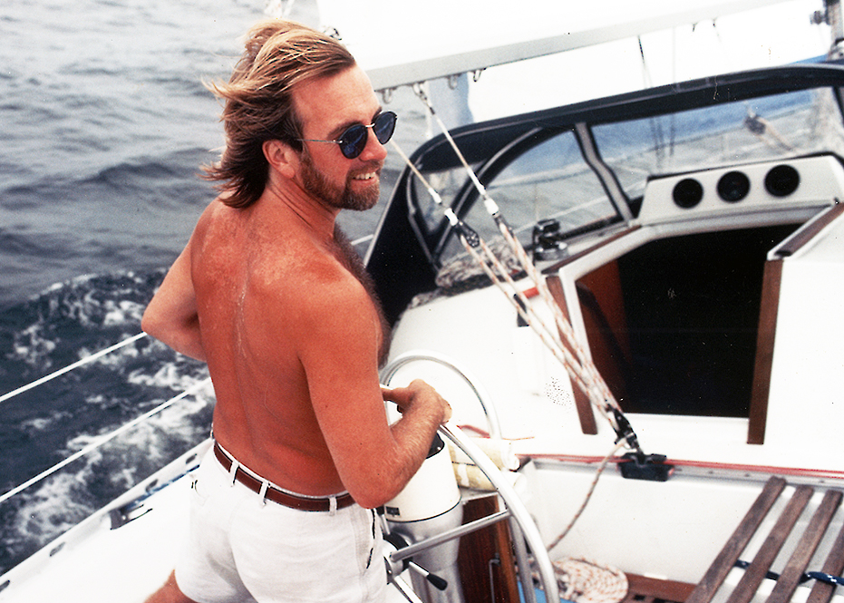
I had never actually sailed by myself, but I liked the idea of having a place on the water that was mobile so Blue Grace became my summer cottage and my passion. I remember bringing her into Valcour Marina the first year and hearing the local sailors talking about my lack of skill, that I didn’t seem to know much. They were right but I am a quick learner.
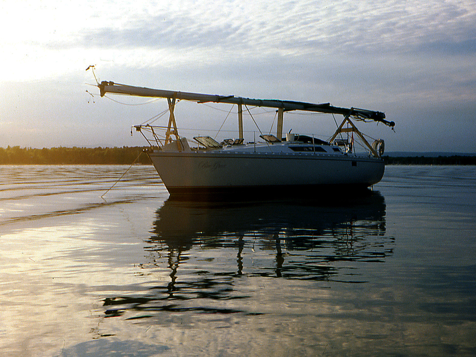
Over the next four years, I sailed in Lake Champlain, which is nestled between the Adirondack mountains of New York and the beautiful, green rolling hills of Vermont – a sailors dream body of water.
Lake Champlain is big – 197 miles long and 23 miles wide at it’s widest point.
I chose Snug Harbour as a marina, just south of Plattsburgh and located a short distance from Valcour Island.
This allowed me to pass through Plattsburgh for supplies, take my dinghy out to Blue Grace and anchor for the night in one of several protected coves on Valcour Island. When I left in the mornings, I missed the marina traffic and could get out onto the lake without jockeying through a gaggle of boats setting on for the weekend. On a good windy day, you could set a tack towards Burlington, Vermont and spend most of the day sailing.
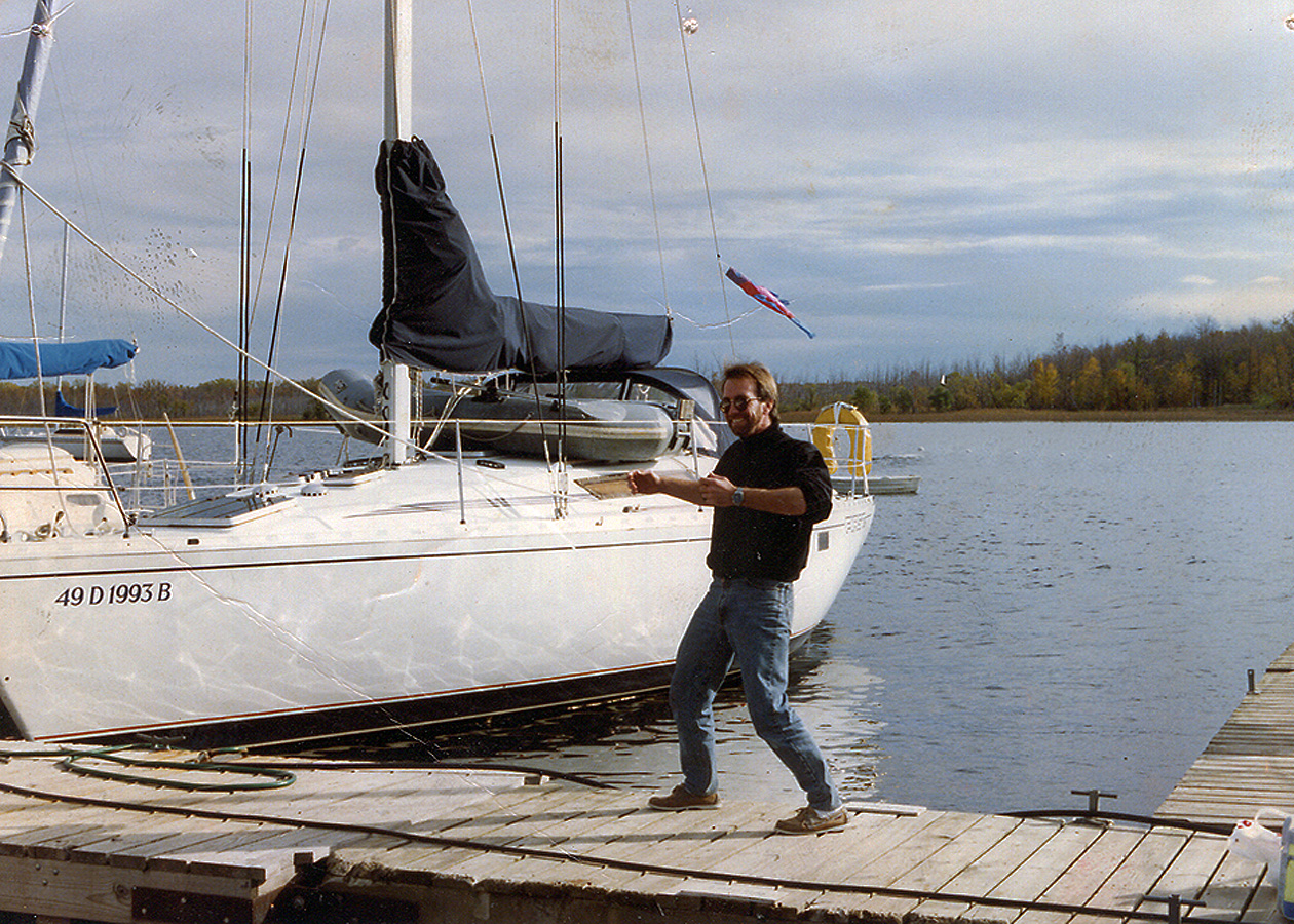
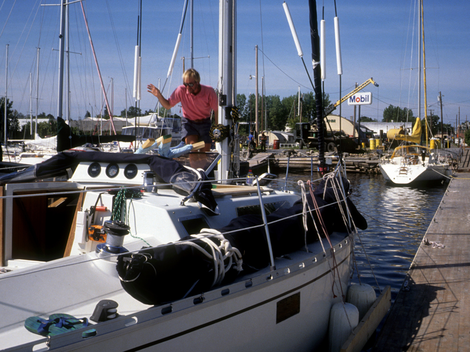
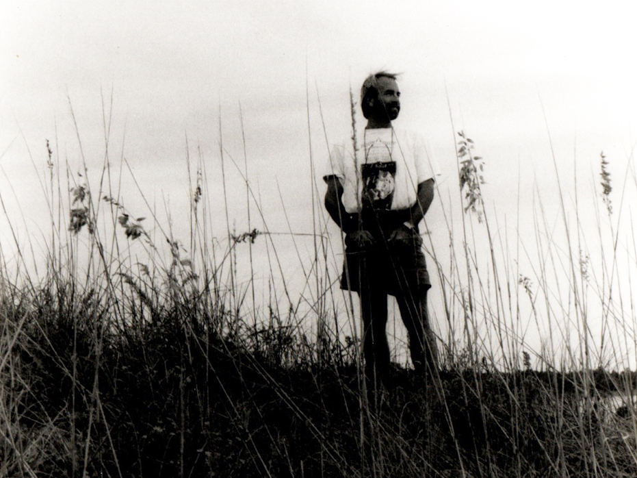
Bringing her home in 1987
When I bought Blue Grace, I had this vague idea that I would one day charter her. The memories of the sailors I met in the French West Indies had stuck with me. I liked their lifestyle at the time. I liked the freedom I assumed went with it.
Over the next few years, my plan gradually developed as my sailing skills increased.
When the time was right, I would sail down to Stuart, Florida, complete my Bareboat Chartering Certificate (Captains License), sail over to the Bahamas and start doing some charters, which would include scuba diving options and spend a year snorkelling and hanging out on the boat. See if I liked it. If not, I would sell her. Easy peazy…
So, over the next few years, I took sailing courses and charters – a one week course in the Florida Keys and then a week sailing in St. Vincent and the Grenadines. In the Grenadines, I learned a lot about sailing in some fairly big water as we sailed between St. Vincent, Bequia and Mustique. That taught me a great deal about sailing very quickly.
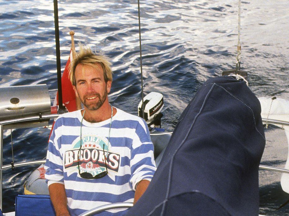
Over the next four years I virtually lived on Blue Grace in the summers, commuting to work in Montreal and heading back most evenings.
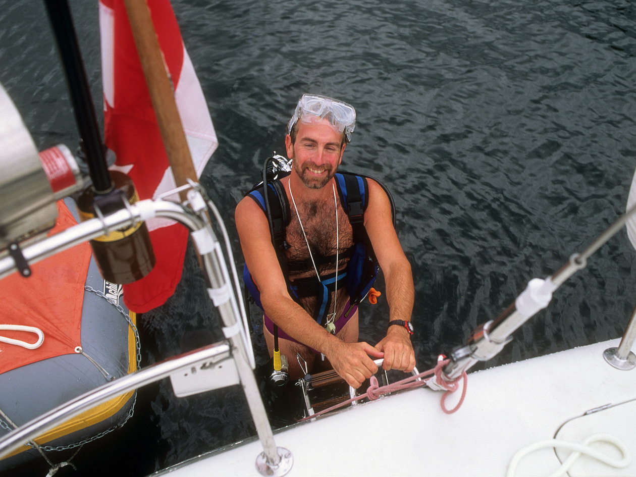
I had outfitted her with two complete sets of scuba gear and I was in my element come the summers.
If something went wrong under the boat, while others were having to hire people to hoist the boat out of the water, I would simply put on my gear and go see if I could fix the problem myself. By my second summer hanging around the marina, most of the other sailors knew that I had the gear and I was often asked to check out simple things, like zinc issues or prop problems.
For the first few years in Lake Champlain, from Friday evening until Monday morning I would be out sailing. It’s a big lake with lots to see and do.
Typical destinations were Willsboro Bay, Mallets Bay, Shelburne Bay and Burton Island. Sometimes we would come across the ferry from Port Kent and sail up close to wave.
Sailing back into Shelburne Bay felt like home to me. I had purchased Blue Grace from a marina there and when I had been a boy, my parents had summered right near here in Vergennes.
I also really enjoyed leaving Snug Harbour Marina on a Friday evening and sailing down to Ausable Chasm. The waters were somewhat shallow in that area and on calm nights, I found it a nice quiet place to toss out my anchor and relax.
By 1989, I had developed a client base in Burlington, Vermont and then had the excuse to spend one day longer each week on the boat because each Monday morning I would attend meetings in Burlington, pick up work and then sail back to Snug harbour then drive into Montreal.
Getting Ready to Travel
In the summer of 1991, I thought I was ready to give the chartering life a try and started to prepare for the upcoming trip to Stuart, Florida and the change of lifestyle and set my travel plans.
I prepared ads for the voyage in hopes of actually taking on some paying guests and to get a sense of what it would be like to have people aboard with me and help pay my way. I made a brochure, which I mailed out to perspective guests.
I published the ads in small local newspapers promoting the opportunity to join me on different legs along the journey – Lake Champlain to New York City, New York City to Annapolis, Annapolis to Norfolk, Norfolk to Beaufort etc. and managed to book a half dozen paying guests to accompany me on several legs of the trip, which provided me some initial confidence that I could make this work.
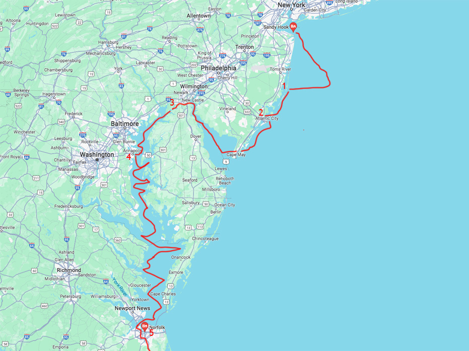
Basically, I broke it down into 5 Legs and the majority of the voyage would take place within the Intracoastal Waterway.
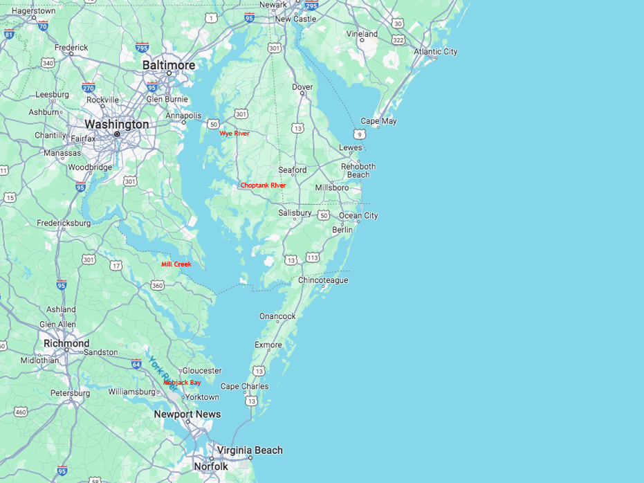
The Intracoastal Waterway is a 3,000 mile (4,500 km) waterway that runs along the Atlantic and Gulf coasts of the U.S.
This waterway is important because it is a way that boats can travel the coasts while avoiding the hazards of the open ocean. The ICW is divided into two segments, the Atlantic and the Gulf. The Atlantic Intracoastal Waterway runs from Norfolk, Virginia to Key West, Florida. So all I had to do was get to Norfolk, Virginia – a mere 1,200 kilometres away.
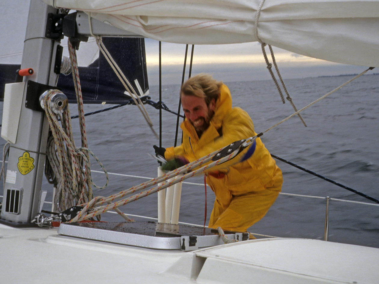
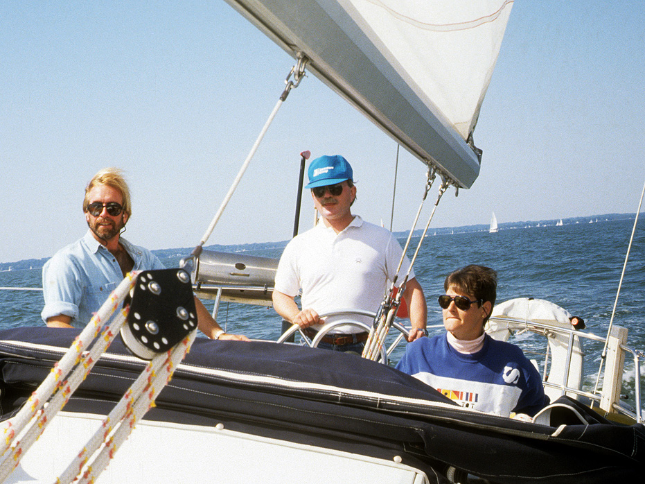
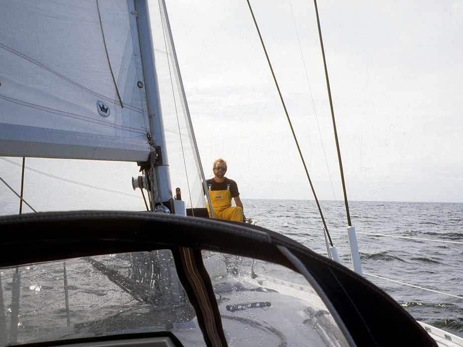
Sailing towards Burlington, Vermont
Leg 1 – Lake Champlain to New York City & Sandy Hook
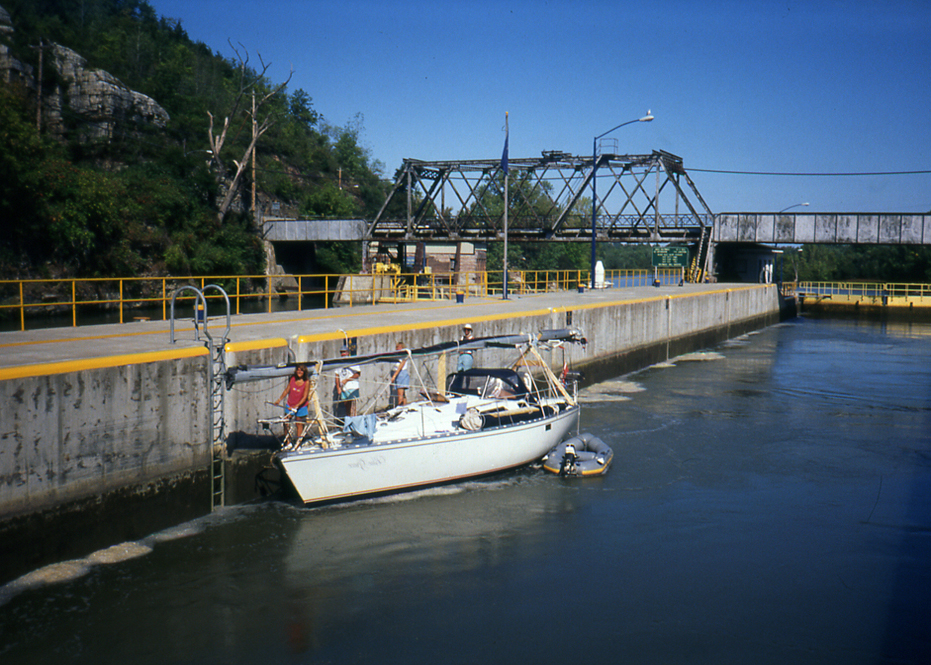
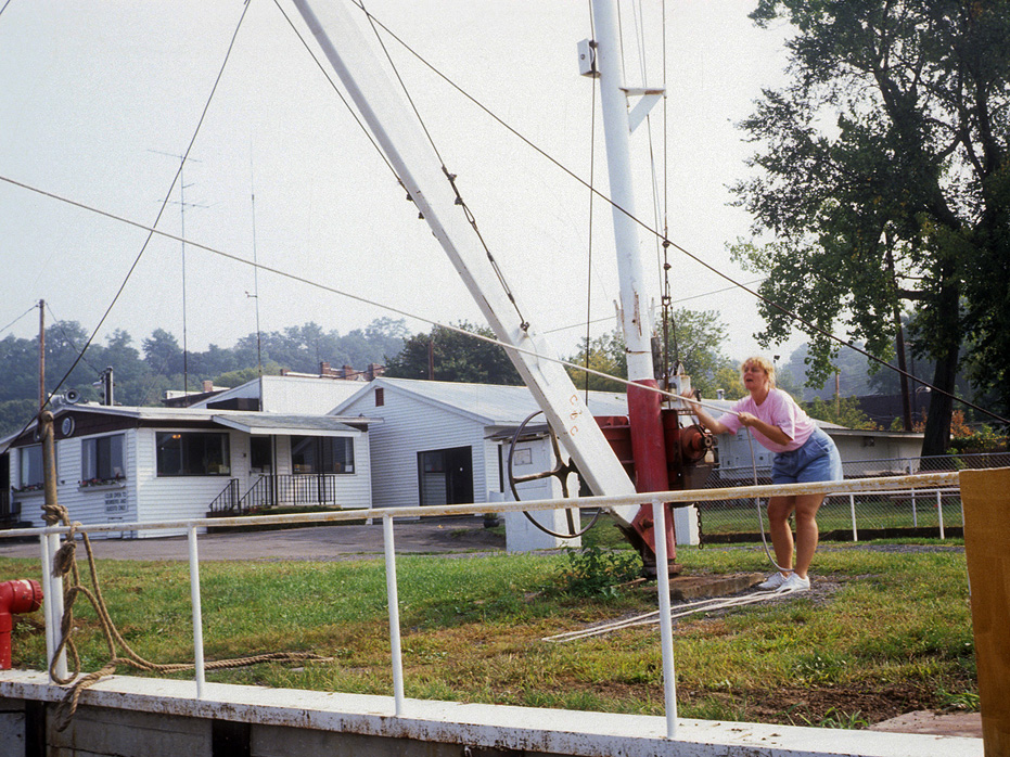
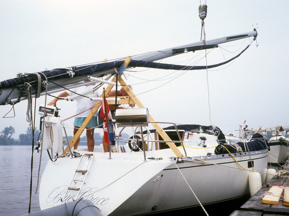
From Valcour Island, the plan was to would sail down to Ticonderoga, enter the Champlain Canal Lock System at Whitehall and continue through the 11 locks along to the Hudson River. The Champlain Canal connects Lake Champlain to the Hudson River and, of course, allows access to the Atlantic Ocean. The canal is 60 miles long from Whitehall to Lock # 11 in Troy, so it was a busy few days getting through this system. I loved going through them. They were so peaceful and section were downright bucolic.
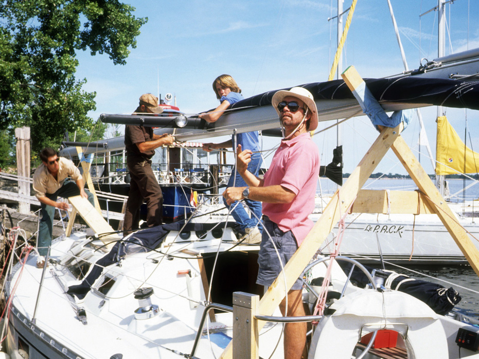
After clearing the first lock, we spent our first night in Whitehall tied up to a bollard along an old crumbling cement canal and enjoyed the barbeques which had been set up for visitors along the route. The next morning, we headed off through the balance of the remaining 10 locks and finished the day at Castleton-on-the-Hudson in time to anchor out and wait for morning, when we would re-step the mast.
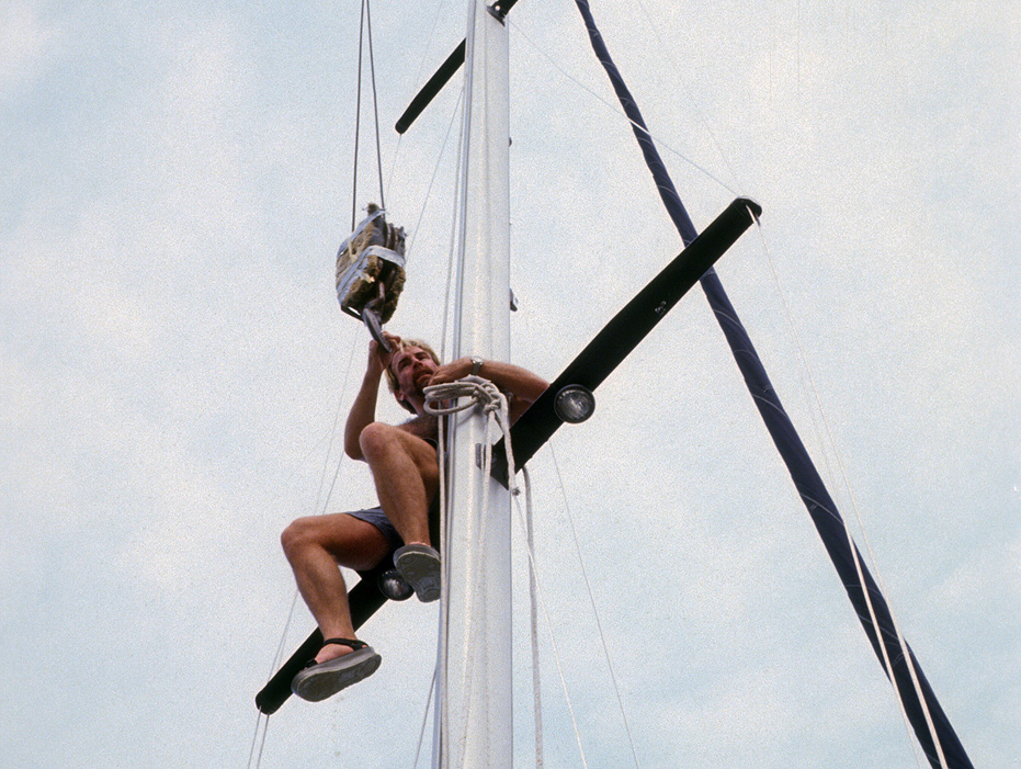
The next morning we motored in to the dock, paid our $35.00 fee (at the time) and the guy at the marina gave us a five minute explanation on how to use the rig. No help. It was completely Do It Yourself – and we did. The unit is rudimentary but worked well enough and as you can see, Sue was able to control the main lift (below) while Bill and I re-positioned and secured the mast.
Something that came in handy is I built two X supports for the mast and wrapped all the wiring in place around it so once we were in position, we just attached the pulley system and lifted the mast up.
In retrospect, it was probably more complicated than I am making it sound but if the three of us could do it, then any able group of people would be capable of using this rig to re-step a mast.
By lunch, we were on our way to New York City.
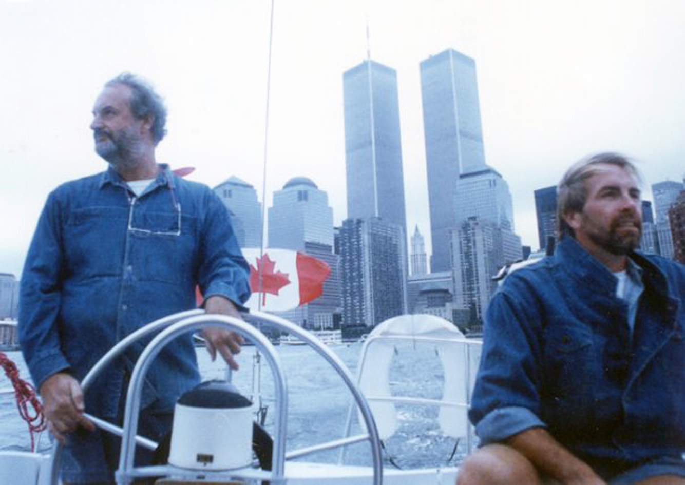
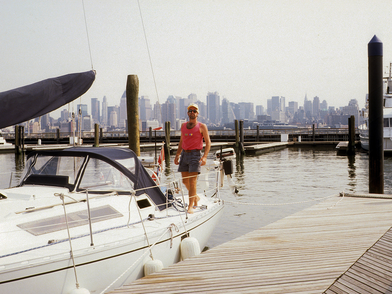
We stopped in New York City for the weekend to have a little fun. Yes, those are the Twin Towers we are passing below. And if you look, you can see the Empire State Building in the background from the New Jersey Marina.
We docked in New Jersey because the cost per foot per night were 50% less than on the New York side.
Ferries went back and forth into the World Trade Centres (at the time) and I got a good taste of what initial life aboard a sailboat was going to be like, relying on alternative modes of transportation to get around. Like my dinghy and my bike, and taxis and ferries.
On the Saturday, we headed off for Greenwich Village and Little Italy, where we enjoyed a great meal before heading back to Blue Grace in preparation for our next leg of the journey.
We were also to pick up another guest in New York City – Patrick, who was to sail with me for two weeks and head home in Norfolk.
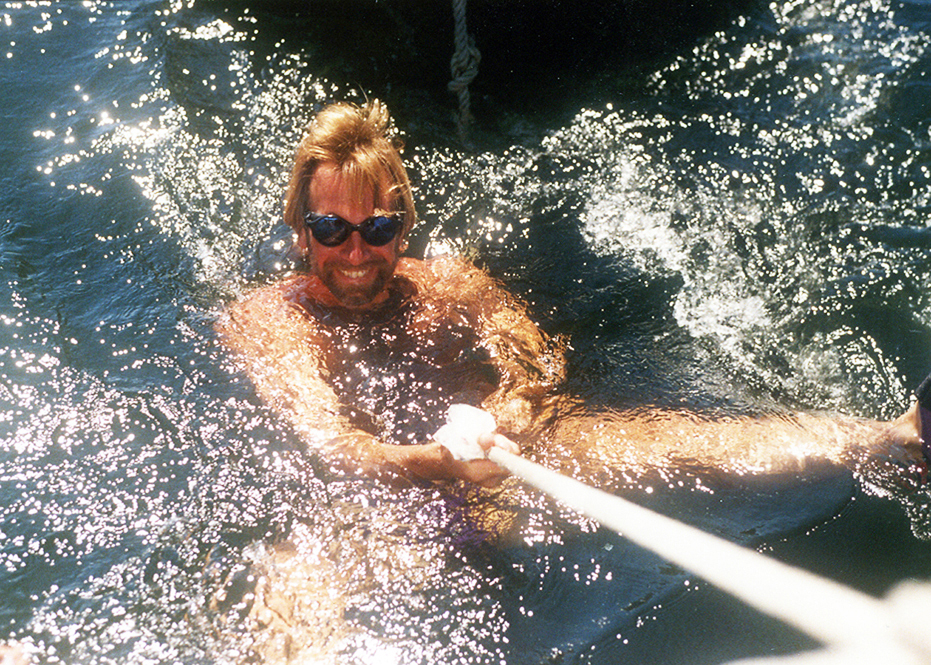
After visiting New York City, the group of us sailed over to Sandy Hook to anchor for the night before heading out into the Atlantic Ocean, and it ended up being quite a night.
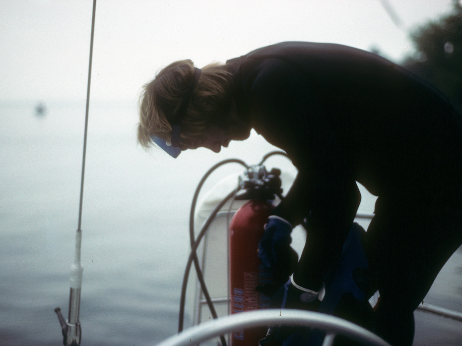
When I tried to set the anchor, the wind was very strong and my anchor line got twisted around the keel and was holding the boat sideways. It had to be undone. It was getting dark. Bill suggested we tie a rope around my waist and I get on my scuba gear and go down with a flashlight and pull the rope down off the keel. So that’s what we did.
Well – as you can imagine, the second the rope slid off the keel, the boat above me started to quickly swing itself into a position 90 degrees different from where it had been and Bill was holding onto a rope above on the boat that was tied to my waist, so I went for quite the spin before things settled down. Ack.
Leg 2 – Sandy Hook to Norfolk
This stage would include a two day stop in Atlantic City, where Bill and Sue would leave. It was the end of my first week aboard Blue Grace.
Sandy Hook is the last spit of sand on the Northern end of the Jersey shore and juts out into the lower reaches of the Hudson River. It is often a staging area for yachts preparing to set off into the ocean and down the coastline.
Sandy Hook to Norfolk
The distance from Sandy Hook to Absecon Inlet (Atlantic City) is about 75-80 nautical miles. It was one long day. We left just after daybreak and for me, this was an ultimate day. It was the first time I was ever going to sail out into the ocean and I was excited and anxious, but much more excited. I was glad Bill and Sue were with me.
There was a chop and the waves were rolling into The Hudson River and I remember this as clear as today. I turned Blue Grace, as I had to face into the oncoming wind in order to clear the river and she rode up the first few swells before a large wave came and I watched in pure delight as the bow of Blue Grace went under the wave and the water rushed down the deck towards me, engulfing me while standing at the Helm and then I was through and out into the ocean.
We reached out quite a ways until we were a few miles offshore but could not catch favourable winds and after 6 – 7 hours decided we would take two days to reach Atlantic City and sailed into Ocean Gate Yacht Basin, which was a good idea. It had been an emotional day and a hard slog and we all wanted to get ashore before heading off again the next morning for Atlantic City, where Bill and Sue were getting off to visit friends before heading back to Montreal.
Heading out into the Atlantic Ocean
Atlantic City to Cape May. We cheated a little bit here.
After dropping Bill and Sue off in Atlantic City, we went through the Cape May Canal. The canal makes the trip into Cape May Harbour possible (and considerably shorter) without having to negotiate the often choppy waters off the Cape May Point and Cape May Inlet.
At that point, we exited into the Delaware Bay and headed inland towards Delaware City before taking the Black Creek into Chesapeake City. From there, we entered Elk River and took that down into the Chesapeake Bay.
Once we entered the Elk River, the fog was so thick that I sent Patrick up onto the bow with the Air Horn to sound it every few minutes. I could not see the bow and was worried we may run into someone. Once we exited Elk River, the fog cleared and we were good to go.
Fogged in on Elk River
The Chesapeake Bay is a magical destination for sailing. It is by far the largest estuary with the most coastline of any other Bay within the United States. In fact, its 11,600 miles of shoreline is more than the entire coastline of the US.
Although it averages only 21 feet in depth, it has deep channels that run to 100 feet accommodating the passage of submarines and commercial traffic of every description along its 200 mile length.
Its width varies from 4 miles at the Bay Bridge to 30 miles at the Potomac. It has more than 150 rivers and streams feeding it, and as much variety along its shores as any cruiser would wish to find.
Once in the bay, I would sail to Annapolis and pick up two new guests, who would then spend a week with Patrick and I, sailing in the Bay. I would drop them all off in Norfolk.
Annapolis is consistently ranked one of America’s most walkable towns. This quaint, historic waterfront town has changed little since its inception in the mid-17th century. Waterfront being the key word here. I got to anchor close by and motor in during the day and enjoy the town. 300-year-old buildings were now restaurants, pubs, specialty shops, boutiques, art galleries, music venues, and so much more, all within a small area, making it easy to spend a few days wandering around Annapolis, which is what I had until the new guests arrive so Patrick and I visited a few bars and anchored out at night.
Once the guests arrived, we settled them in and set out a plan based on what they wanted to do while aboard. Fundamentally, the husband wanted to learn more about sailing, so every morning, we would set a plan for the day and Patrick and I would act as a hands on board. It was fun for me and Patrick seemed fine with it also. My thoughts are he was just chilling off some time or needed a break from something in his life because all he seemed to want was to relax and enjoy the ten days on board.
Our Stops in Chesapeake Bay
On the first day, the guests wanted to go out sailing for the day to get introduced to the boat and then return to Annapolis so they could enjoy the town for one night, which was fine by me. They bought dinner and we all enjoyed having an easy day before we headed south towards Norfolk.
After a full day of sailing, our first overnight anchorage was at Dividing Creek, on the Wye River, which provided us a well-protected space and sufficient depth for a number of boats. The creek winds back into Wye Island for quite a distance and is surrounded by natural woods on both sides. We anchored near the mouth of the creek, but additional anchorages can be found further up the creek.
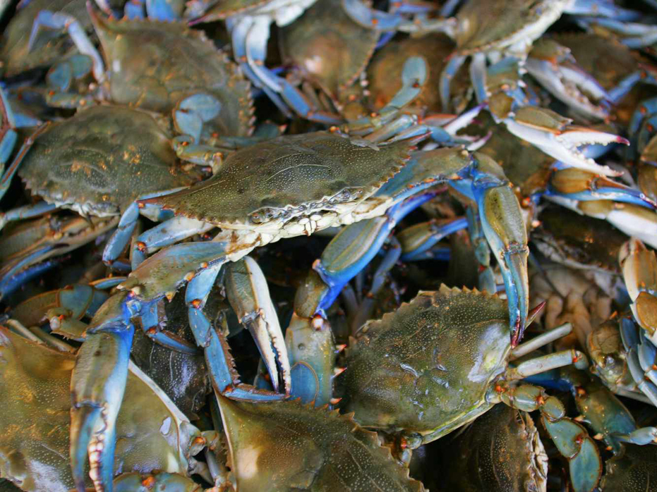
While on the Chesapeake, one of the things we all discovered was crabbing. The good folks at the town marina in Annapolis had provided us with this little tidbit and we were all keen to give it a try. All we needed was a sturdy string with bait tied at one end and a net. Turns out, Blue crabs aren’t particularly picky eaters. They eat clams, mussels, snails, dead fish, old chicken, and more. If they can’t find other food sources, blue crabs will even eat smaller, dead blue crabs.
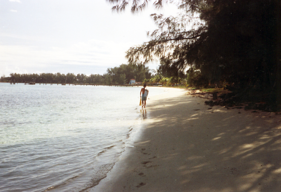
The next evening, we anchored at La Trappe Creek- located just off of the Choptank River. There was a beautiful beach there and deep water close to the beach and we came back here for a second night as we found this location to have lots of crabs.
We found another nice spot on the western side at Mill Creek and unlike some of the other coastal towns that line the Chesapeake Bay, you won’t be fighting for an anchoring spot when you pull into Mill Creeks. There was hardly anyone here. As well as top notch marinas, sailors will find snug anchorages that offer good protection, decent holding, and plenty of space.
Our last anchorage in the Chesapeake was at Mobjack Bay. We dropped anchor in a spot with good wind protection from everywhere but the South. On the shore just across from us was a small, old, abandoned mill complete with paddlewheel which sat right next to a pristine, though apparently also unoccupied, massive plantation-style mansion. The location was great, and it would have been easy to stay for more than a day and go exploring but I had to get my guests to their drop off the next day.
On our way to Norfolk the next day, we were sailing alongside the famous Chesapeake Bay bridge, which disappears under the water at a section to allow ocean traffic to enter the bay. It was pretty weird to see cars driving along from a distance and then disappear under the water.
Leg 3 – Norfolk to St. Augustine.
So, one of the things I did not know was that Norfolk is the world’s largest naval station, supporting 75 ships and 134 aircraft alongside 14 piers and 11 aircraft hangars. The base houses the largest concentration of U.S. Navy forces.
I was gobsmacked at the sheer destructive power I was sailing past… it bothered me for quite a long time to see the sheer capacity of military vessels. It is a place I never wish to see again.
I dropped off all our guests at Portsmouth and continued along my way, happy to be alone now and happy to be leaving the Norfolk area.
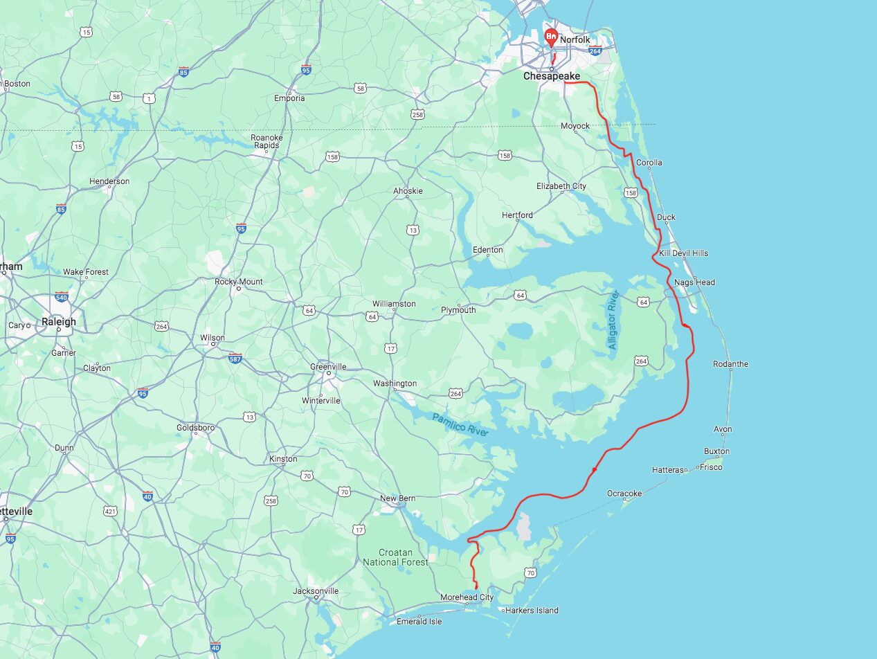
Norfolk to Morehead City
Entering The Intracoastal Waterways
It was here that I entered the Intracoastal Waterways.
The Army Corps of Engineers maintain the ICW at a depth of 12 feet with a channel width of 90 feet and runs 1,090 miles to Key West.
There are 137 bridges of which 81 need to open for sailboats. In the last 130 mile stretch there’s 41 opening bridges. I would be spending a considerable amount of time over the next few weeks waiting for bridges to open so I could pass through.
Each bridge is operated by a single person who has to operate the entire bridge and manage the flow of cars and yachts through this transportation intersection. Bridges monitor VHF channel 13, and will always respond when called upon.
Calling the bridge is simple, you get on VHF Channel 13 and say “This is South-bound sailing vessel calling Surf City Swing Bridge.” Then you wait for them to answer “This is Surf City Swing Bridge, go ahead.” At this point, you can ask them what their opening schedule is. “What is your opening schedule.” And to this, they will respond with the times they open “We open at the top of the hour” meaning that they open at 10am, 11am, noon, etc.
I lost count of how many bridges I passed through but I do recall that the number of bridges increased once I was in Florida.
—
I was now headed towards Albermarle Sound and then on into Pamlico Sound.
Stretching from Albemarle Sound approximately 80 miles to the south and west, the shallow waters of Pamlico Sound are frequently avoided in favour of the ICW but I liked the idea of being in a big open body of water. Maximum depths in the sound are just 26 feet so I had to be a little careful as my draft was over 6 feet. It is roughly 30 miles across at its widest point and a stiff breeze generates a chop but on a quiet day in a gentle wind, the sound gives you flat-water sailing at its best.
I was lucky. The weather was perfect and of course, I was in no hurry so I could have waited had it not been.
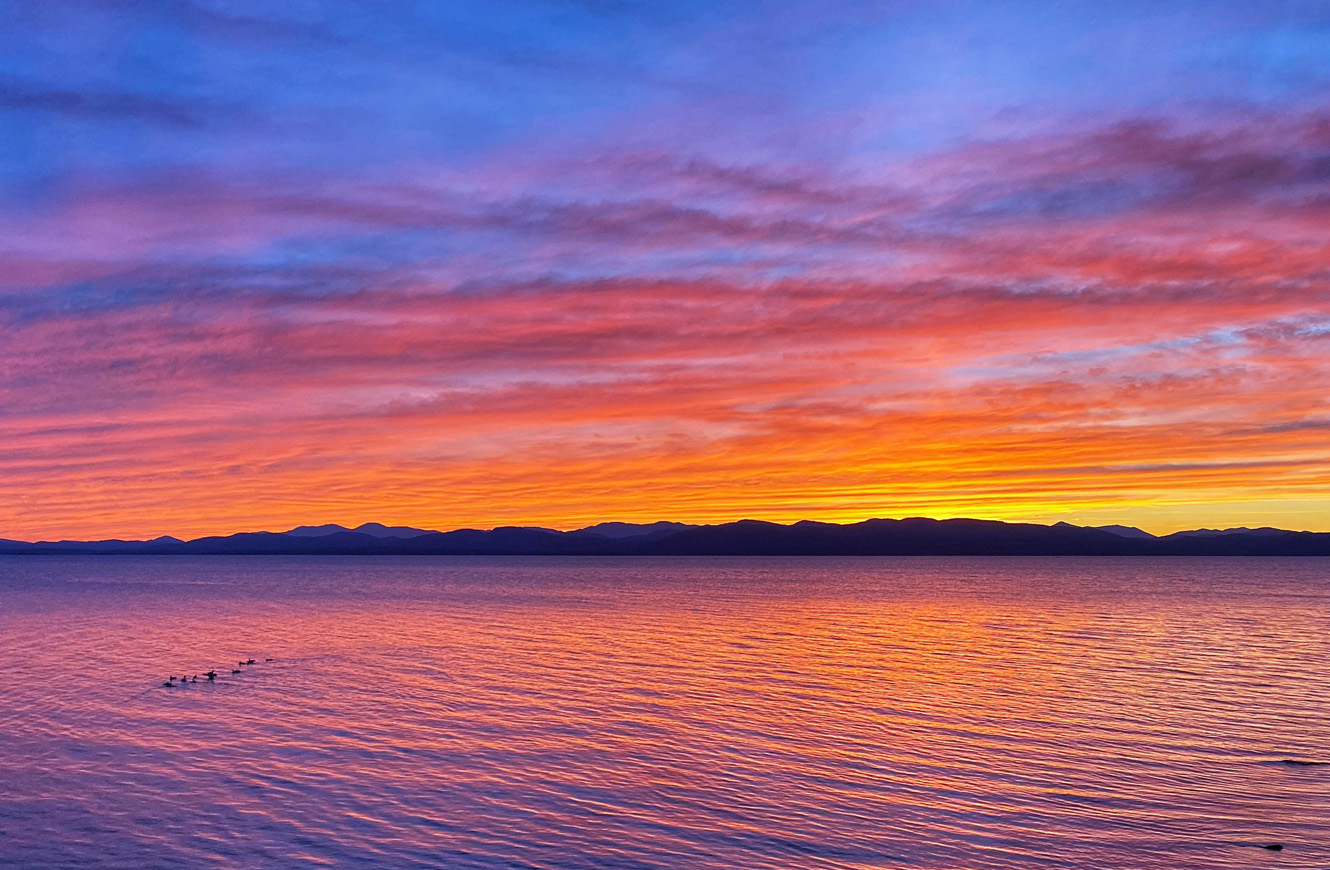
I spent two absolutely lovely evenings here. I did some fishing and swimming here and as the sun was setting at night, I headed out on my dinghy to catch the wonderful sunsets (shown below). It seemed I had the entire Sound all to myself.
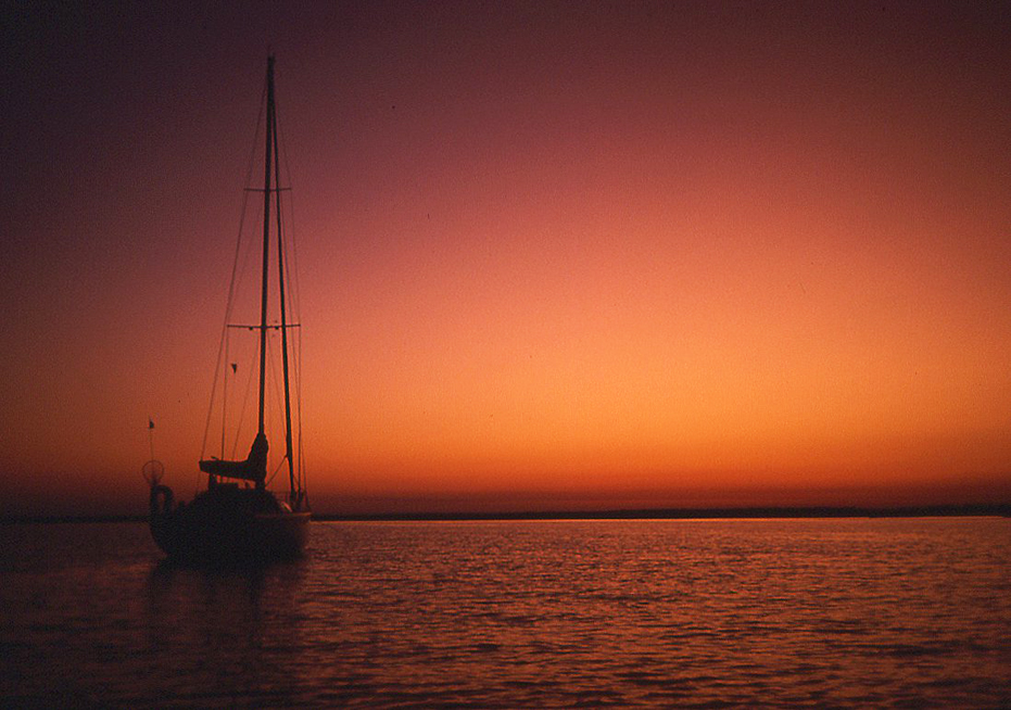
Sunset on Pamlico Sound
That said, the main reason was that I did not want to go outside and around Cape Hatteras.
Cape Hatteras has been a known hazard since the middle of the 16th century when the first ship foundered there. It juts like an elbow out into the Atlantic, and two major ocean currents with very different characteristics converge off the cape. Throw shifting shoals and shallows into the mix with low-lying, hard to spot barrier islands and you have a very challenging body of water to get through. With good weather and clear conditions, you can sail safely through the area. But if you get caught out in poor conditions, it can get dangerous in a hurry.
From Morehead City, I would cruise along through Myrtle Beach, Charleston, Beaufort, Savannah, Jekyll Island, Cumberland Island and down to St. Augustine.
I stopped for a weekend in Charleston to visit the historic downtown.
Charleston became a city in 1783. Because it is a port city on the eastern seaboard of the U.S. Charleston has always been kind of a big deal. It was originally settled in 1670 (only 50 years after Plymouth Rock).
Not surprisingly, I spent the first day at the historic Charleston Market, buying food. The City Market extends four blocks between Meeting Street on the west and East Bay Street on the east. Four long sheds lie between North Market and South Markets Streets, which house open-air stalls for selling goods.
The City Market continues to be used as it was initially established as a market. However, art, food, jewelry, and souvenirs have replaced meat and produce. One of the more popular items sold at the city market today is the famous Gullah-Geechee sweetgrass baskets. The Gullah-Geechee people are descendants of the slaves who were brought from West Africa to the Lowcountry around Charleston, South Carolina. The tradition of the sweetgrass baskets has been passed on through the years and today is very popular in the City Market.
Back on Blue Grace, I stored my groceries and made preparations to continue along my route.
There are some fairly serious tidal ranges around here and the morning I was leaving Charleston, the tide was forcing Blue Grace back against the dock and a Marina Hand came down to give me a hand getting off the docks. He began pushing as I motored against the tide and as I arced, he overextended himself and there was no option. He had his hands on the boat and his feet on the dock and Blue Grace was moving away from the dock. As I pulled further away, into the waters he went and last I saw of him, he was smiling back at me as I motored away. A good lad.
Now I was motoring and simply enjoying the journey.
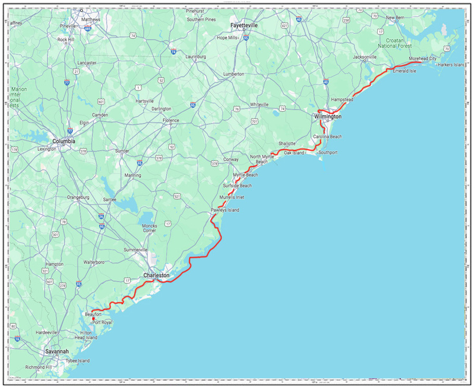
Morehead City to Beaufort
On to Beaufort.
I stopped for dinner in Beaufort for two nights at a wonderful dock alongside a small downtown core right on the water catering to ICW traffic. The marina is an all-transient facility with 98 berths, all of which are floating docks. The waterfront is very pleasant and features a long boardwalk with near-total public access for over a mile of public docks and seawall along Taylor Creek. It made for a wonderful night out within sight of Blue Grace, which was tied up dockside for the night.
As usual, the next morning was spent hunting down groceries and then I decided to visit the Rachel Carson Estuarine Reserve, just across the waterway.
Carrot Island, just across the creek, is part of the Rachel Carson Estuarine Reserve and encompasses a total area of 2,315 acres. One of the most notable features of the reserve is the population of wild horses that often congregate on the shoreline and can sometimes be seen from the Beaufort waterfront. While wandering about on the island the next day, I did see several but have since misplaced the photos, .
Rachel Carson Estuarine Reserve
Then the next morning, I was off heading south. Bright green grassy banks lined the river banks now in these Georgia marshlands with Herons and egrets wading along the muddy shores.
I was entertained by the names of some of the bodies of water I was passing through – like the Little Mud River, Buttermilk Sound, Old Teakettle Creek and DoBoy Sound, just winding my way further southward.
At time, pelicans were seemingly everywhere in the part of the ICW. They’d careen past me at top speed, dive into the water, swallow their catch and then fly off again. When they weren’t fishing, they seemed to congregated wherever they could for some socializing, which was mostly buoy markers.
It was in the out islands of Georgia that I really discovered the tidal ranges down in that part of the world. I was motoring between Jekyl Island and Cumberland Island and it was getting late in the afternoon and I happened to look beside me because something didn’t feel quite right. The water was flowing out from the bullrushes along the intracoastal waterway and I realized that the tide was going out – and fast. I really had no idea what to do and before I knew it, I felt my keel stop in the mud and Blue Grace began to lean over.
Fortunately, the tide was mostly out and we were stuck in the mud at a 45 degree angle for the night until the tide lifted again. No damage except to my ego when motor-boaters passed me by laughing.
For reference: Georgia’s tides are categorized as semidiurnal, featuring two high tide peaks and two low tide troughs over a 24 hour period and range from 6 to 9 feet.
St. Simons and Jekyll Islands experience the most severe tidal ranges, which I mention above in my self deprecating anecdote.
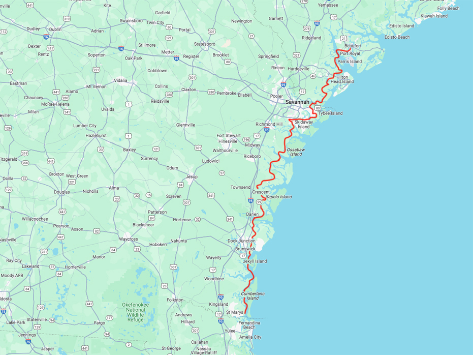
Beaufort to St. Marys
One of the good things that came from that ‘sojourn in the mud’ was I discovered that Cumberland Island was once home to Andrew Carnegie and it was possible to visit.
Cumberland Island National Seashore is Georgia’s largest, southernmost barrier island. Congress protected it under the 1964 Wilderness Act. It has 36,000 acres of pristine maritime forests, wild beach, freshwater lakes and saltwater marshes and 9,800 acres of wilderness a magnificent national park. It is accessible by ferry only, which departs from St. Marys, a small town located on the Georgia coast approximately midway between Jacksonville, Florida, and Brunswick, Georgia.
Once on the island, a must-see are the Dungeness Ruins. Built by the Carnegie family in the 1880s, they are a true sight to see. You can easily spend a few hours touring the property and relaxing.
If you do visit, you will most likely find the wild horses grazing the grounds here. Keep in mind, they are wild, and approaching them is not recommended.
It was a nice break day – the ferry is about a 45 minute ride and it comes and goes so you can spend as much time or as little as you like.
Leg 4 – St. Mary’s to St. Augustine to Stuart, Florida
After visiting Cumberland Island, we headed out again towards St. Mary’s inlet when the morning got very interesting.
I was motoring along when my VHF popped on with a stern statement;
“This is the US Coast Guard to the sailing vessel in the St. Marys Inlet. We are on a collision course and request that you move to the side of the inlet and hold your position. Do you copy?”
I could see no one on the horizon. There were a few boats around in the general vicinity but nothing of particular interest when the warning came a second time;
“This is the US Coast Guard to the sailing vessel in the St. Marys Inlet. We are on a collision course and request that you move to the side of the inlet and hold your position. Do you copy?”
At that point, I guess a decision was made that I could not see them (since they were underwater) and a Nuclear Submarine decided to break the surface of the water so I could see them. As you can see, they were pretty close to me or I was pretty close to them but I didn’t know that. They had my attention now.
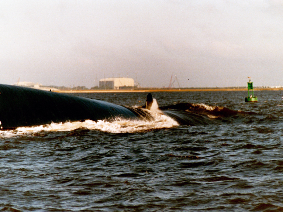
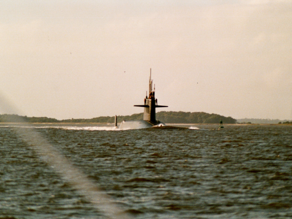
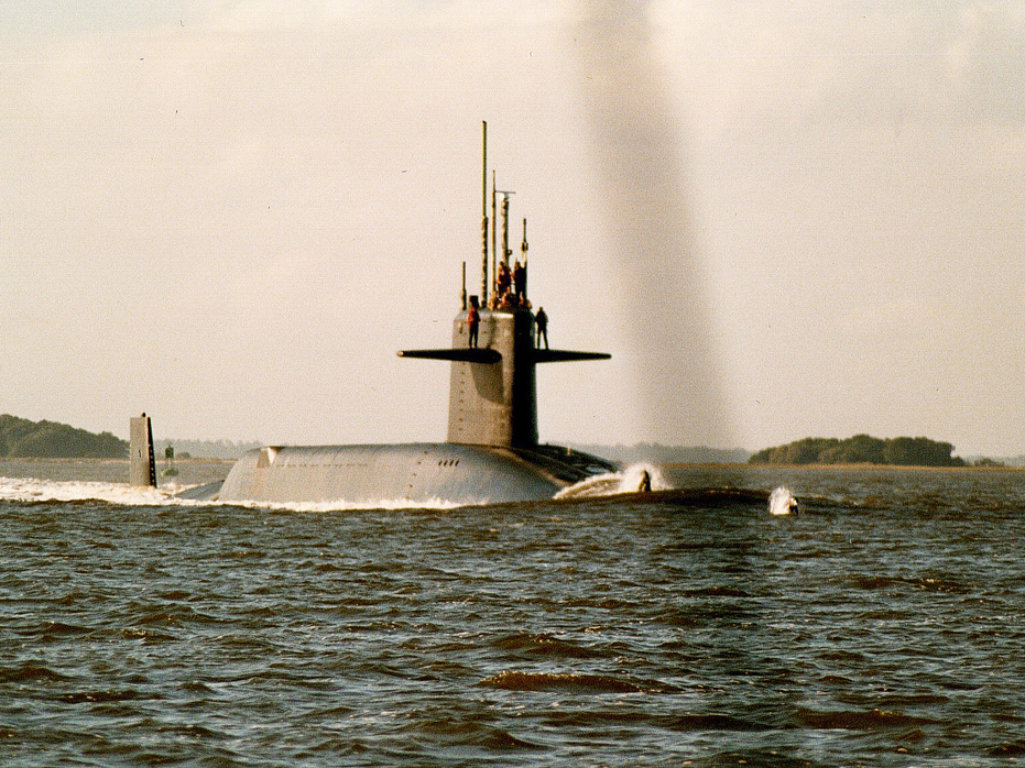
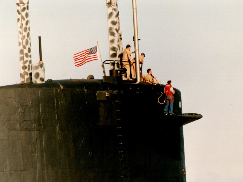
I couldn’t believe it! I had no idea that St. Marys was home to a US Navy submarine base. The odds of seeing a returning submarine are incredibly low. The chances of it happening while I was heading through the inlet are even lower.
As we held our position, the submarine continued to emerge and personnel came out on deck. Before we knew it, the submarine had passed.
After that thrilling experience, we continued on our way towards St. Augustine, where I went ashore for another weekend break and grocery run.
Founded in 1565, St. Augustine is the oldest continuously occupied settlement of European and African-American origin in the United States. Forty-two years before the English colonized Jamestown and fifty-five years before the Pilgrims landed at Plymouth Rock, the Spanish established at St. Augustine this nation’s first enduring settlement. It is a beautiful City and unlike any I have seen in the US, with the exception of New Orleans. It is completely unique.
From St. Augustine, the trek down to Stuart was a real slog. There is no possibility of sailing and most of your time will be spent paying attention to potential hazards – motor boats, other sailboats – simply a LOT of marine traffic.
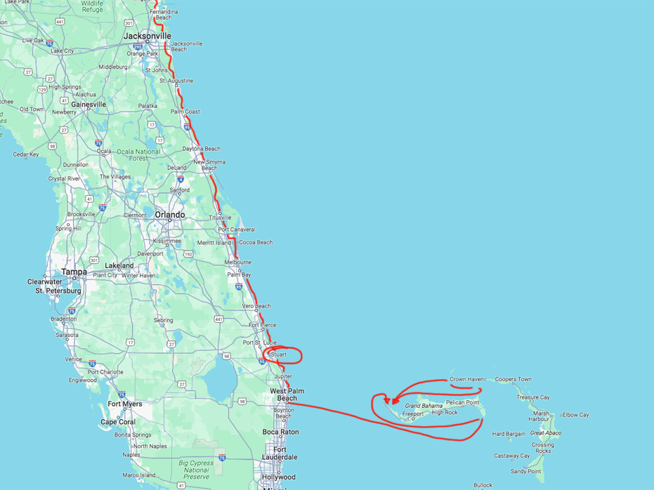
St. Marys to Stuart and over to Grand Bahama Island
A few days later, after enduring the bridges and delays and stopping in New Smyrna Beach, I arrived in Stuart where I settled into Stuart Marina (now named Safe Harbour Yacht Club) and went to school for a few weeks to complete the Bareboat Charter Certification at The Chapman School of Seamanship – a world-renowned boat school that encompasses 9 waterfront acres in South Florida, located just minutes by water from both the Intracoastal Waterway (ICW) and the Atlantic Ocean.
For the first time in weeks, I got to take my bike off the boat and have some ground transportation and I was thrilled. I could take my bike for groceries and go for bike rides again. It felt so good to be connected to a dock with access to everyday life.
This was probably my instincts telling me that the life of a charter boat Captain was not for me. I relished being back on land.
For 6 weeks, I went to school every day to complete what was called a Six Pack Bareboat Chartering License, meaning I could take 6 paying guests on board at any time, which was all I required. I also took a Navigation Course because at this time, there were no electronics to help you find your way across to the Bahamas. Sure, Loran existed but it wasn’t very accurate so I learned to plot my course on a chart using a slide-ruler and calculating speed over water and how to take the speed of the gulf flow into consideration.
I enjoyed that but it wasn’t something I really got that into. I was kind of a point me in a direction type of guy so I’m glad I didn’t try to sail to Bermuda.
Stage 5 – West Palm Beach to Grand Bahama Island
On December 19th, I picked up paying guests who were experienced sailors but wanted to see what it was like to cross the Gulf Stream so they joined me for a week.
They flew into Fort Lauderdale and met me in Fort Worth where at midnight on December 21st, 1991, I began my first ocean crossing without any form of electronics. All the navigation was done by projecting lines of position and gulf stream water speed to arrive at an estimated time or arrival at Freeport on Grand Bahama Island.
I remember I told the guests it ‘should’ take about 13 hours and when, some 15 hours later, we still could not see land the woman of the couple got pretty nervous but sure enough, at hour 16, I spotted the cel towers at Freeport and an hour or so later we were tucked away clearing customs.
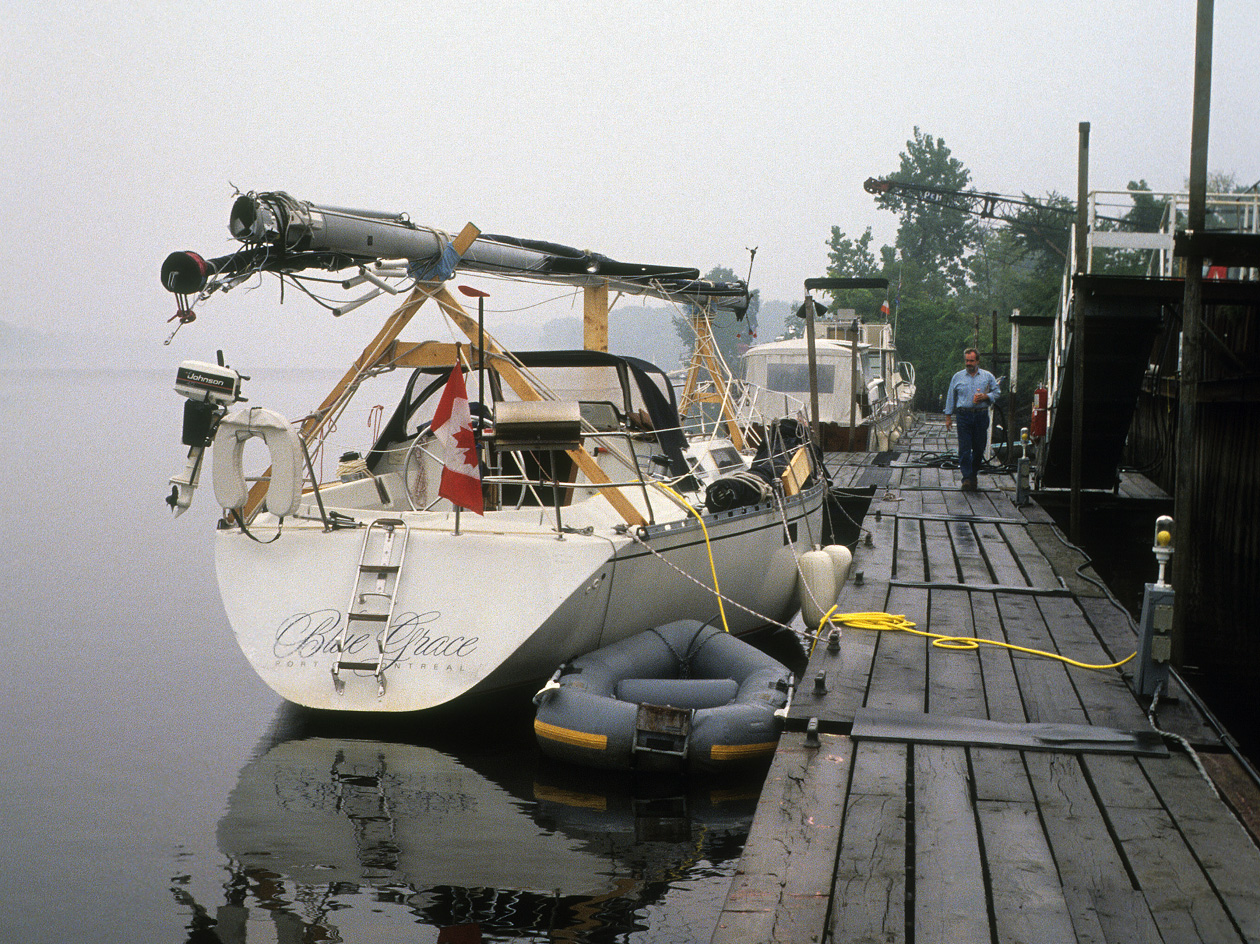
After checking in at Lucaya, we set sail towards the west end of Grand Bahama, where there was a marina at an abandoned Jack Tar Village, which was where I made my home base for the next couple of months.
After my guests left, I had no other guests scheduled and in fact, never managed to find another paying guest so I decided that I would spend some time snorkelling and scuba diving around the area.
Above: West End Marina, Grand Bahama Island. My home base for two months.
For those of you who have never visited, the out islands around Grand Bahama Island take up a LOT of empty space. There are big distances between islands and I had started to like the small amenities I had at the West End Marina. It had a shower, local farmers and small entrepreneurs brought in produce and water two or three times a week and a bunch of other sailors were hanging around, so I had some company. I learned how to catch and prepare conch, catch lobster with a sling and spearfish hogfish and snappers and was pretty happy overall other than coming to the realization that I was going to spend all my cash if I didn’t find paying guests or go back to work and I knew there was no work for me in the Bahamas.
It became pretty clear to me that I had naively overestimated my ability to find paying guests once I got to the Bahamas…
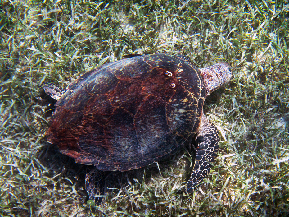
That said, I did manage to enjoy a couple of months sailing around the area. I made it out to Great Sale Caye, Strangers Caye, Sugna Island and Little Abaco Island just sailing around in the shallow waters. I thought it was a lot of fun being by myself and sailing off to these little cayes. For the most part, the waters were rarely more than 50 feet deep and in a lot of places, less than 25 feet so I could see the bottom much of the time.
I used to throw out my anchor and go for short little dives when I spotted large outcroppings of coral. At times, I couldn’t see anyone else as far as I could see. I remember finding a Queen Helmut Conch shell, which to this day sits behind me at my desk.
At times, I loved it but most of the time, my head was yelling at me telling me this was not what I was supposed to be doing.
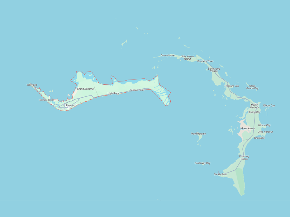
Grand Bahama Island and Little Abacos
Being a sailing bum at 36 years old in the Bahamas was not how I intended to spend the rest of my life… I found it terribly monotonous after a while and not being able to be active drove me crazy. And by active, I mean not being able to walk around, or get in a car and drive to a grocery store, or go for a bike ride. I was confined to 35 feet and at this point, I had figured out this was not going to work.
I had pretty much made the decision to sail back to Stuart and sell Blue Grace and find my way back up to Montreal but as luck would have it, in late March of 1992, I got a message over my VHF Radio that I had received a phone call from someone in Bermuda at the marina I had been staying at in Stuart, Florida so I called and asked what was up. They gave me a name and a number of the agency’s Director in Bermuda and I gave him a call.
When I got through, I was told, ‘You are a hard man to track down. We’re sorry it’s taken so long but we liked your application and your work and we’d like to hire you and move you to Bermuda to work with us to create print materials for the Bermuda Department of Tourism and The Royal Naval Dockyard”. So I said, ‘YES’.
(To back this up a bit, in early 1991, I had noticed an ad in Marketing Magazine looking for a Senior Art Director for Foote, Cone and Belding in Hamilton, Bermuda and I decided that I would prepare a resume and apply. I was ready to pursue one of my goals of becoming a Creative Director or try my luck at becoming a Charter Bareboat Captain. I wasn’t going anywhere working at O’Keefe other that right where I was, which was really a good place but not what I wanted any longer. I was preparing for an extended voyage on my sailboat and thought that if the Bermuda gig worked out, I could sail over to Bermuda and work for a two year period then continue along my path. As luck would have it, nothing came of it and in late summer, I set sail from Lake Champlain, which you are reading about and headed off to the Caribbean to do some chartering and scuba diving on Blue Grace).
After accepting the position, I thought I would be able to sail over to Bermuda and live aboard Blue Grace but the import duty on my boat was going to be 75% so I decided to sell her and take the job, as the Bareboat Chartering business was draining my bank account and truth be told, I had had enough of living full time on a sailboat after nine months.
This stint had resolved within me my desire to be a charter boar operator (which was to be tested again in 2006 when Stu and Fran tried very hard to get Yim and I to become a Charter Boat Captain and Hostess in the BVI, but that’s another story).
Fortunately, Blue Grace sold within two weeks and in April of 1992 I was settling into a small apartment on Tee Street in Devonshire Parish outside Hamilton, Bermuda.
My life has taken some twists and turns but Lady Luck has always seemed to be on my side.

No Comments